

 Complaint

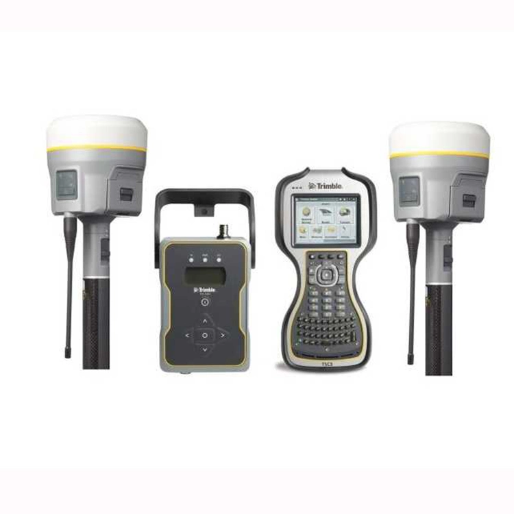
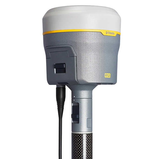
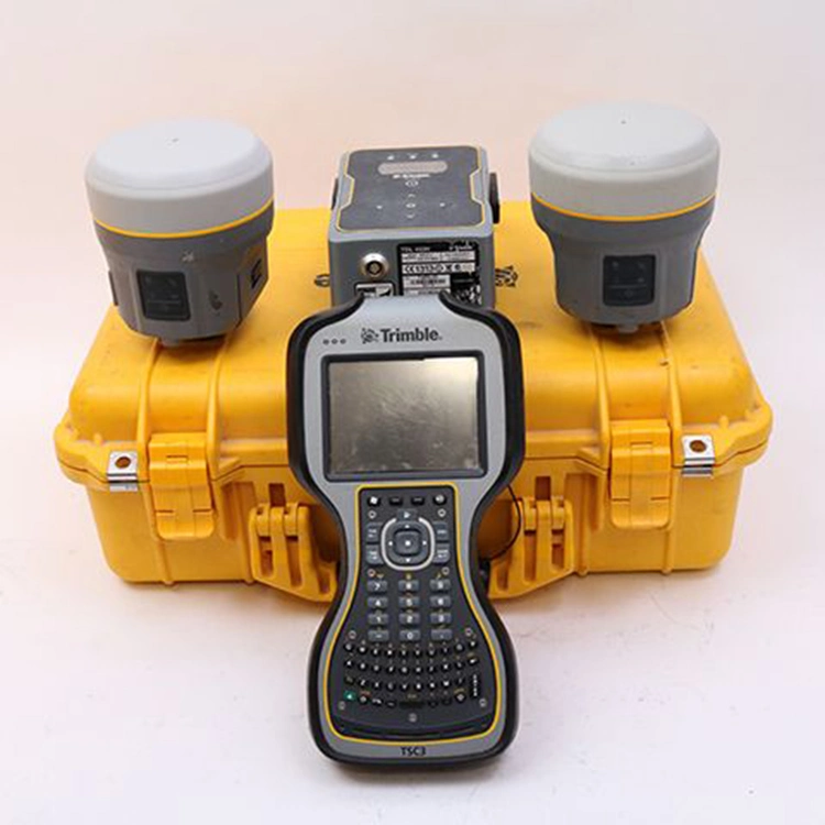
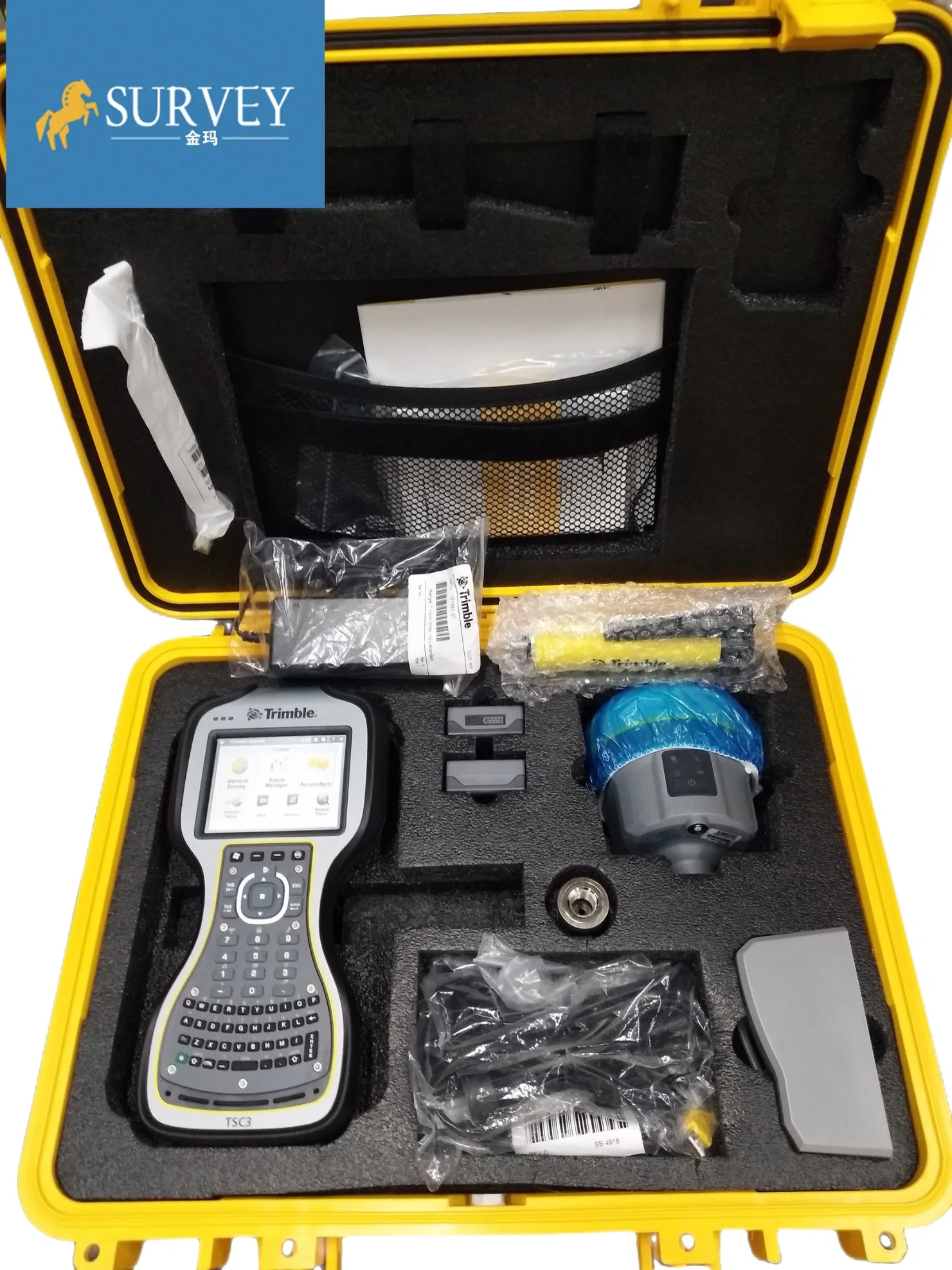
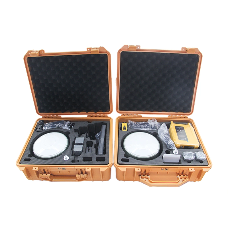
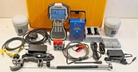
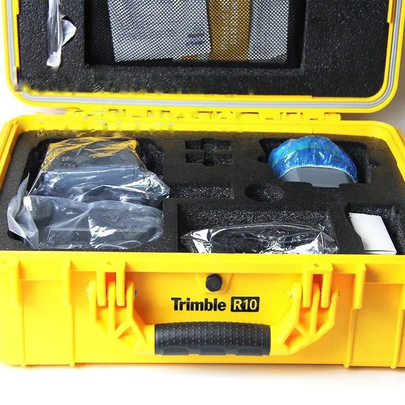
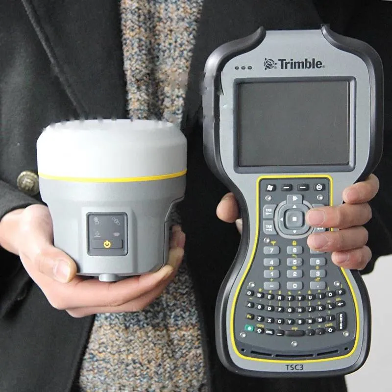
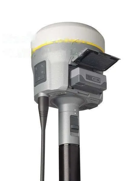
1.Trimble R10 gnss receiver
2.A cutting edge Trimble HD-GNSS processing engine
3.Trimble SurePointaa for precise position capt
Trimble R10 gnss receiver
Features
Performance specifications
Measurements
• Measuring points sooner, faster and in harsh environments with Trimble HD-GNSS technology
• Increased measurement traceability with Trimble SurePoint electronic plumb detection
• Reduced downtime due to loss of radio signal with xFill technology
• Advanced Trimble Maxwell 6 Custom Survey GNSS chips with 440 channels
• Future-proof your investment with Trimble 360 GNSS tracking
• Satellite signals tracked simultaneously:
-- GPS: L1C/A, L1C, L2C, L2E, L5
-- GLONASS: L1C/A, L1P, L2C/A, L2P, L3
-- SBAS: L1C/A, L5 (For SBAS satellites that support L5)
-- Galileo: GIOVE-A and GIOVE-B, E1, E5a, E5B
-- COMPASS: B1, B2, B3
• OmniSTAR HP, XP, G2, VBS positioning
• QZSS, WAAS, MSAS, EGNOS, GAGAN
• Positioning Rates: 1 Hz, 2 Hz, 5 Hz, 10 Hz, and 20 Hz
Positioning performance
Code differential GNSS positioning
Horizontal. . . . . . . . . . . . . . . . . . . . . . . . . . . . . . . . . . . . . . . . . 0.25 m + 1 ppm RMS
Vertical. . . . . . . . . . . . . . . . . . . . . . . . . . . . . . . . . . . . . . . . . . . 0.50 m + 1 ppm RMS
SBAS differential positioning accuracy2. . . . . . . . . . . . . . . . . . .typically <5 m 3DRMS
Static GNSS surveying
High-Precision Static
Horizontal. . . . . . . . . . . . . . . . . . . . . . . . . . . . . . . . . . . . . . . . 3 mm + 0.1 ppm RMS
Vertical. . . . . . . . . . . . . . . . . . . . . . . . . . . . . . . . . . . . . . . . . 3.5 mm + 0.4 ppm RMS
Static and Fast Static
Horizontal. . . . . . . . . . . . . . . . . . . . . . . . . . . . . . . . . . . . . . . . 3 mm + 0.5 ppm RMS
Vertical. . . . . . . . . . . . . . . . . . . . . . . . . . . . . . . . . . . . . . . . . . 5 mm + 0.5 ppm RMS
Real Time Kinematic surveying
Single Baseline <30 km
Horizontal. . . . . . . . . . . . . . . . . . . . . . . . . . . . . . . . . . . . . . . . . . 8 mm + 1 ppm RMS
Vertical. . . . . . . . . . . . . . . . . . . . . . . . . . . . . . . . . . . . . . . . . . . 15 mm + 1 ppm RMS
Network RTK
Horizontal. . . . . . . . . . . . . . . . . . . . . . . . . . . . . . . . . . . . . . . . 8 mm + 0.5 ppm RMS
Vertical. . . . . . . . . . . . . . . . . . . . . . . . . . . . . . . . . . . . . . . . . 15 mm + 0.5 ppm RMS
RTK start-up time for specified precisions . . . . . . . . . . . . . . . . . . . . . 2 to 8 seconds
Trimble CenterPoint RTX
Horizontal. . . . . . . . . . . . . . . . . . . . . . . . . . . . . . . . . . . . . . . . . . . . . . . . . . . 4 cm
Vertical. . . . . . . . . . . . . . . . . . . . . . . . . . . . . . . . . . . . . . . . . . . . . . . . . . . . . 9 cm
RTX convergence time for specified precisions12. . . . . . . . . . . .30 minutes or less
RTX QuickStart convergence time for specified precisions12. . . . .5 minutes or less
Trimble xFill5
Horizontal. . . . . . . . . . . . . . . . . . . . . . . . . . . . . . . . . RTK6 + 10 mm/minute RMS
Vertical. . . . . . . . . . . . . . . . . . . . . . . . . . . . . . . . . . . RTK6 + 20 mm/minute RMS
Hardware
Physical
Dimensions (W×H). . . . . . . . . . . . . . . . . . . . . . . .11.9 cm x 13.6 cm (4.6 in x 5.4 in)
Weight. . . . . . . . . . . . . . . . . . . . . . . . . . .1.12 kg (2.49 lb) with internal battery,
internal radio with UHF antenna,
3.57 kg (7.86 lb) items above plus range pole, controller & bracket
Temperature
Operating. . . . . . . . . . . . . . . . . . . . . . . . . .-40 °C to +65 °C (-40 °F to +149 °F)
Storage. . . . . . . . . . . . . . . . . . . . . . . . . . . .-40 °C to +75 °C (-40 °F to +167 °F)
Humidity. . . . . . . . . . . . . . . . . . . . . . . . . . . . . . . . . . . . . . . . . . . . 100%, condensing
Ingress Protection. . . . . . . . . . . . . . . . . . . IP67 dustproof, protected from temporary
immersion to depth of 1 m (3.28 ft)
Shock and vibration. . . . . . . . . . . . . . . . . . . . . . . . . Tested and meets the following environmental standards:
Shock. . . . . . . . . . . . . . . . . . .Non-operating: Designed to survive a 2 m (6.6 ft) pole
drop onto concrete. Operating: to 40 G, 10 msec, sawtooth
Vibration. . . . . . . . . . . . . . . . . . . . . . . . . . . . . . . . . . . . MIL-STD-810F, FIG.514.5C-1
Electrical
• Power 11 to 24 V DC external power input with over-voltage protection on Port 1 and Port 2 (7-pin Lemo)
• Rechargeable, removable 7.4 V, 3.7 Ah Lithium-ion smart battery with LED status indicators.
• Power consumption is 5.1 W in RTK rover mode with internal radio.
• Operating times on internal battery:
-- 450 MHz receive only option . . . . . . . . . . . . . . . . . . . . . . . . . . . . . . . .5.5 hours
-- 450 MHz receive/transmit option (0.5 W) . . . . . . . . . . . . . . . . . . . . . . 4.5 hours
-- 450 MHz receive/transmit option (2.0 W) . . . . . . . . . . . . . . . . . . . . . . 3.7 hours
-- Cellular receive option . . . . . . . . . . . . . . . . . . . . . . . . . . . . . . . . . . . . .5.0 hours
Communications and Data Storage
• Serial: 3-wire serial (7-pin Lemo)
• USB: supports data download and high speed communications
• Radio Modem: fully Integrated, sealed 450 MHz wide band receiver/transmitter with frequency range of 410 MHz to 470 MHz:
-- Transmit power: 2 W
-- Range: 3-5 km typical / 10 km optimal
• Cellular: integrated, 3.5 G modem, HSDPA 7.2 Mbps (download), GPRS multi-slot class 12, EDGE multi-slot class 12, UMTS/HSDPA (WCDMA/FDD) 850/1900/2100MHz, Quad-band EGSM 850/900/1800/1900 MHz, GSM CSD, 3GPP LTE
• Bluetooth: fully integrated, fully sealed 2.4 GHz communications port (Bluetooth)
• WiFi: 802.11 b,g, access point and client mode, WEP64/WEP128 encryption
• External communication devices for corrections supported on - Serial, USB, Ethernet, and Bluetooth ports
• Data storage: 4 GB internal memory; over three years of raw observables (approx. 1.4 MB /day), based on recording every 15 seconds from an average of 14 satellites
• CMR+, CMRx, RTCM 2.1, RTCM 2.3, RTCM 3.0, RTCM 3.1 input and output
• 24 NMEA outputs, GSOF, RT17 and RT27 outputs
WebUI
• Offers simple configuration, operation, status, and data transfer
• Accessible via WiFi , Serial, USB, and Bluetooth
Supported Trimble Controllers
• Trimble TSC3, Trimble CU, Trimble Tablet Rugged PC
Certifications
FCC Part 15 (Class B device), 22, 24; R&TTE CE Mark; C-Tick, A-Tick; PTCRB; WFA
Contact Us
https://surveyinginstrument.en.made-in-china.com/contact-info.html