
 Complaint

| V60 Technical Parameters | |
| 220 channels:Advanced Pacific Crest Maxwell 6 Custom Survey GNSS Technology | GPS:L1C/A, L2C, L2E, L5 |
| GLONASS:L1C/A, L1P, L2C/A (GLONASS M only), L2P | |
| BDS: B1, B2 | |
| GALILEO:L1 BOC, E5A, E5B, E5AltBOC | |
| SBAS: Simultaneous L1 C/A, L5 | |
| Module technology | Trimble GNSS MaxwellTM advanced custom measurement technology, |
| GNSS carrier phase measurements of very low noise, | |
| precision of 1 Hz bandwidth of <1mm, | |
| mature Trimble low elevation tracking technology | |
| Positioning Output | 1Hz, 2Hz, 5Hz, 10Hz, 20Hz, 50Hz |
| Differential support | sCMRx, CMR, CMR +, RTCM2.1,2.2,2.3,3.0,3.1 |
| Output format support | ASCLL: NMEA-0183, and binary: Trimble GSOF |
| Data storage | 1GB Internal storage + 8GB Internal Micro SD Card memory Record GNS and Rinex format simultaneously |
| Performance Specifications | |
| Real Time Kinematics (RTK) | Horizontal: 8mm+1ppm RMS |
| Vertical: 20mm+1ppm RMS | |
| Initialization time: typically<8s | |
| Initialization reliability: typically >99.9% | |
| Post Processing Static | Horizontal: 2.5mm+0.5ppm RMS |
| Vertical: 5mm+0.5ppm RMS | |
| Post Processing Kinematics(PPK) | Horizontal: 1cm+1ppm RMS |
| Vertical: 2.5cm+1ppm RMS | |
| Communications | |
| RS232 serial port | x2 |
| Bluetooth, NFC | x1 |
| Integrated GSM/GPRS or 3G modem | x1 |
| TNC antenna connector | x1 |
| DC power intput (8pins&5 pins) | x2 |
| USB standard 2.0 port | x1 |
| Hi-target internal UHFradio(Standard) | 450-470 Mhz, 116 channels, 1w,2w,5w adjustable. work distance: 5-10KM |
| Hi-target external UHF radio(Standard) | Hi-target External radio: 460Mhz,116 channels. 5w, 10w, 20w, 30w adjustable, work distance:8-20km |
| Pacific Crest internal/external UHF radio(optional) | Internal: 403-473Mhz, 3-10KM; External: 390-430Mhz or 430-470Mhz, 8-20KM(work range) |
| Features and Indicators | |
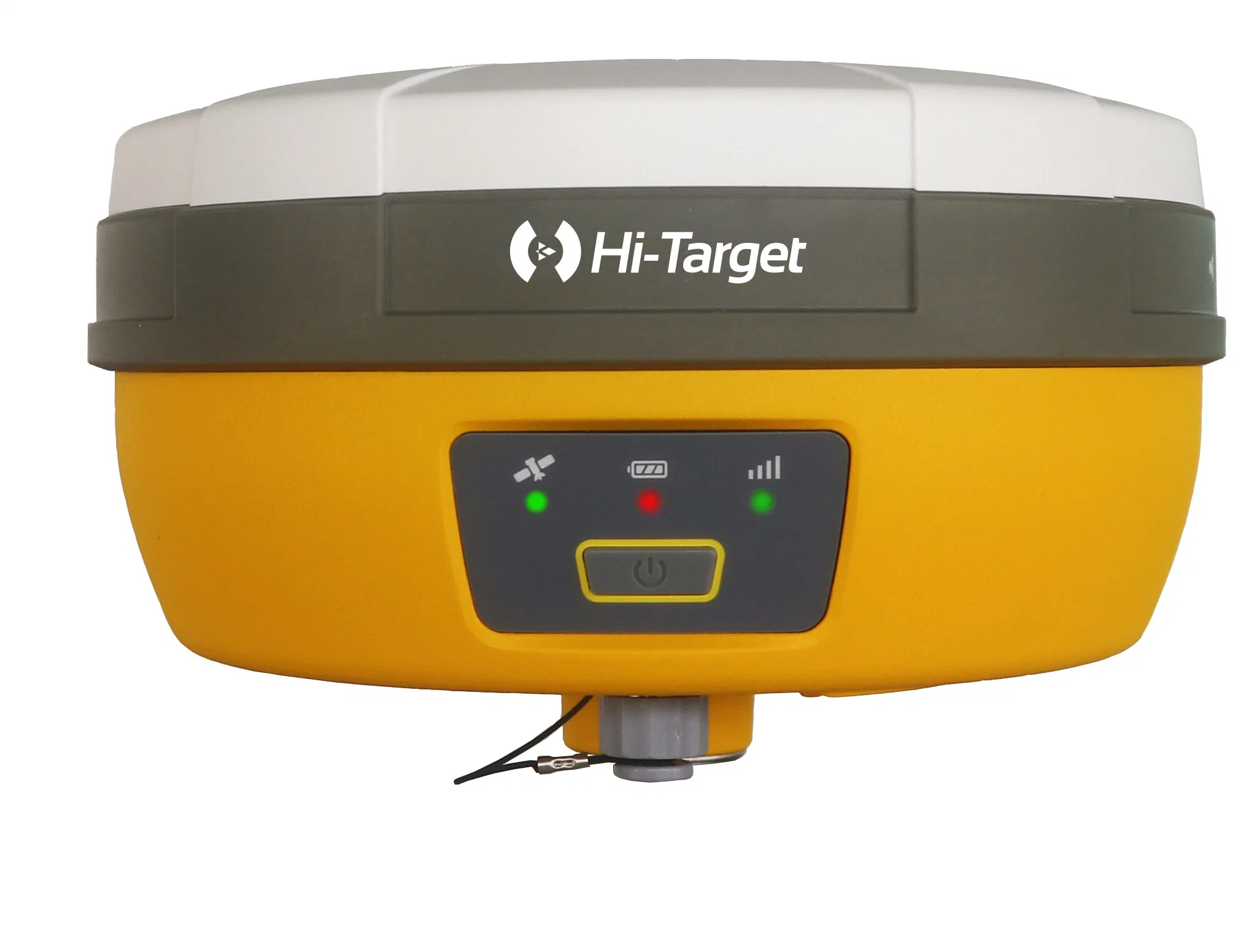
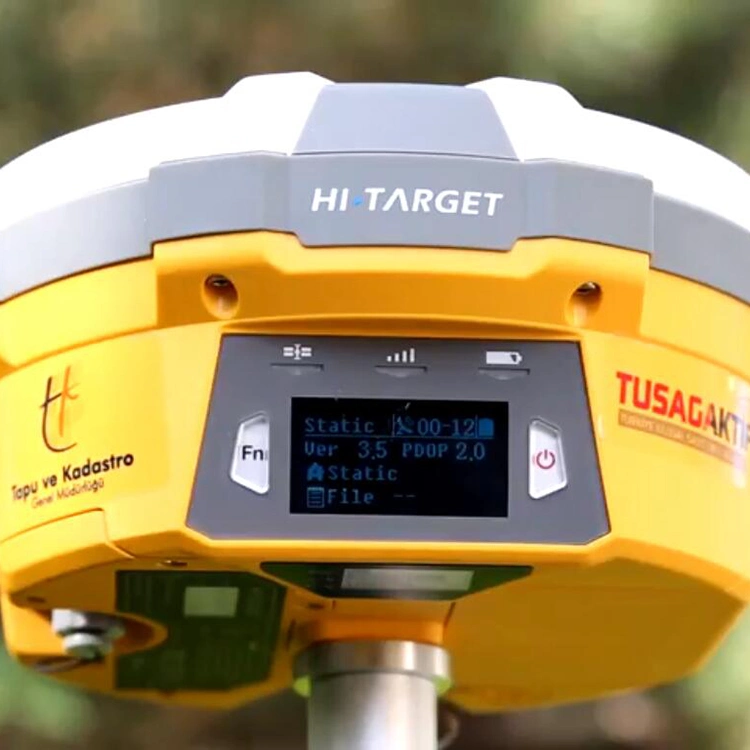
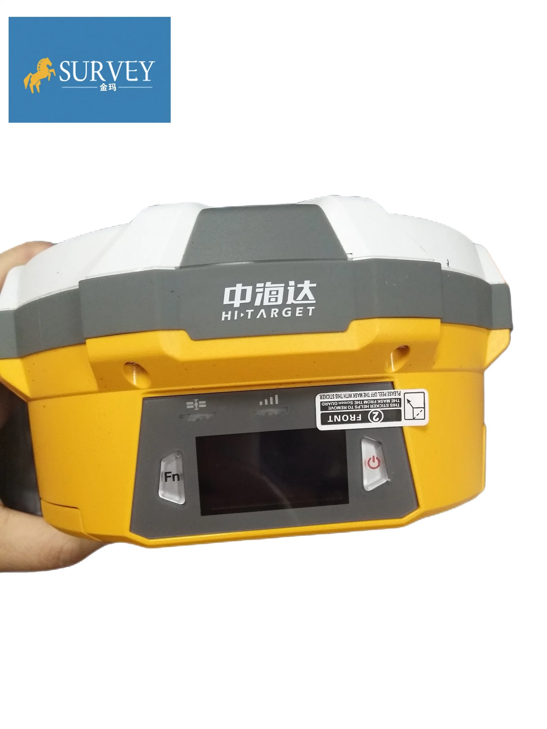
| Operation buttons | one power button, one function key |
| Indicators | one satellite indicator (highlighted green), |
| one status indicator (highlighted red and green), | |
| one power indicator (highlighted in red). | |
| Physical | |
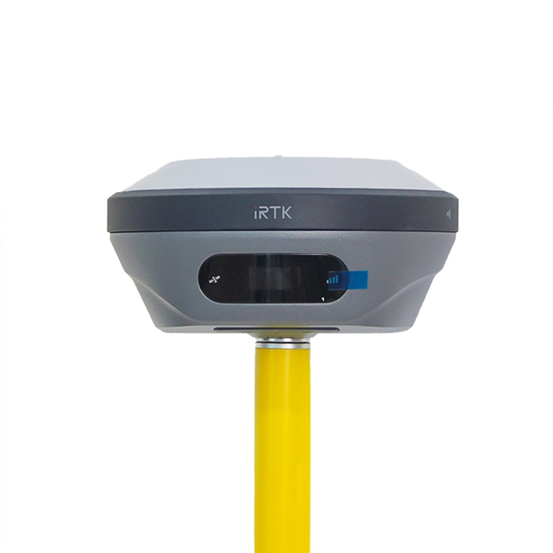
| Dimension | 18.20cm x 9.80cm (7.17inch x 3.86inch) |
| Battery | 2*5000mAh, 7.4V |
| Material | The shell is made of environmentally friendly materials Universal Nano |
| Weight | 1.25kg (2.76lb) without internal battery |
| Water and Dust Proof | IP67 ,protected from temporary immersion to depth of 1m (3.28ft). |
| Shock and vibration | Designed to survive a 3m(9.84ft) natural fall onto concrete. |
| External power input | 6V to 28V DC |
| Working temperature: | -45 ºC ~ 65 ºC |
| Storage temperature: | -55 ºC ~ 85 ºC |
| Model | iHand20 | Qmini MP | |||
| System Configuration | OS | Android 4.2 | Windows mobile 6.5 | ||
| Processor | MT6589, 1.5GHz, 4core | 806MHz | |||
| RAM | 1GB | 256MB | |||
| Flash memory | 4 GB | 8 GB | |||
| Communication interface | Bluetooth,Mini USB,WIFI:802.11b/g,MicroSD card slot, support up to 32 GB Dual Sim Dual Standby, support 2G and 3G | Bluetooth,Mini USB,WIFI:802.11b/g,MicroSD card slot, support up to 32 GB,Built-in 3G module | |||
| Physical | Power | 3.7V, 6300mAh lithium battery, up to 25 hours continuous work | 3.7V, 3100mAh lithium battery, up to 8 hours continuous work | ||
| Keyboard | Physical keyboard | 10 keys, include the four arrow keys | |||
| Size | 213mm x 89mm x 35mm | 152mm x 82mm x 32mm | |||
| Weight | 520g (with battery) | 315g (with battery) | |||
| Operating temperature | -20ºC to +55ºC | -20ºC to +70ºC | |||
| Storage temperature | -30ºC to +65ºC | -30ºC to +80ºC | |||
| Water/dustproof | IP68 | IP65 | |||
| Anti-shock | 1.2m natural fall | 1.5m natural fall | |||
| 440 Channels | |
Advanced Pacific Crest Maxwell 6 Custom Survey GNSS Technology | ||
High precision multiple correlator for GNSS pseudo range measurements | ||
Unfiltered, unsmoothed pseudo range measurements data for low noise, low multipath error, low time domain correlation and high dynamic response | ||
Very low noise GNSS carrier phase measurements with <1 mm precision in a 1 Hz bandwidth | ||
Signal-to-Noise ratios reported in dB-Hz | ||
Proven Pacific Crest low elevation tracking technology | ||
Satellite signals tracked simultaneously | GPS: Simultaneous L1C/A, L2C, L2E, L5 | |
GLONASS: Simultaneous L1C/A, L1P, L2C/A (GLONASS M only), L2P | ||
SBAS: Simultaneous L1 C/A, L5 | ||
Galileo: Simultaneous L1 BOC, E5A, E5B, E5AltBOC | ||
BDS/Compass(optional): B1, B2 | ||
QZSS: L1 C/A, L1 SAIF, L2C, L5 | ||
POSITIONING PERFORMANCE | Static and Fast Static GNSS surveying | Horizontal: 2.5mm+0.5ppm RMS |
Vertical: 5mm+0.5ppm RMS | ||
Post Processing Kinematic (PPK / Stop & Go) GNSS surveying | Horizontal: 1cm+1ppm RMS | |
Vertical: 2.5cm+1ppm RMS | ||
Initialization time: typically 10 minutes for base while 5 minutes for rover | ||
Initialization reliability: typically > 99.9% | ||
RealtimeKinematic(RTK) surveying | Horizontal: 8mm+1ppm RMS | |
Vertical: 15mm+1ppm RMS | ||
Initialization time: typically < 8 seconds | ||
Initialization reliability: typically > 99.9% | ||
Code Differential GNSS positioning | Horizontal: 25cm+1ppm RMS | |
Vertical: 50cm+1ppm RMS | ||
SBAS[iv]: 0.50m Horizontal, 0.85m Vertical | ||
HARDWARE | Physical | Dimensions (W x H): 19.50cm x 10.40cm(7.68 in x 4.09 in) |
Weight: 1.3kg (2.86lb) with internal battery, internal radio, standard UHF antenna | ||
Operating temperature: -45ºCto +65ºC | ||
Storage temperature: -55ºC to +85ºC | ||
Humidity: 100%, considering | ||
Water/dustproof: IP67 dustproof, protected from temporary immersion to depth of 1m (3.28ft) | ||
Shock and Vibration: Designed to survive a 3m(9.84ft) natural fall onto concrete | ||
Electrical | Power 6V to 28V DC external power input | |
Power consumption 2.5W | ||
Automatic Switching between internal power and external power | ||
Rechargeable, removable 7.4V, 4400mAh Lithium-Ion battery in internal battery compartment | ||
Internal battery life | Static 13 - 15 hours | |
RTK Rover (UHF/GPRS/3G) 10 - 12 hours | ||
RTK Base 8 - 10 hours | ||
I/O interface | 1 x Bluetooth | |
1 x standard USB2.0 port | ||
2 x RS232 serial port | ||
2 x DC power input (8-pin & 5-pin) | ||
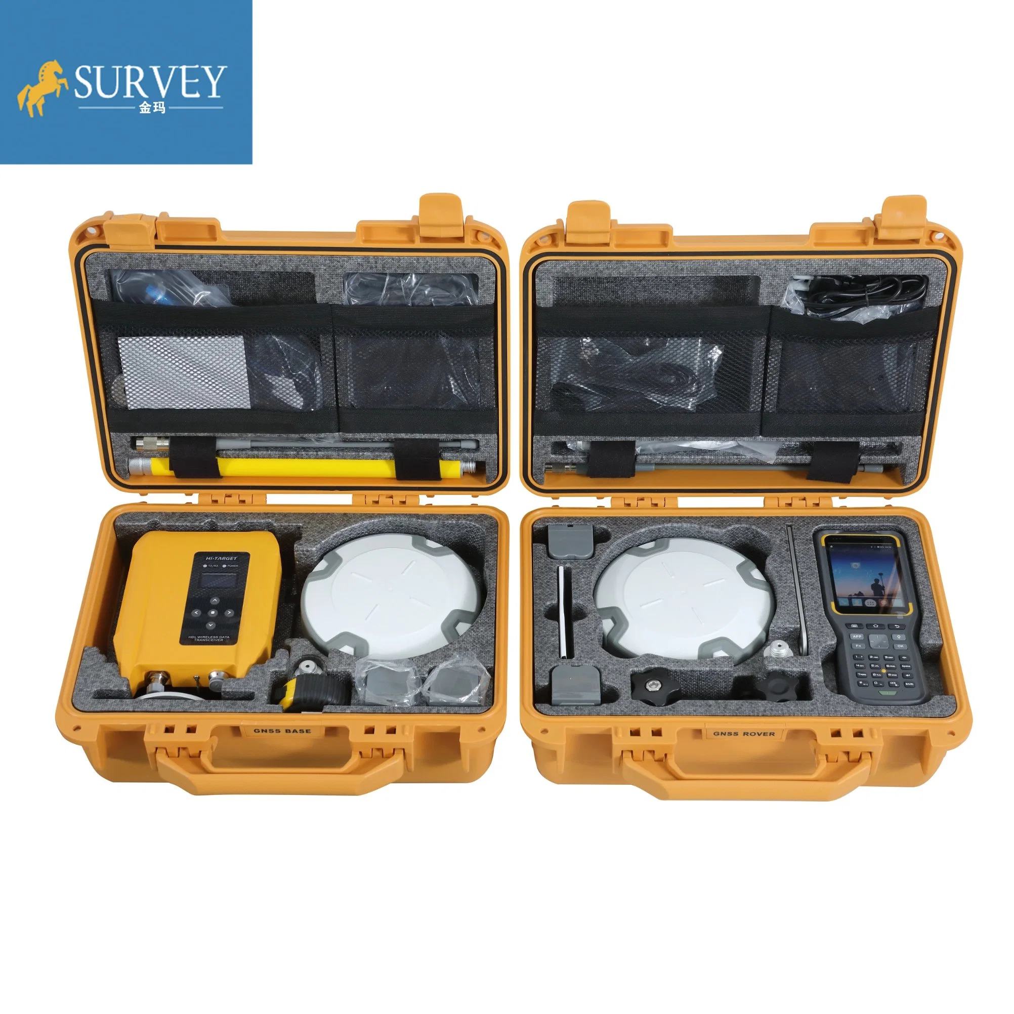
Software | Field Software | There are optional field controllers and software in the V30 package. The controllers with OS Microsoft Windows Mobile 6.5 are fully compatible with the third party software such as Carlson SurvCE, MicroSurveyFieldGenius, Digiterra Explorer, EsriArcPad etc. besides standard field&GIS software made by HI-TARGET. HI-TARGET controller with WiFi, Bluetooth, and GPRS/3G is completely wireless to connect to any device, collect data and connect to server simultaneously and seamlessly. |
Post-processing Software | HI-TARGETGeomatics Office (HGO) software provides total GNSS solution with a complete suite of programs to support HI-TARGET GNSS receivers. Standard Rinex data and HI-TARGET raw data can be processed flexibly and easily. | |
COMMUNICATION AND DATA STORAGE | GPRS/GSM or 3G | Fully integrated, fully sealed internal GPRS/GSM or 3G |
Network RTK (via CORS) range20-50km | ||
HI-TARGET internal UHF radio (standard) | Frequency: 460 MHz with 116 channels | |
Transmitting Power: 0.1W, 1W, 2W adjustable | ||
Transmitting Speed: Up to 19.2Kbps | ||
Working Range: 3~5Km typical, 8~10km optimal | ||
HI-TARGET External UHF radio (standard) | Frequency: 460 MHz with 116 channels | |
Transmitting Power: 5W, 10W, 20W, 30W adjustable | ||
Transmitting Speed: Up to 19.2Kbps | ||
Working Range: 8~10Km typical, 15~20km optimal | ||
Data storage | 64MB internal memory | |
Data formats | (1Hz positioning output, up to 50 Hz - depends on installed option) | |
CMR: sCMRx, CMR, CMR+input and output | ||
RTCM: RTCM 2.1, 2.2, 2.3, 3.0, 3.1 input and output | ||
Navigation outputs ASCII: NMEA-0183 GSV, AVR, RMC, HDT, VGK, VHD, ROT, GGK, GGA, GSA, ZDA, VTG, GST, PJT, PJK, BPQ, GLL, GRS, GBS | ||
Navigation outputs Binary: GSOF | ||
1 Pulse Per Second Output | ||
Service
2.All our products have one year warranty, And we sure the products will be free from maintenance within warranty period.
3.All products will have been strictly quality checked in factory before sending out.
We accept payment by TT,Paypal, West union.
If you'd like other payment method, Pls let us know before the order
Delivery / shippment :
1.Usually, we will send out the products within 3-5 working days after the payment confirmed
2.Before shipment, pls supply the following information to us :
Contact person or company name,Detail address,Telephone No,Zipcode
3.The buyer are responsible for the tax and/or duty charged by their country.
Return and warranty:
1.All products are inspected before shipment, if you are not satisfactory with the purchase,you can exchange the items in one week,and you must contact us within 24 hour of receipt of the products.
2.The shipping charges are not refundable and the customer should be responsible for all the charges of return and reshipping.
3.For our majority products (Auto level, Theodolite, Total Station) we are offing 1 year warranty;
4.For small issues like missing or damaged part, key board, please send us the photos, we will send the required part and related instructions to you for free;
5. For big issues in one year warranty like EDX board, main board issue. We could only ask you to send the instrument back to us. Normally we will have it fixed in 10 working days and send back to you. You and we shall take care of the corresponding shipping cost on each side. For big issues out of one year warranty, the customer should be responsible for all the cost.