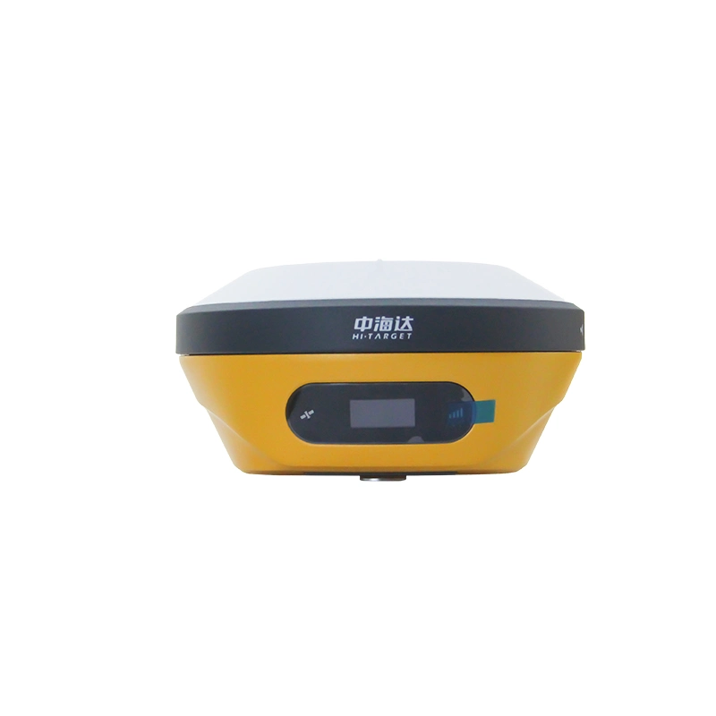
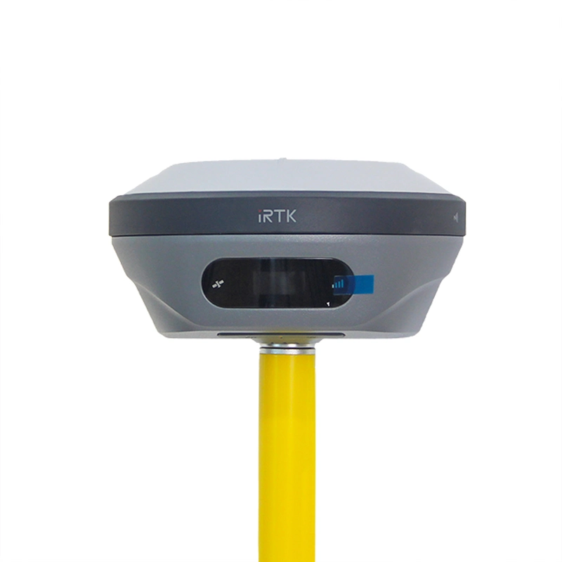
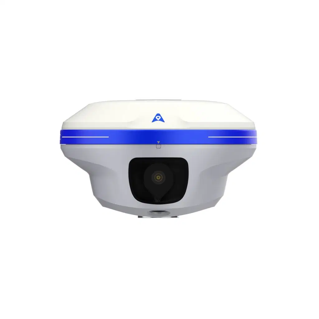
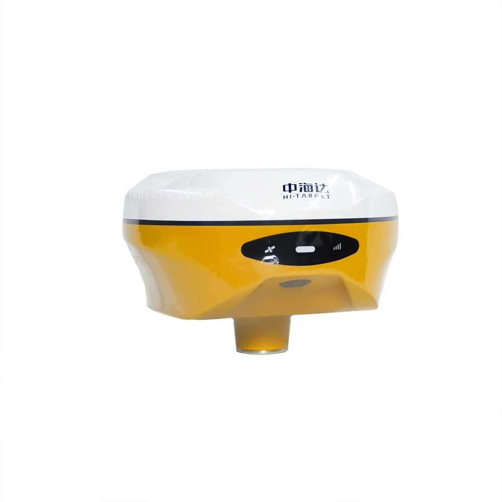
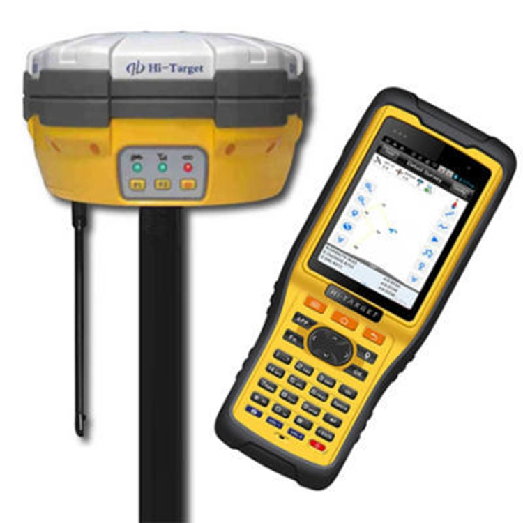
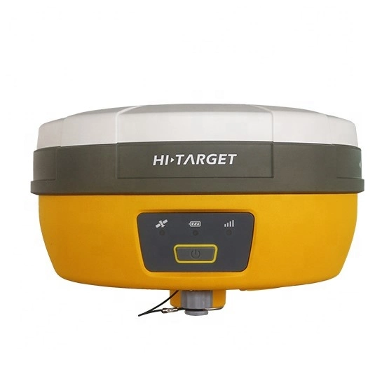
Description
Key features
1)BD970 GNSS engine;
2)Support GPS, GLONASS, BDS, GALILEO;
3)Rugged design and user-friendly functions.
Detail advantage functions
1 Multi-constellation tracking
1)220 tracking channels;
2)Supports GPS, GLONASS, BDS, SBAS;
3)NGS approved GNSS antenna.
2 Intelligent operation
1)Equipped with a smart speaker guiding the whole operation;
2)Multi one-button functions make fieldwork easier, such as auto base setup by one button, the rover can get fix solution once it is turned on.
3 Diversify RTK application
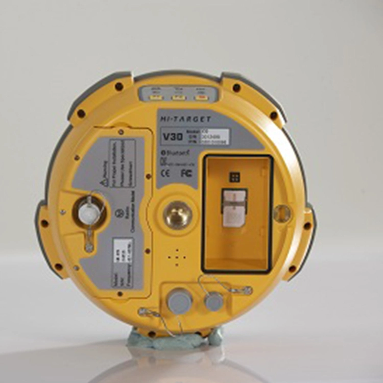
Optional transceiver UHF radio
1)The transceiver UHF radio enables the working mode to be switchable between base and rover;
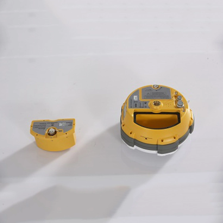
2)Removable internal UHF radio enables users to fix or exchange simply;
Seamless operation in CORS system;
3)Built-in GPRS/GSM/3G module ensures that the V30 works perfectly with network RTK positioning.
4 Long-life battery
1)Powered by 5000mAh Li-ion battery;
2)Static working time 13 - 15 hours;
3)RTK Rover (UHF/GPRS/GSM) working time 10 - 12 hours;
4)RTK Base working time 8 - 10 hours.
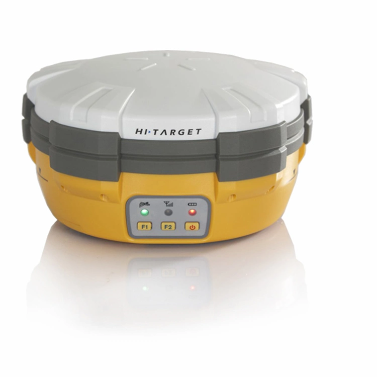
5 Rugged and unique design
1)IP67 dust/water protection;
2)Withstands 3-meter natural fall onto concrete;
3)Rapid tracking and perfect avoidance or reduction of obstruction and multipath effect to ensure superior positioning capability.
Specifications:
| Model | V30 plus |
| System Configuration | Data storage | 8GB internal memory |
| Data Formats | 1Hz positioning output, up to 50 Hz - depends on installed option |
| CMR: sCMRx,CMR,CMR+input and output |
| RTCM: RTCM 2.1, 2.2, 2.3, 3.0, 3.1,3.2 input and output |
| Navigation outputs ASCII: NMEA-0183 GSV, AVR, RMC, HDT, VGK, VHD, ROT, GGK, GGA, GSA, ZDA, VTG, GST, PJT, PJK, BPQ, GLL, GRS, GBS |
| Navigation outputs binary: GSOF,1 Pulse Per Second Output |
| Satellite Signals Tracked Simultaneously | Channels | 220,Advanced Pacific Crest Maxwell 6 Custom Survey GNSS Technology |
| BDS | B1, B2,B3 |
| GPS | L1, L2C/P, L5 |
| GLONASS | Simultaneous L1, L2 |
| SBAS | Simultaneous L1, C/A, L5(EGNOS, WAAS, MSAS, GAGAN, QZSS) |
| Static and Fast Static GNSS Surveying | Horizontal | 2.5mm+0.5ppm RMS |
| Vertical | 5mm+0.5ppm RMS |
| Post Processing Kinematic (PPK / Stop & Go) GNSS Surveying | Horizontal | 1cm+1ppm RMS |
| Vertical | 2.5cm+1ppm RMS |
| Initialization time | Typically 10 minutes for base while 5minutes for rover |
| Initialization reliability | Typically > 99.9% |
| RealtimeKinematic(RTK) surveying | Horizontal | 8mm+1ppm RMS |
| Vertical | 15mm+1ppm RMS |
| Initialization time | Typically < 8seconds |
| Initialization reliability | Typically > 99.9% |
| Code Differential GNSS Positioning | Horizontal | 25cm+1ppm RMS |
| Vertical | 50cm+1ppm RMS |
| SBAS | 0.50m Horizontal, 0.85m Vertical |
| Power and Battery | Power | 6V to 28V DC external power input,Power consumption ≤3.5W |
| Internal battery | Rechargeable, removable 7.4V, 5000mAh Lithium-ion battery |
| Internal battery life | static:13 - 15 hours |
| RTK Rover (UHF/GPRS/3G) 10 - 12 hours |
| RTK Base 8 - 10 hours |
| I/O Interface | 1 xBluetooth, 1 x standard USB2.0 port,2 x RS232 serial port ,2x DC power input (8-pin & 5-pin) |
| Physical | Dimensions (W x H) | 164mm x 83.5mm |
| Weight | 1.4kg with internal battery, internal radio,standard UHF antenna |
| Operating temperature | -45ºCto +65ºC (-49ºF to +149ºF) |
| Storage temperature | -55ºC to +85ºC(-67ºF to +185ºF) |
| Humidity | 100%, considering |
| Water/dustproof | IP67 dustproof, protected from temporary immersion to depth of 1m (3.28ft). |
| Shock and vibration | Designed to survive a 3m(9.84ft) natural fall onto concrete. |
 Complaint