 Complaint

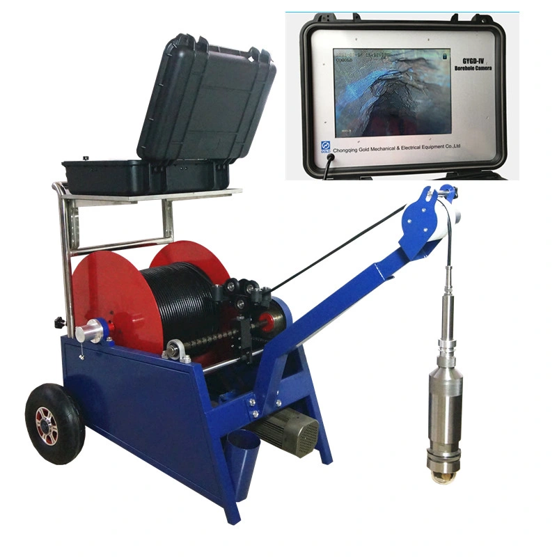
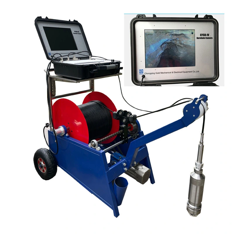
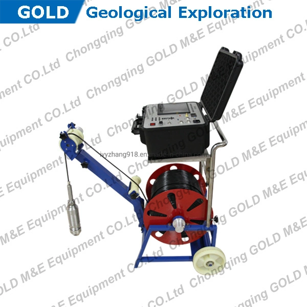
| No. | Configuration | Dimension | Specification |
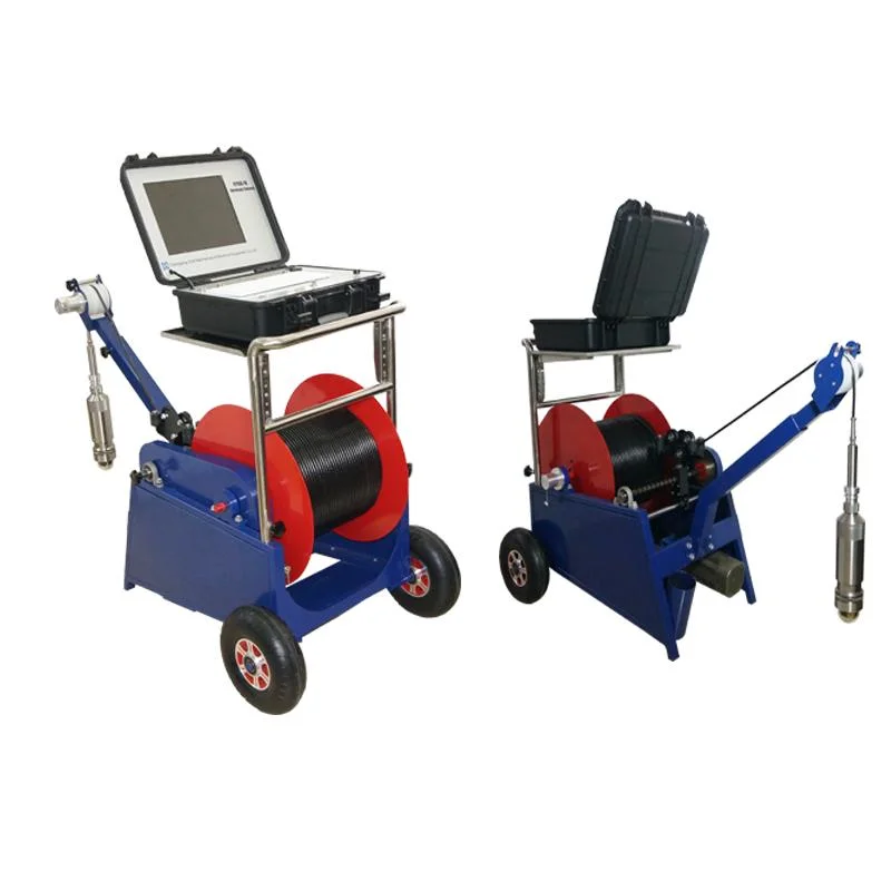
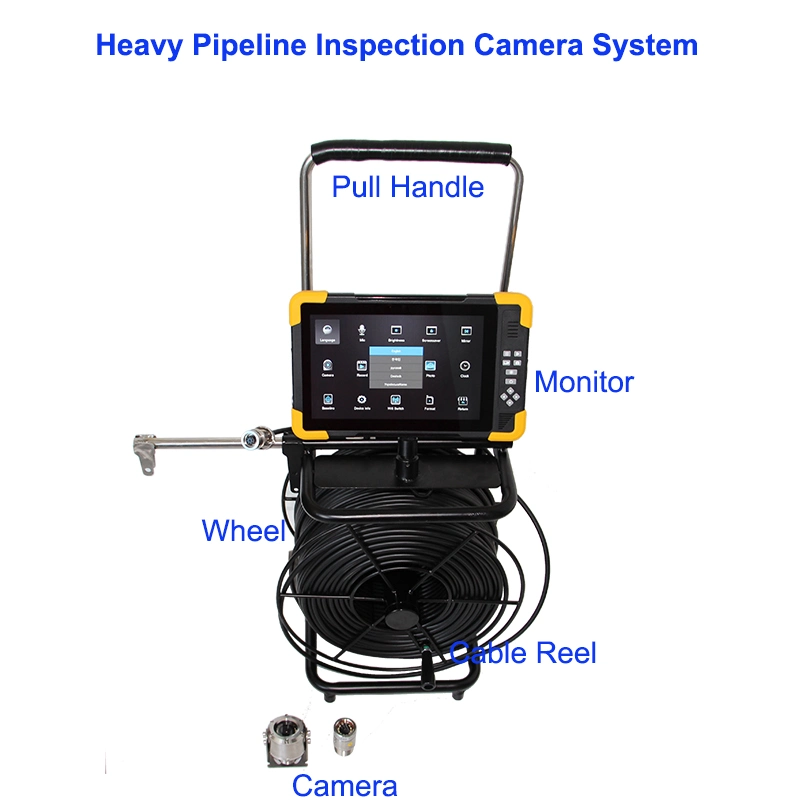
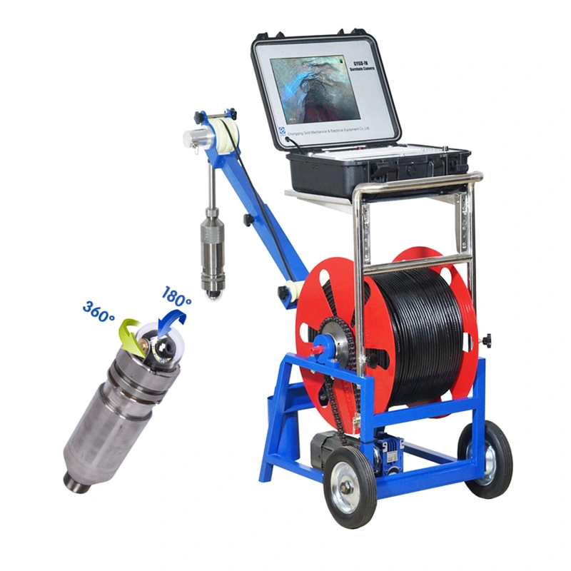
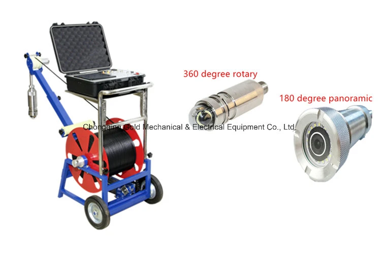
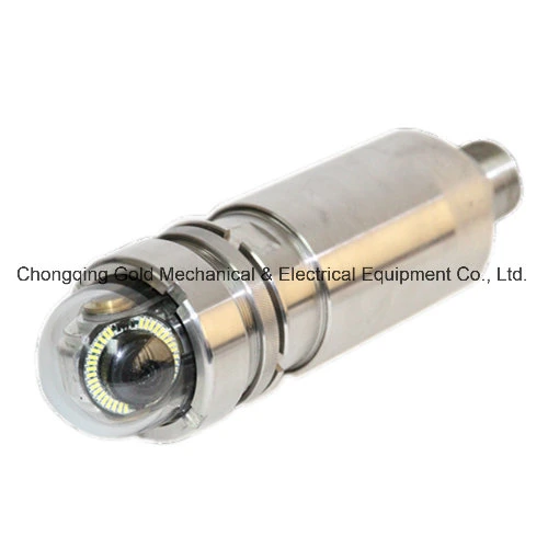
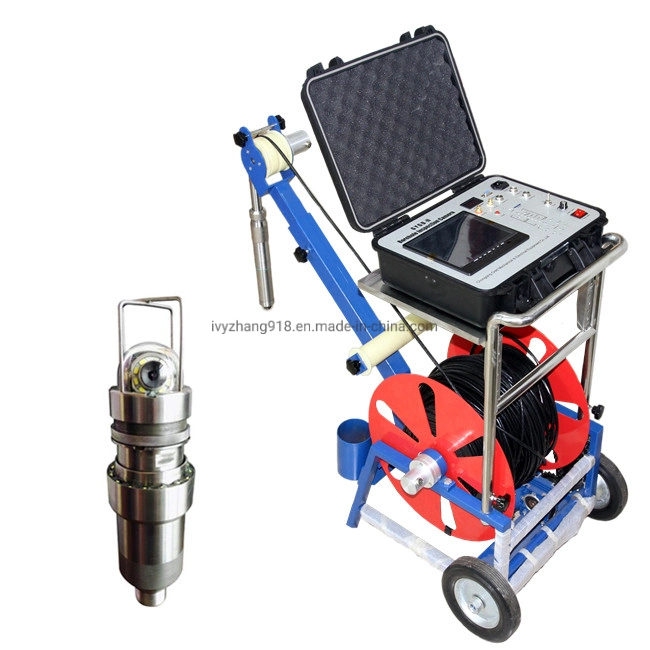
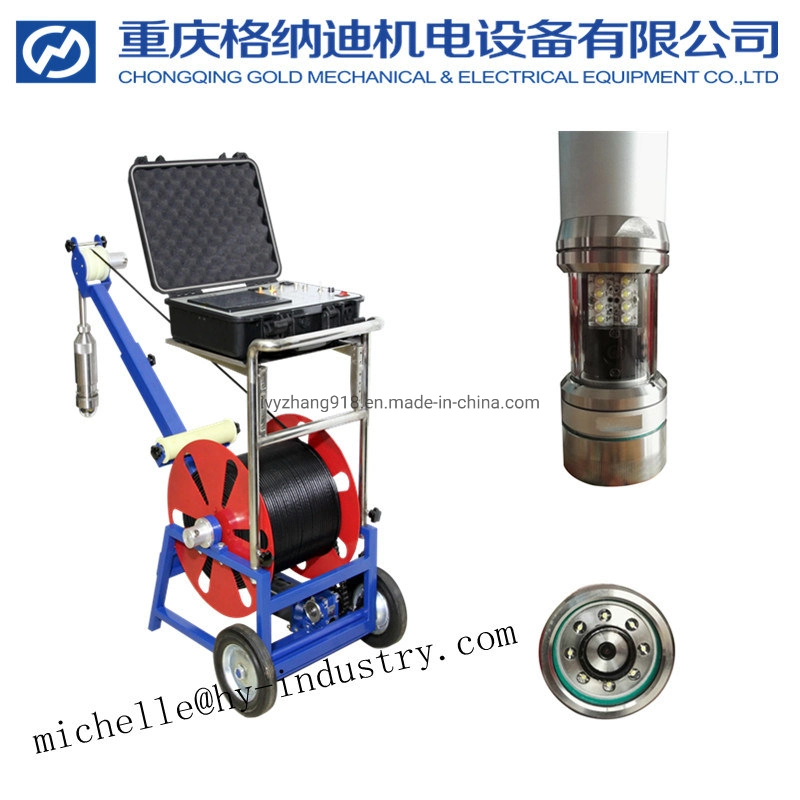
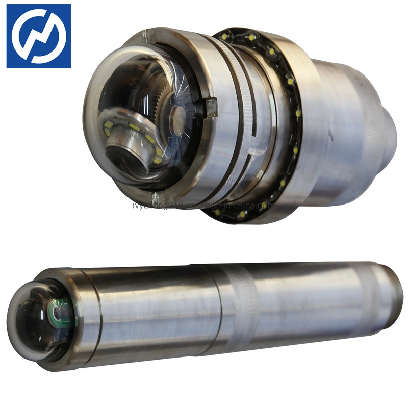
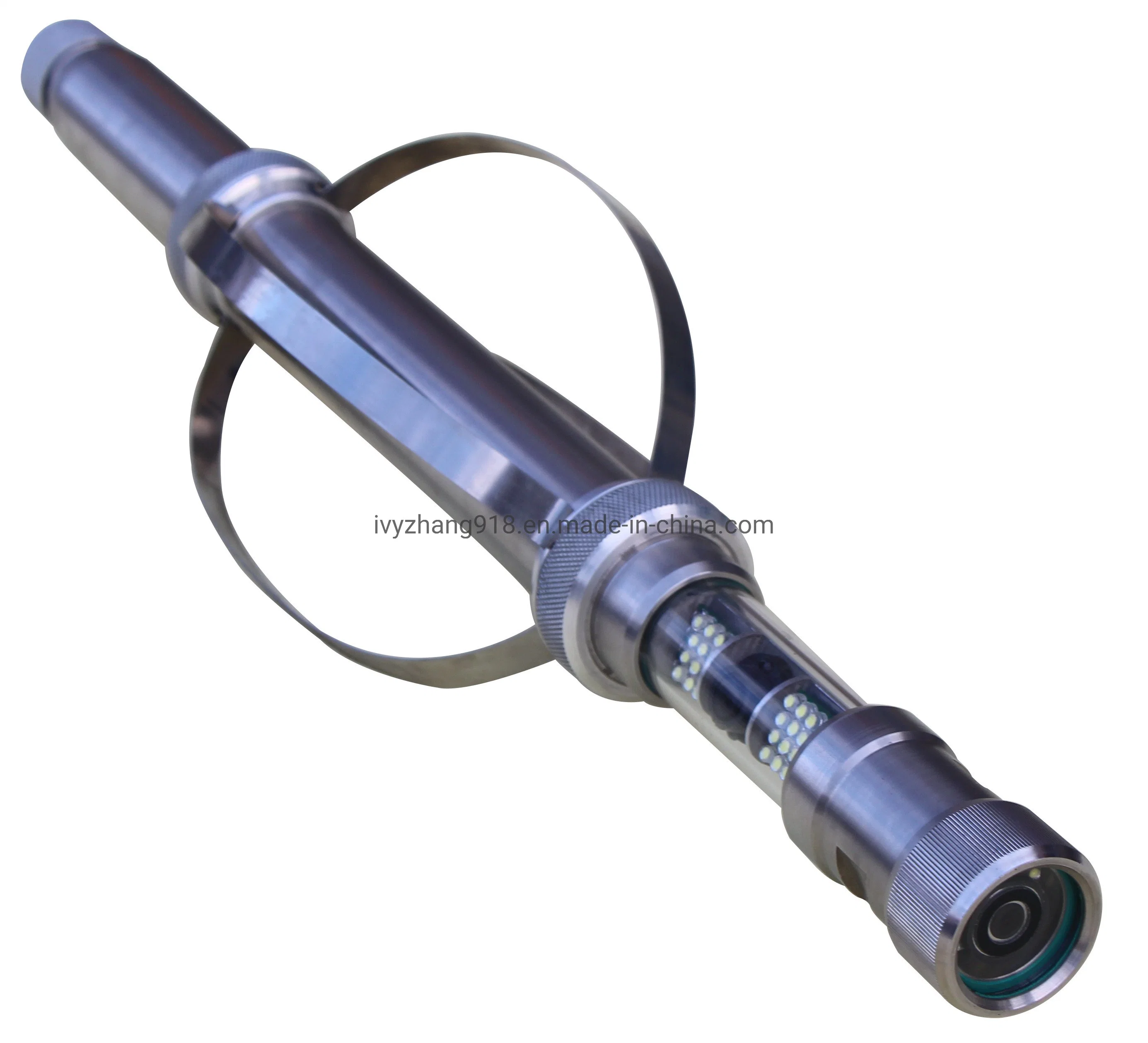
| 1 | Camera probe | Diameter: 50/80mm Length: 470mm | 1. Camera lens are manufactured with high-quality resins. 2. High-quality steel body with solid structure, not easy to be damaged. 3. Maximum bearable pressure: 20Mpa (can reach the depth of 2000m under water) 4. 6-12 LED lamps are available |
| 2 | Camera | 1. Sony inducer 1/3'' CCD 2. HD 850 TVL image definition 3. Waterproof 4. Panoramic lens/electric rotating camera | |
| 3 | Specialized cable | Length: 0-2000m (optional) | 1. With steel wire 2. Max bearable tension: 260kg |
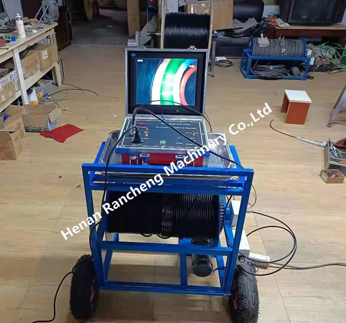
| 4 | Control unit | 1. 220V/380V/12V optional voltage mode 2. Aeronautic aluminium case | |
| 5 | Downhold pulley | Logging depth counter equiped | |
| 6 | Logging winch | Manual & electric winch available | |
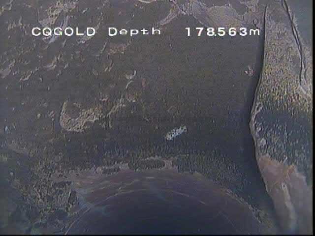
| 7 | HD DVR | SD card |
Chongqing Gold Mechanical & Electrical Equipment Co., Ltd
We are specialized in manufacturing and developing of Geophysical Exploration Instrument such as Resistivity Meter, IP Instrument, Resistivity Image, Seismic Instrument, Electromagnetic Instrument, Borehole Camera, Borehole Logging System, Water Level Meter; Borehole Drilling Equipment including Core/ Water Well/ Tunnel/ Engineering/ Anchor Drilling Rigs&Accessory and Geodetic Surveying Instrument(GNSS RTK System, Total Station, GIS Mapping and Echo Sounder).
Q1. How much is the shipping cost?