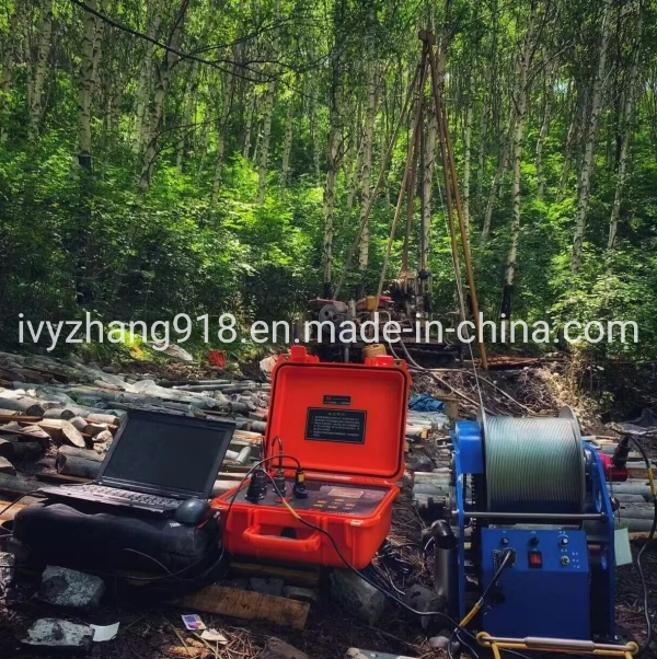
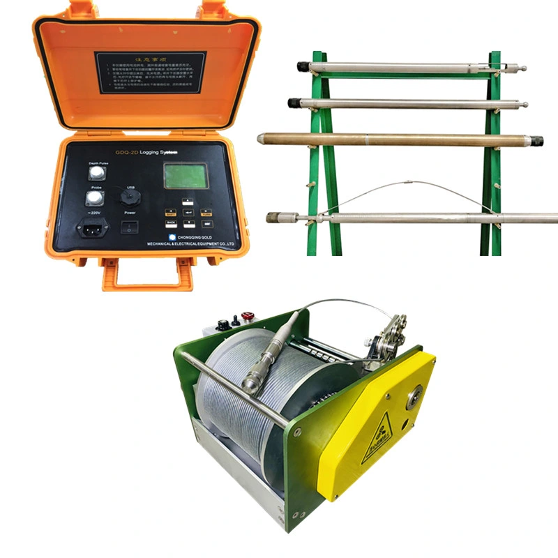
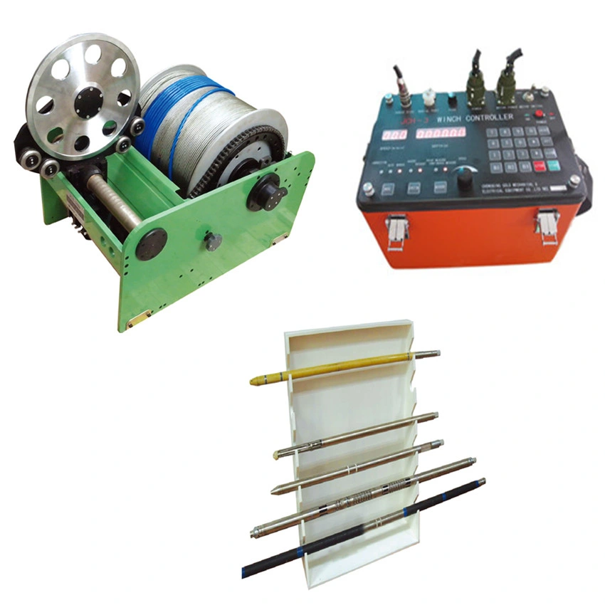
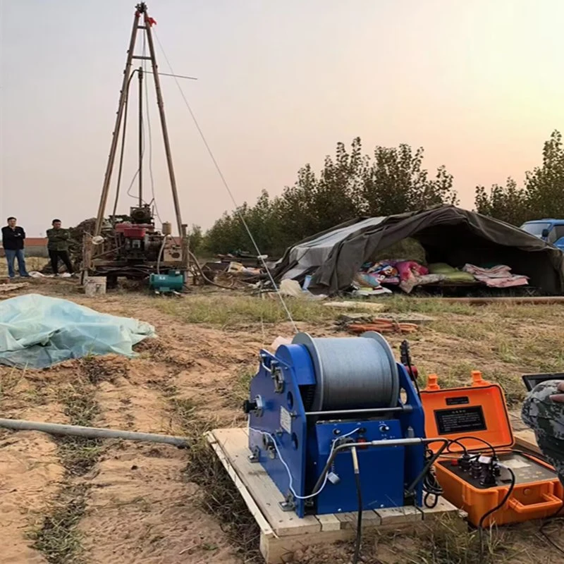
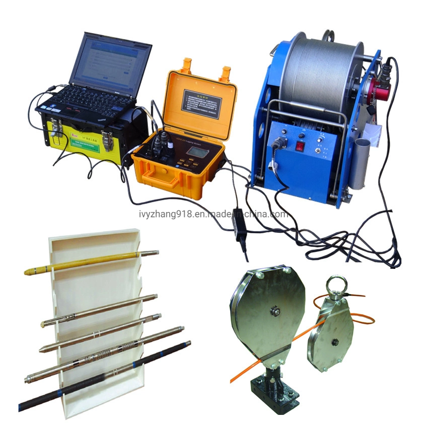
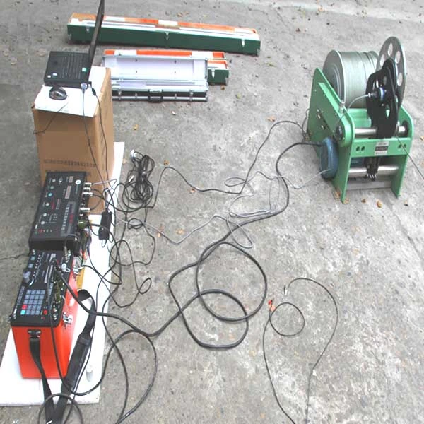
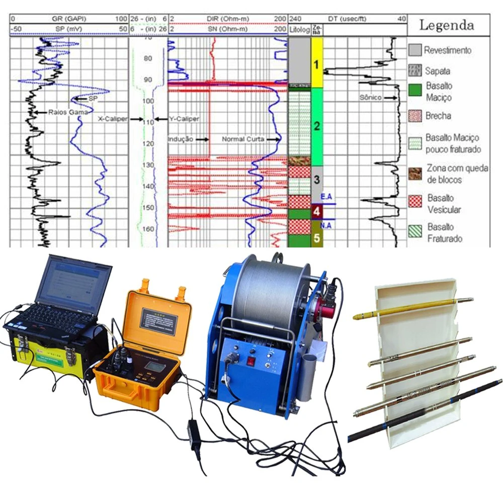
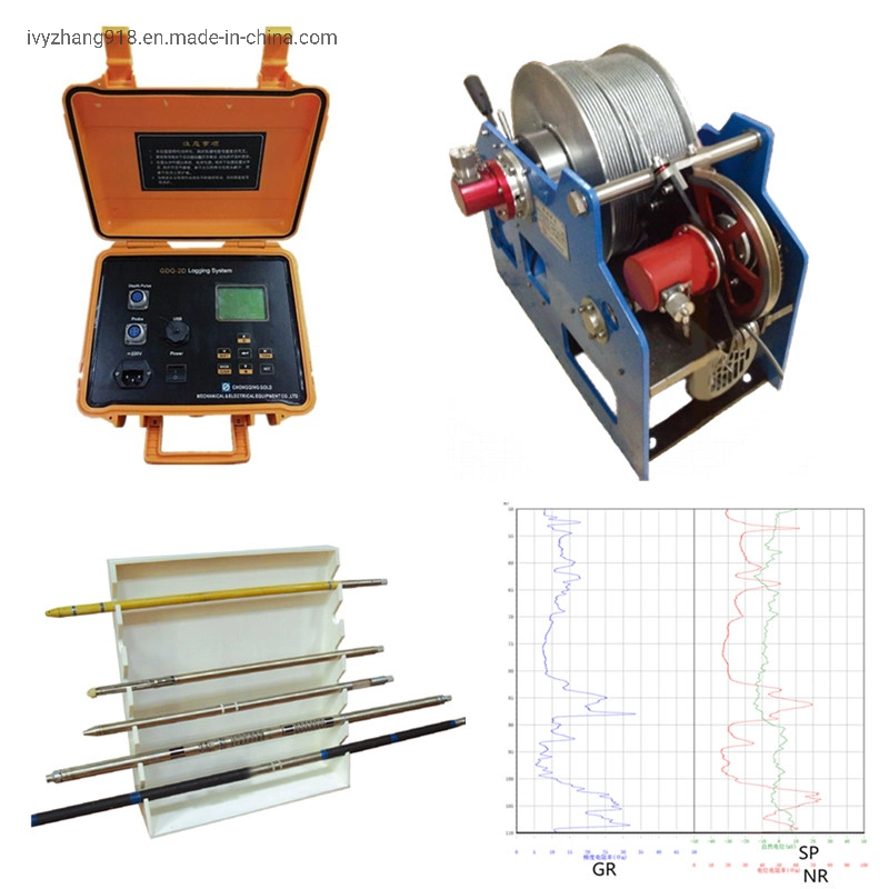
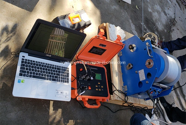
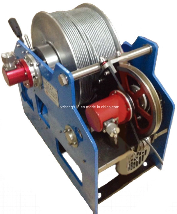
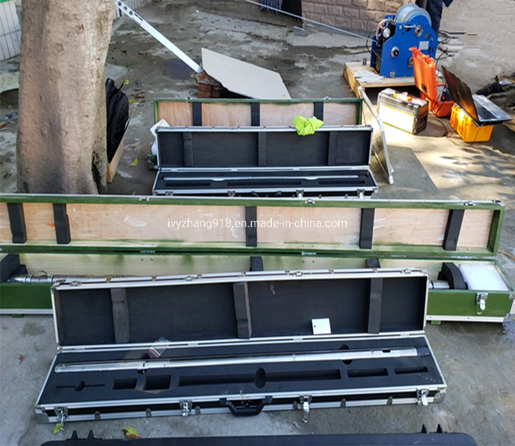
Description
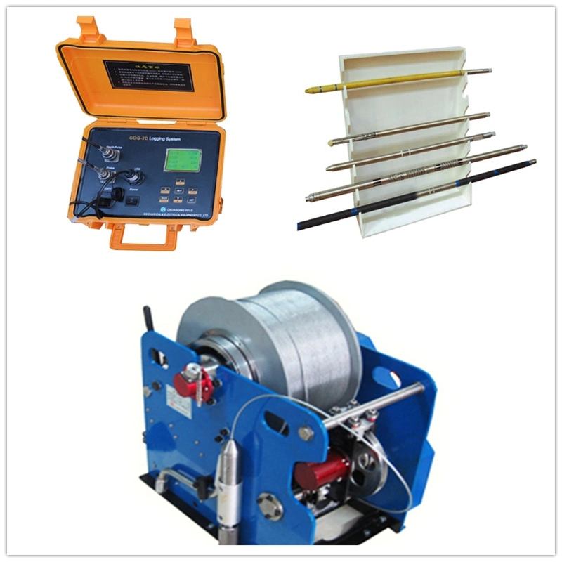
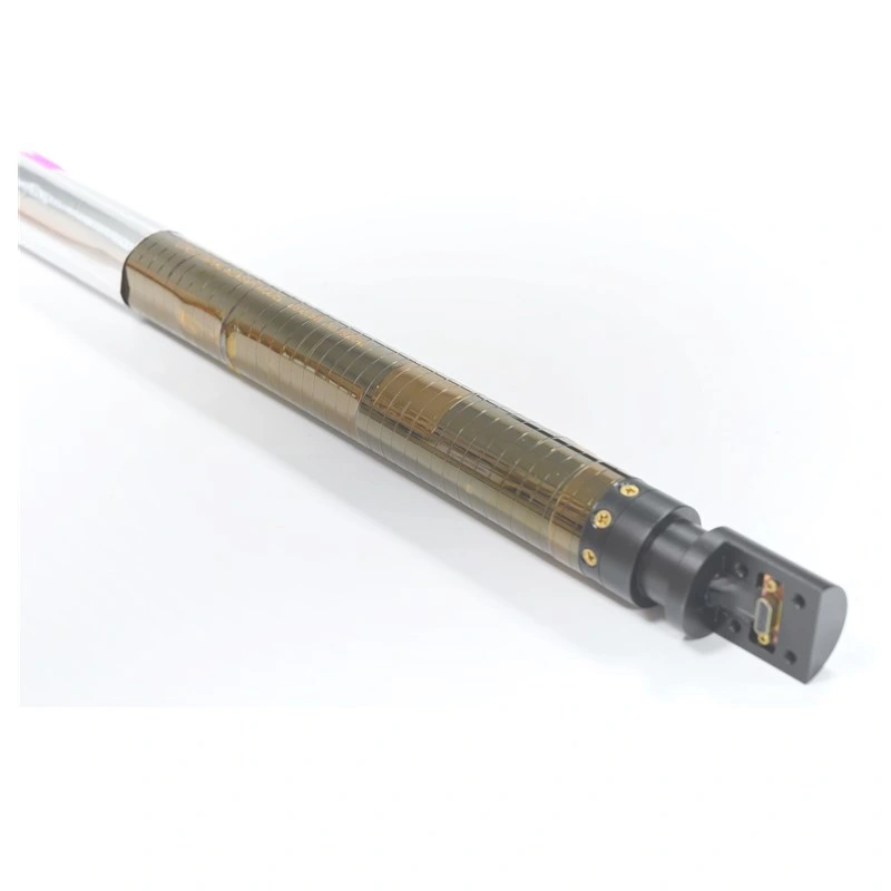
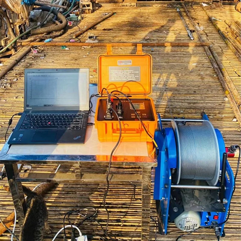
Borehole Geophysical Logging Tools Wellbore Resistivity Imaging Tools Hydrogeological Logging Tools Groundwater Exploration Equipment With Well logging softwareIt is the practice of making a detailed record of the geologic formations penetrated by the well. The log may be either geological logs or geophysical logs. In geothermal, geophysical logging is done to identify location of fractures, the lithology and record the physical parameters like temperature and pressure. Important logs include temperature, pressure, gamma, neutron, cement bond log, calliper log, resistivity and directional surveying.
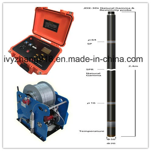
No | Model/ Name | Parameter to Measure |
1 | JDX-2Dr Resistivity & Gamma Probe | SP, Apparent Resistivity, Natural Gamma |
2 | JDX-3Dr Combined Probe | 16"/64" Resistivity, SP, Natural Gamma, Temperature, SPR |
3 | JJH-2 Res/IP Probe | 16"/64"Resistivity, SP, IP |
4 | JCX3-GMD Laterolog & Gamma | Laterolog-3 Resistivity, Natural Gamma, SP |
5 | JCC-2A Three-component Magnetometer | Magnetic Tri-component |
6 | JCH-2 Magnetic Susceptibility Probe | Susceptibility |
7 | JWY-1 Temperature & Fluid Resistivity | Temperature, Fluid Resistivity |
8 | JWL-2W Flow Combined Probe | Temperature, Water level, Flow |
9 | JJX-3DA High Precision Inclination Probe | Vertex Angle, Azimuth |
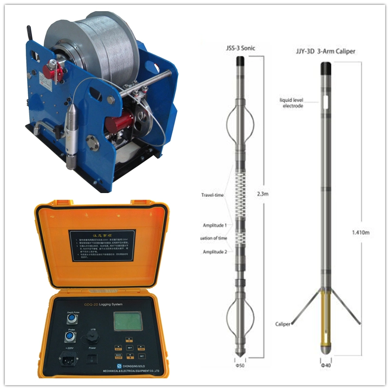
10 | JJY-3D Three-Arm Caliper | Diameter, Liquid level |
11 | JSS-3 Sonic Probe | Travel-time, Equation of time, Amplitude1, Amplitude2 |
12 | JMZD-2D Combined Density Probe | Density, Laterlog Resistivity, Natural Gamma, SP, Caliper |
13 | JZZ-3 Neutron & Gamma Probe | Natural Gamma, Porosity |
FAQ:
Q: Are you trading company or manufacturer ?
A: We are factory.
Q: How long is your delivery time?
A: Generally it is 5-10 days if the goods are in stock. or it is 15-20 days if the goods are not in stock, it is according to quantity.
Q: Do you provide After-sale service? is it free or extra ?
A: Yes, we could offer the after-sale service but do not pay the cost of freight.
Geophysical Logging is one of the applied geophysical methods (including gravity, magnetic and electroseismic nuclei) to measure geophysical parameters by taking advantage of the geophysical characteristics such as electrochemical characteristics, electric conductivity, acoustic characteristics and radioactivity of rock strata. In oil drilling, logging, also known as completion electrical measurement, must be carried out after drilling to the designed well depth, in order to obtain all kinds of petroleum geology and engineering technology data, as the original data of well completion and oilfield development. This log is conventionally called an open hole log.
The series of logging, which is carried out after casing running, is called production logging or development logging. The development has experienced four stages of analog logging, digital logging, numerical control logging and imaging logging.

 Complaint