
 Complaint

Measurements | 220 channels | |
| Advanced Pacific Crest Maxwell 6 Custom Survey GNSS Technology | ||
| High precision mulciple correlator for GNSS pesudo range | ||
| Unfiltered,low noice,low multipath error,low time domine correlation | ||
| Very low noise GNSS carrier phase measurements with<1mm precision(1 Hz) | ||
| Signal-to-Noise ratio reprted in dB-Ha | ||
| Proven Pacific Crest low elevation travking technology | ||
| Satellite Singnals Tracked | GPS: L1C/A,L2C,L2E,L5 | |
| Simultaneously | GLONASS: L1C/A,L1P,L2C/A(GLONASS M only),l2p | |
| SBAS: L1 C/A,L5 | ||
| Galileo: L1 BOC,E5A,E5B,E5ALtBOC | ||
| BDS/Compass: B1,B2 | ||
| QZSS: L1 C/A, L1 SAIF,L2C,L5 | ||
| Positioning performance | Static and Fast Static | Horizonta:l2.5mm+0.5ppm RMS |
| GNSS surveying | Vertica:l5mm+0.5ppm RMS | |
| Post Processing Kinematic | Horizontal:1cm+1ppm RMS | |
| (PPK/Stop&Go) GNSS surveying | Vertical:2.5cm+1ppm RMS | |
| Initialization time:typically 10 minutes | ||
| For base while 5 minutes for rover | ||
| Initialization reliability:typically>99.9% | ||
| Realtime Kinematic(RTK) surveying | Horizontal.8mm+1ppm RMS | |
| Vertical.15mm+1ppm RMS | ||
| Initialization timetypically < 8seconds | ||
| Initialization reliability.typically > 99.9% | ||
| Code Differential GNSS postioning | Horizontal.25cm+1ppm RMS | |
| Vertical.50cm+1ppm RMS | ||
| SABS:0.50m Horizontal, 0.85m Vertical | ||
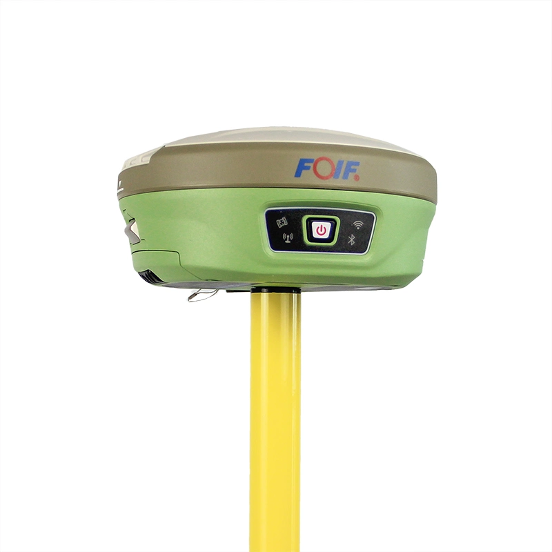
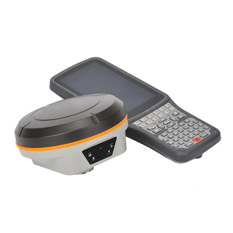
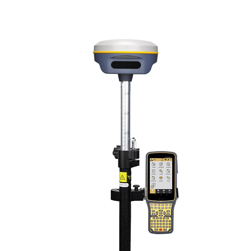
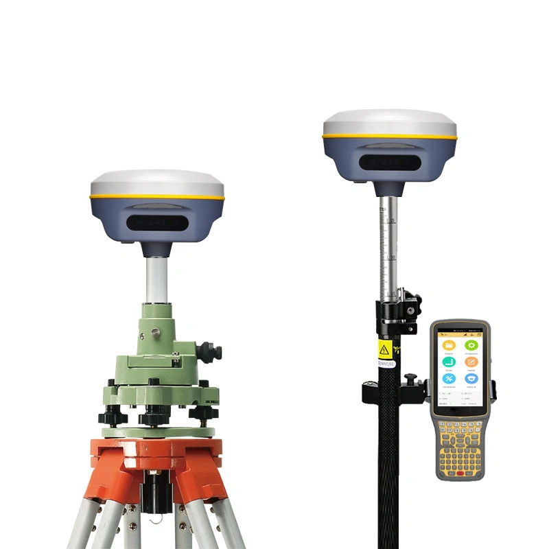
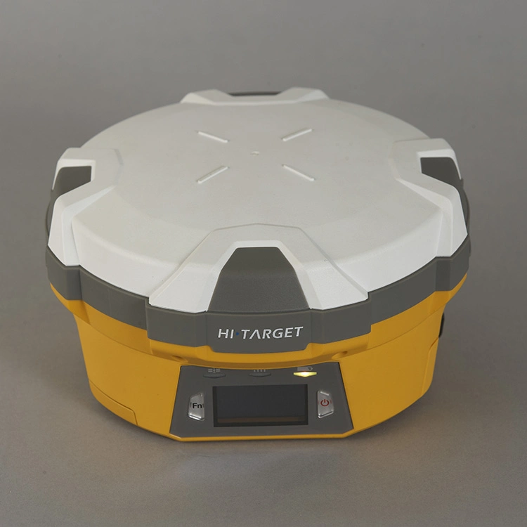
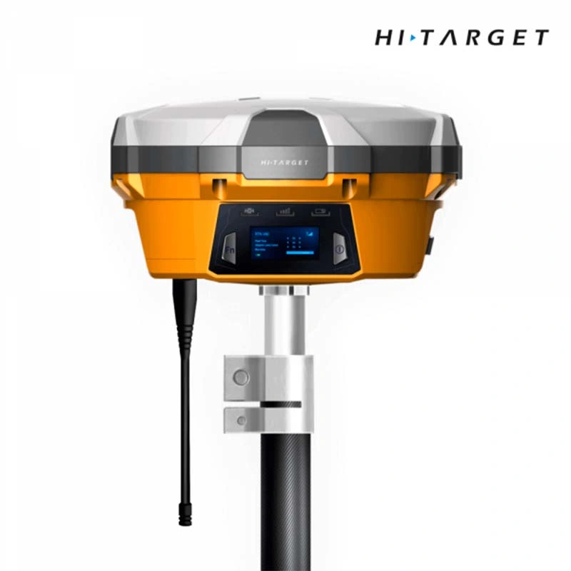
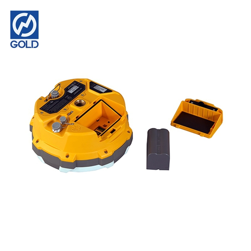
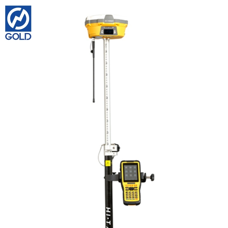
| Hardware | Physical | Dimensions(W × H):18.20cm×9.80cm(7.17 in.×3.86 in.) |
| Weight:1.25kgs(2.76lbs)without internal battery | ||
| Operating:-45°C to+65°C(-49°F to+149°F) | ||
| Storage temperature.-55°C to+85°C(-67°F to+185°F) | ||
| Humidity:100%,considering | ||
| Water/dustproof.IP67 dustproof,protected from | ||
| Temporary immersion to depth of 1 m(3.28ft) | ||
| Shock and Vibration.Designed to survive | ||
| a 3m(9.84ft) nature fall onto contrete. | ||
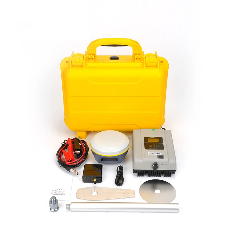
| Electrical | Power 6V to 28V DC external power input | |
| Power consumption ≤3.5w | ||
| Automatic Switching between internal power and external power | ||
| Rechargeable, removable 7.4V,5000mAh Lithium-Ion | ||
| Battery in internal battery compartment | ||
| Internal battery life | Static 13-15 hours | |
| RTK Rover(UHF/GPRS/3G)10-12 hours | ||
| RTK Base 8-10 hours | ||
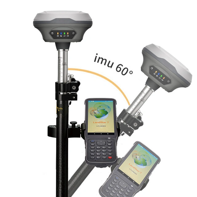
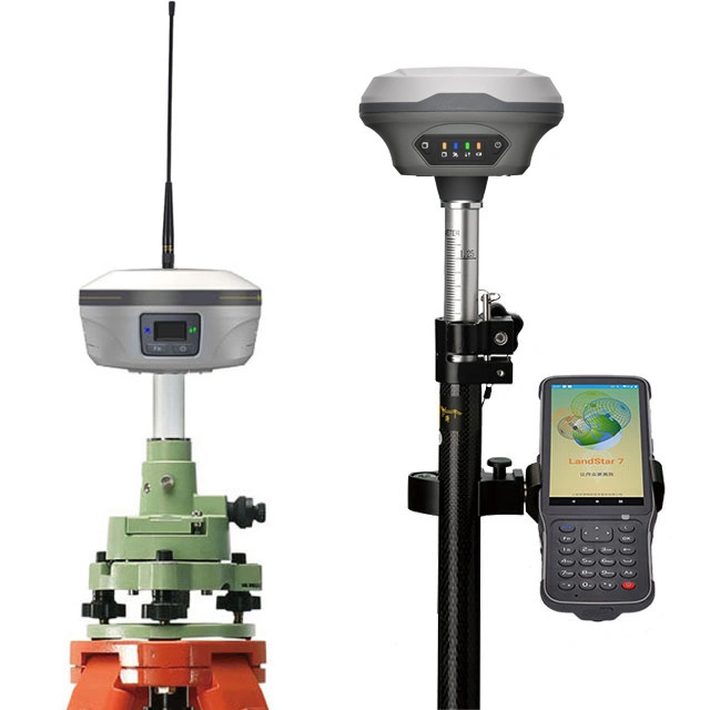
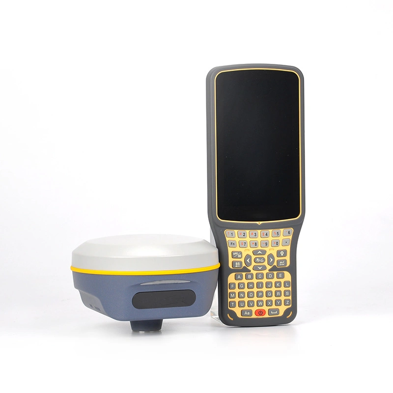
| I/O interface | 1×Bluetooth | |
| 1×standard USB2.0 port | ||
| 1×TNC UHF connector | ||
| 2×RS232 serial port | ||
| 2×DC power input(8-pin & 5-pin) | ||
| 1×Micro SD card port | ||
| Communication and data storage | 3G Communication | Fully integrated, fully sealed internal 3G, |
| compatabile with GPRS | ||
| Network RTK(via CORS) range 20-50km | ||
| HI-TRAGERT internal UHF radio(standard) | Frequency:450~470MHz with 116 channel | |
| Transmitting Power:1W,2W,5W,adjustable | ||
| Transmitting Speed:9.6Kbps,19.2Kbps | ||
| Working Range:5km typical,8-10km optimal | ||
| Pacticic Crest XDL Micro internal UHF RADIO | Frequency:403-473MHz | |
| Transmitting Power:0.5W,2W adjustable | ||
| Transmitting Speed:Up to 19.2Kbps | ||
| Working Range:3-5km typical,8-10km optimal | ||
| Hi-Target external UHF radio(standard) | Frequency:460MHz with 116 channels | |
| Transmitting Power:5W,10W,20W,30W adjustable | ||
| Transmitting Speed:Up to 19.2Kbps | ||
| Working Range:8-10km typical,15-20km optimal | ||
| Pacific Crest ADL vantage Pro External UHF radio | Frequency:390-430MHz or 430-470MHz | |
| Transmitting Power:4W to 35W adjustable | ||
| Transmitting Speed:Up to 19.2Kbps | ||
| Working Range:8-10km typical,15-20km optimal | ||
| Support other external Communication device | For example, external GSM moderm. | |
| Data formats | CMR:sCMRx,CMR, CMR+ input and output | |
| RTCM:RTCM2.1 2.2 2.3 3.0 3.1 3.2 input and output | ||
| Navigation outputs ASCII:NMEA-0183 | ||
| Navigation outputs Binary:GSOF | ||
| 1 Pules Per Second Output | ||