Description
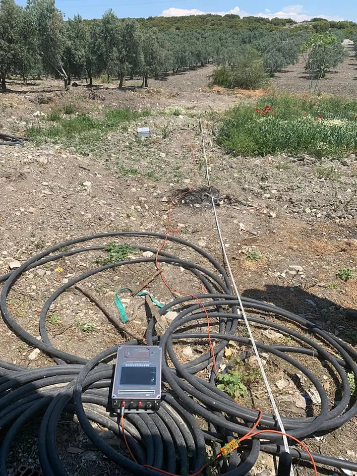
[Geophysical Exploration Technology and Application]---Automatic mapping water detectorAutomatic mapping water detector: it is based on the field source of earth's electromagnetic field and differences in conductivity of different underground geological structures, to study the variation law of electric field components at different frequencies to study the geological structure and changes. Changes in geological structure are displayed in real-time through multiple curves. Automatic mapping geological profile by one key operate easily, get rid of complicated computer graphics. Geological structure and specific information such as aquifers, fractures, faults, and caves can be easily analyzed through automatic mapping curve and profile on site . The device can be widely used in different terrains such as plains, hills, mountains, plateaus, and basins for rapid analysis of geological structure changes and determines the well locations, aquifers, and aquifer depth.Advantage[ High Measurement Speed and high efficiency
] Complete more than 8000 meters profile measurement in one day to realize geological abnormality in different depth, the prospecting speed and efficiency is improved about 10 times more than traditional resistivity method.
[ Resolution of measurement
] Is up to 0.001mV, and precision is ±
2%. It gains high stability and abnormity curves,It has advanced anti-jamming technology and multiple anti-jamming designs.
[ 6 Language Support
] Our water detector has 6 languages (English, French, Spanish, Arabic, Russian, Polish, Thai, Italian and Portuguese ) for options, The host machine is guaranteed for two years.
[ light and easy to carry
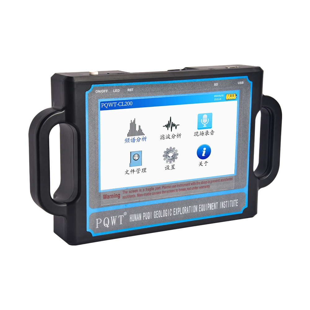
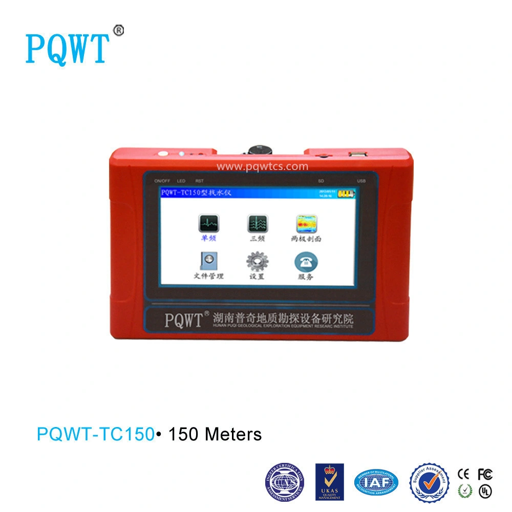
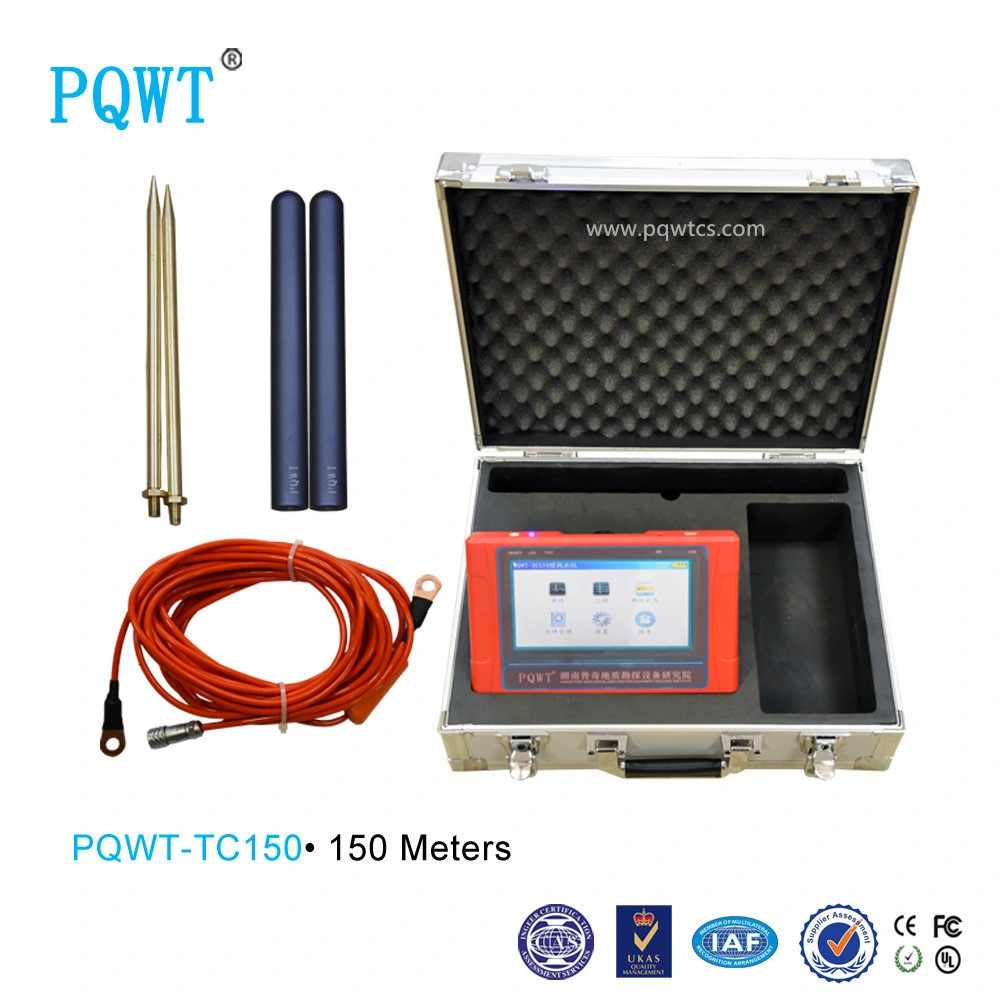
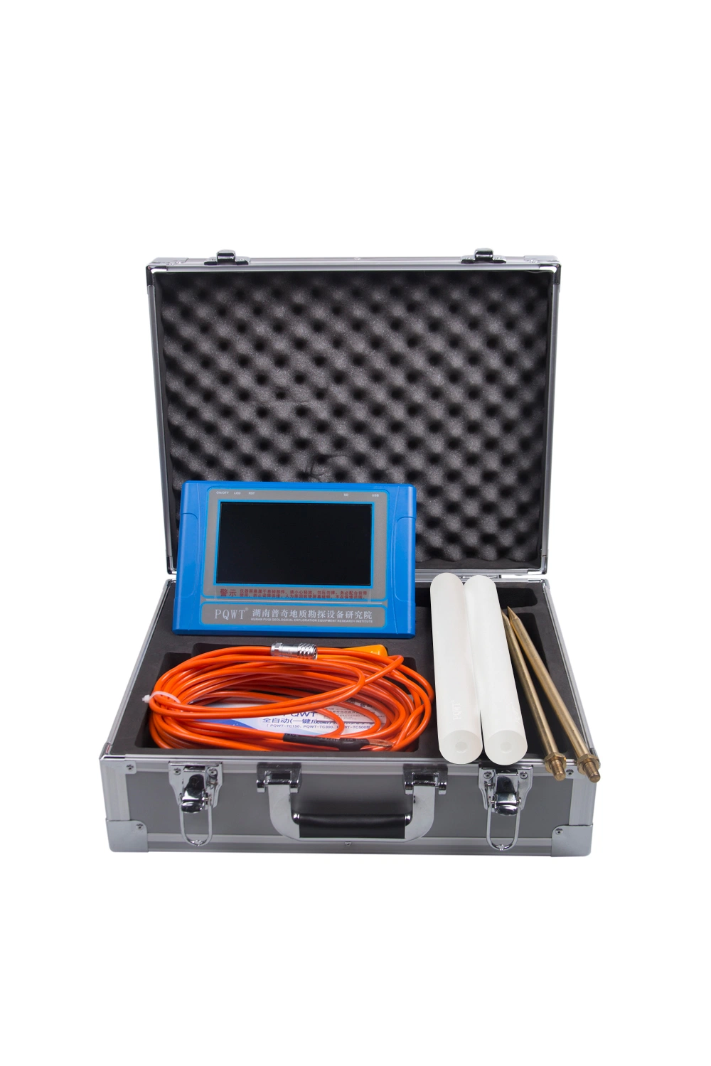
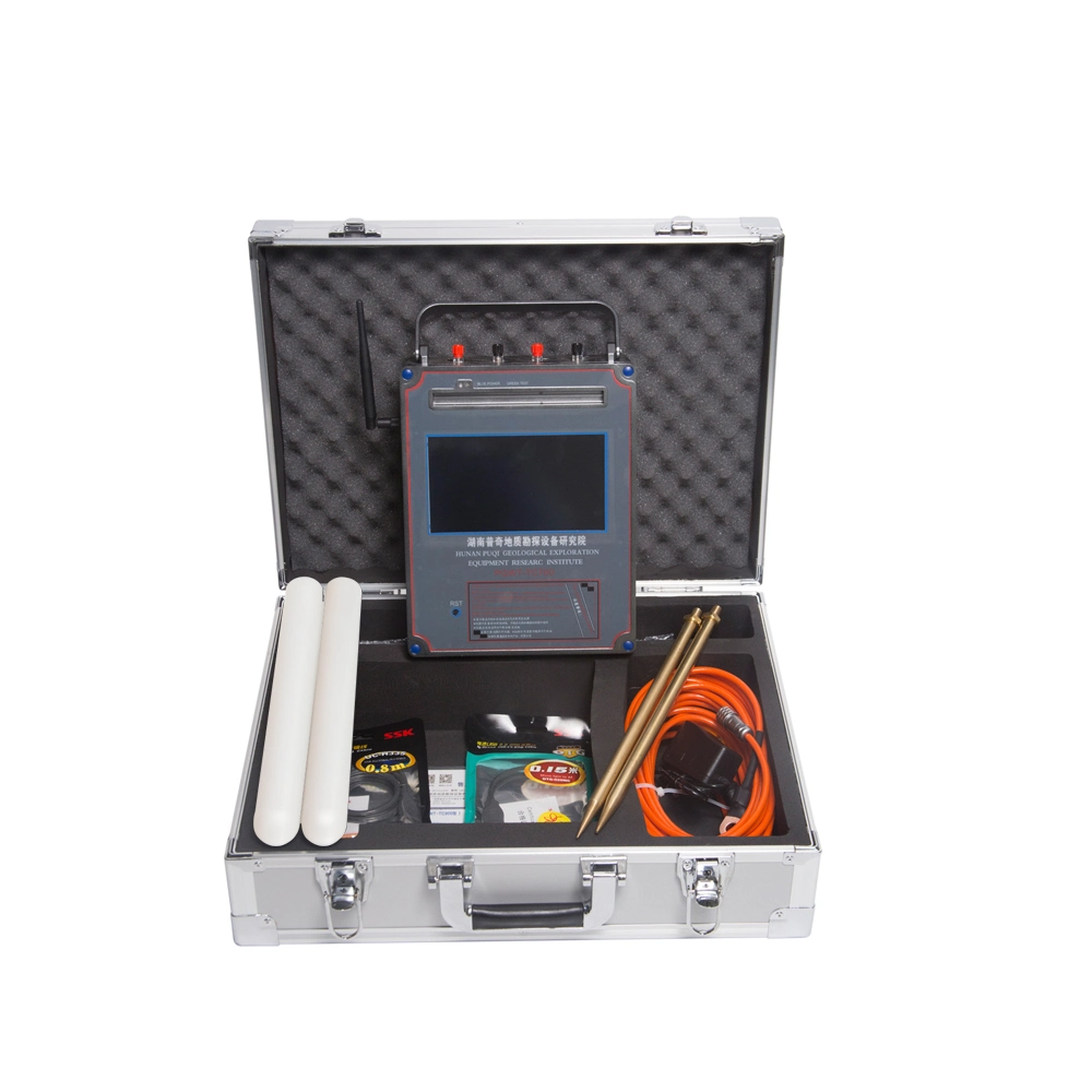
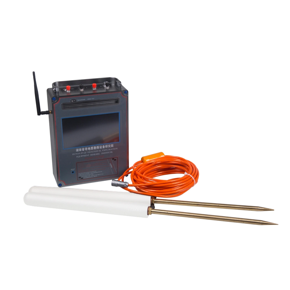
] The length of measurement line need only 5-10 meters, only one person can complete the operation, saving manpower and time, full touch LCD screen,, Simply operation, external insert a large-capacity memory card,Mostly used by well driller, drilling company, geologist.
[ Real-time mapping function
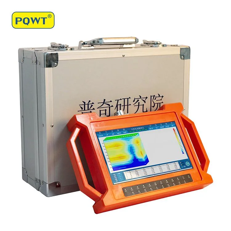
] The instrument can automatically draw curve and profile map with one key after collect data, showing water depth and location in the map.It is widely used in underground water sources, geological structures, mine veins, mine tunnels, cavities, karst caves, ant holes, mined-out areas, dam.
Features
1. Simple operation
Equipment is automatically controlled by micro PC. You can learn its operation in 10 minutes. It will take 10 minutes for persons without prospecting experience to finish training.
2. Good performance
he resolution of measurement is up to 0.001mV, and precision is ±2%. It gains high stability and abnormity curves
matching with that of traditional geo-electrical equipment in lots of field survey.
3. Strong Anti-interference Ability
It has advanced anti-jamming technology and multiple anti-jamming designs. You can observe
abnormity curves result with good repetition even in weak signal area, city, high electric jamming
area and working area with other exterior interference via frequency selector and digital
processing.
4. The unique feature of Automatic mapping
This instrument can automatically form curve graph and profile map with one button after
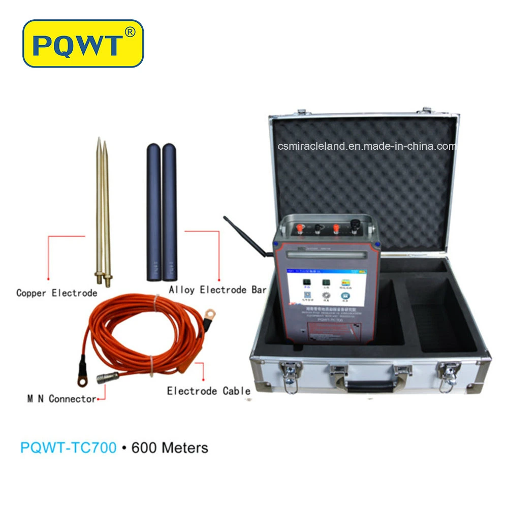
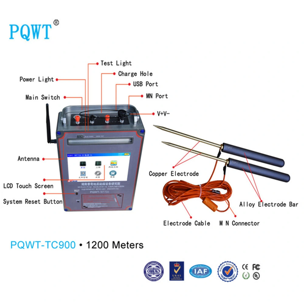
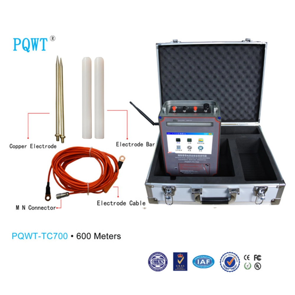
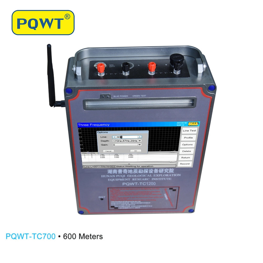
completed recording data, no need transfer the data to computer for drawing mapping.Technical Parameters | Model | TC700 | TC900 | TC1200 |
| Depth | 150/300/500/600 Meters | 150/300/600/1200 Meters | 600/900/1500 Meters |
| Frequency | Single, Triple, 20, 40, 56, 68frequency | Single, Triple, 20, 40, 56, 68frequency | Single, Triple, 30, 48, 62, 98 customized frequency |
| Measurement Range | 0mV-2000mV |
| Accuracy | 0.001mv |
| Channel | 8 |
| Power Supply | Battery Model #26650; 3.7V 4000mAh Rechargeable lithium battery | Controllable External Power |
| LCD | Industrial 7-inch HD touch screen |
| System | PQWT |
Packing & Shipping Packing
| one set in flight case and strong carton |
| size (LxWxH):49x20x45cm |
| G.W: 9KG |
| Shipment terms | Shipping way: DHL/ FEDEX / TNT/UPS/EMS |
| Delivery time: 1-2days after receipt of payment |
Shipping time: 5 working days express.
5-7 working days by air.
23-25 working days by sea |
| Payment methods | T/T ,Western Union, PayPal , ESCROW |
| Payment terms | sample order: 100% payment before production
bulk order: prepay 30-50% deposit before production, the balance should be paid before shipment |
FAQ Is it difficult to operate?
---The device is simple to operate and can be used without any experience.
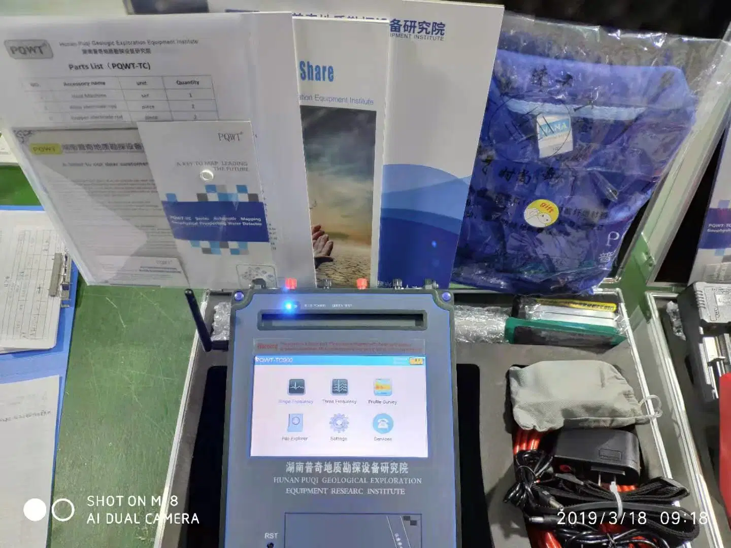
There are related U disks with detailed information in the box.
Guide for After-sale Service
> 2-year guarantee-if using of the product is influenced due to quality problem, you may receive guarantee of the product within 2 year after the date of purchase;
> Lifetime maintenance-lifetime maintenance service is implemented on all factory series products. We offer maintenance of machine which surpasses the maintenance period or has manual damage with material and labCase show Company Hunan Puqi Water Environment Institute Co.Ltd. is the professional institution in China who engaged in the R & D, manufacturing and sales of pipe water leak detector, leakage automatic analyser, geophysical prospecting underground water detector, cavity detector, mine locator, dam piping detector, borehole inspection camera and pipeline detector.
Over the years, Puqi focuses on Hydrogeological exploration, Intelligent data-capture technology and Application of special technique, carrying out Scientific research, Technical services and Marketing application. We have completed more than 65 items including National ministries, Sino-foreign cooperation and major scientific research projects. Having the honour to win a number of national research awards, with more than 117 national patents.
 Complaint