 Complaint

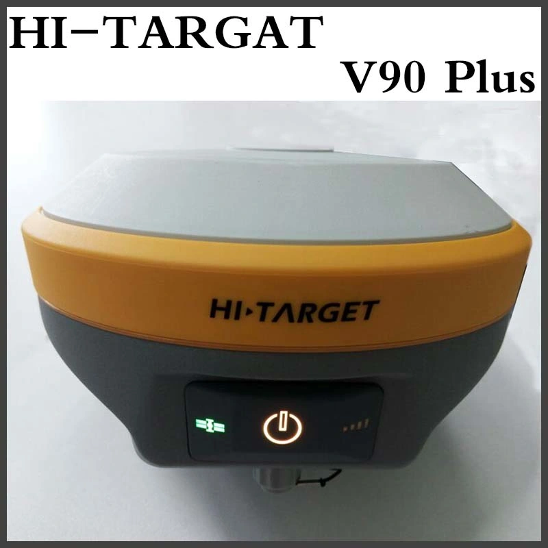
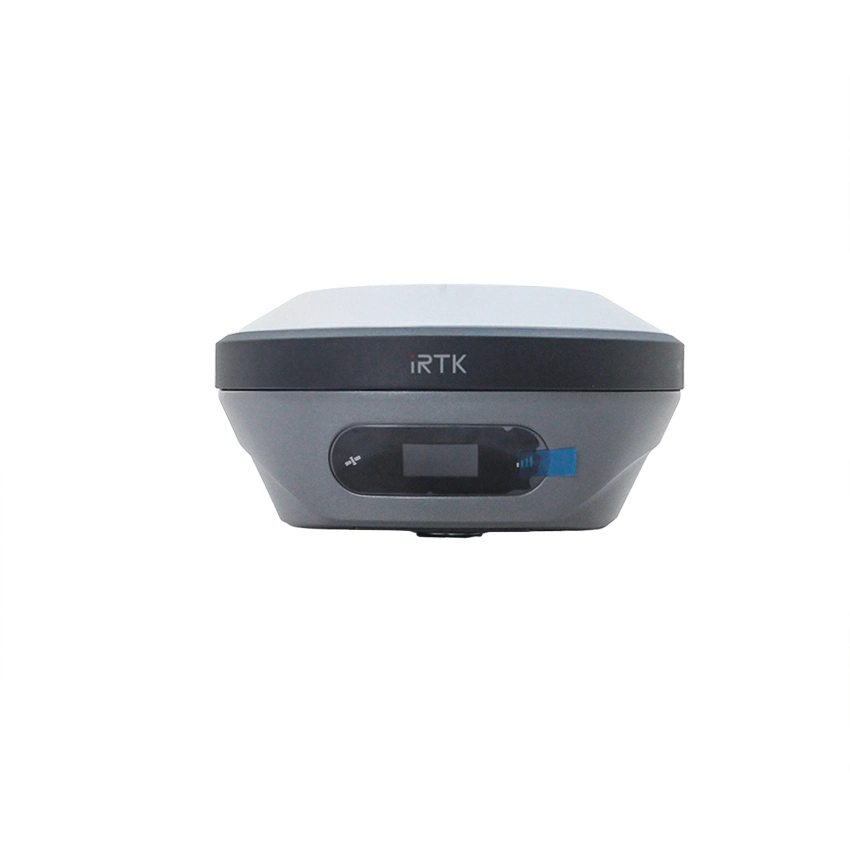
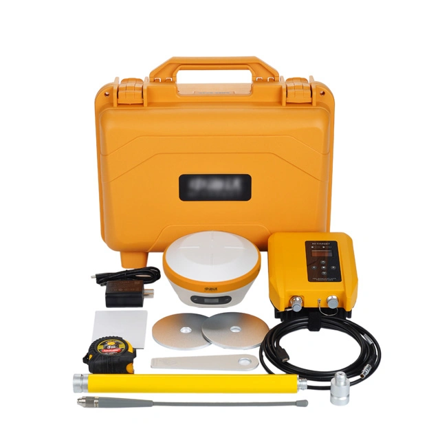
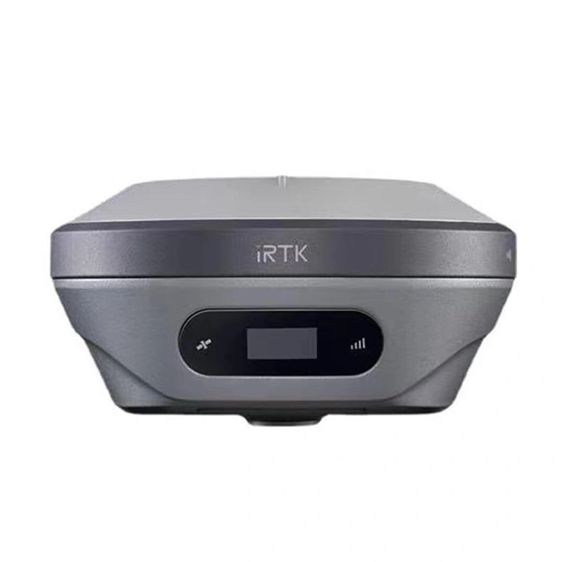
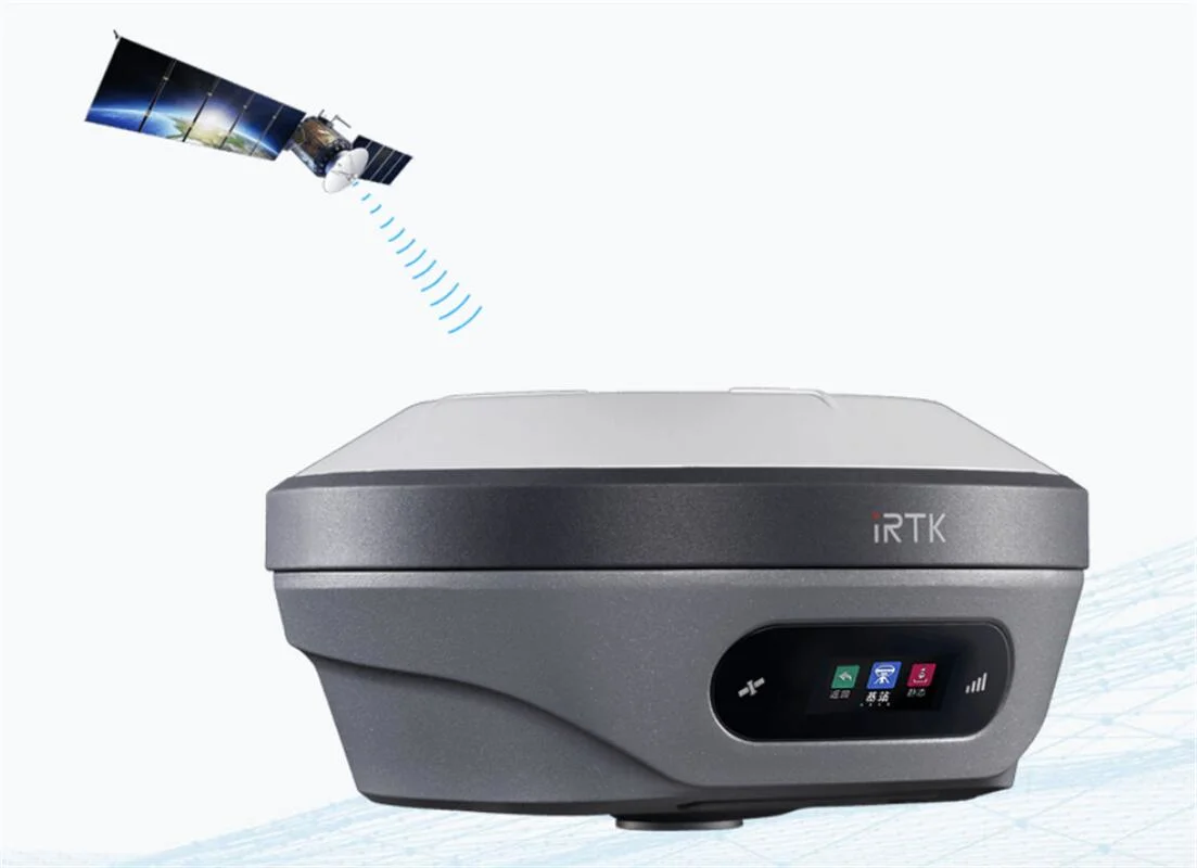
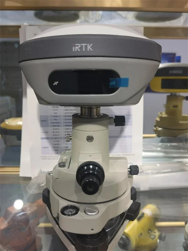
*IMU GNSS RTK
Immediately start with calibration-free tilt compensation technology, assist you quickly and accurately survey or stake out points without leveling the pole, error less than 3cm within 45° inclination, boost working efficiency by 20%.
| GNSS configuration | Number of channels: 800 + | ||
| BDS: B1/B2/B3/B1C/B2a | |||
| GPS: L1/L2/L5/L2C | |||
| GLONASS: L1/L2/L3 | |||
| GALILIEO: E1/E5 AltBOC/E5a/E5b/E6 | |||
| SBAS: L1/L5 | |||
| QZSS: L1/L2/L5/L6 | |||
| IRNSS: L5 | |||
| Global correction service: Hi-RTP (optional) | |||
| Output format | ASCII: NMEA-0183, binary code | ||
| Positioning output frequency | 1Hz~20Hz | ||
| Static data format | GNS, Rinex dual format static data | ||
| Difference format | CMR, RTCM2.X, RTCM3.0, RTCM3.2 | ||
| Network mode | VRS, FKP, MAC; support NTRIP protocol | ||
| System Configuration | operating system | Linux operating system | |
| Start Time | 3 seconds | ||
| data storage | Built-in 8GB ROM, supports automatic storage of static data | ||
| Positioning Performance | High-precision static GNSS Surveying | Horizontal:2.5mm + 0.1ppm RMS Vertical:3.5mm + 0.4ppm RMS | |
| Static and Fast Static | Horizontal:2.5mm + 0.5ppm RMS Vertical:5mm + 0.5ppm RMS | ||
| Post Processing Kinematic (PPK / Stop & Go) | Horizontal:8mm + 1ppm RMS | ||
| Vertical:15mm + 1ppm RMS | |||
| Initialization time:Typically 10 min for base and 5 min for rover | |||
| Initialization reliability:Typically>99.9% | |||
| Code Differential GNSS Positioning | Horizontal:25cm+1ppm RMS | ||
| Vertical: 50cm+1ppm RMS | |||
| SBAS:0.5m (H), 0.85m (V) | |||
| Real Time Kinematic (RTK) | Horizontal:8mm+1ppm RMS Vertical:15mm+1ppm RMS | ||
| Initialization time:Typically <10 seconds | |||
| Initialization time:Typically 99.9% | |||
| Time to first Fix | Cold start:< 45 s Hot start:< 30 s Signal re-acquisition:< 2 s | ||
| Initialization reliability | >99.99% | ||
| Hi-Fix | Horizontal:RTK+10mm / minute RMS Vertical:RTK+20mm / minute RMS | ||
| Tilt Survey Performance | Additional horizontal pole-tilt uncertainty typically less than 8mm +0.7mm / °tilt (2.5cm accuracy in the inclination of 60°) | ||
| Communication unit | Communication | Bluetooth 4.2/2.1+EDR, 2.4GHz | |
| 4G cellular mobile network (TDD-LTE, FDD-LTE, WCDMA, EDGE, GPRS, GSM) | |||
| WiFi frequency is 2.4G, support 802.11b/g/n protocol. | |||
| Internal UHF Radio | Frequency:403-473MHz Channel:116 (16 scalable) | ||
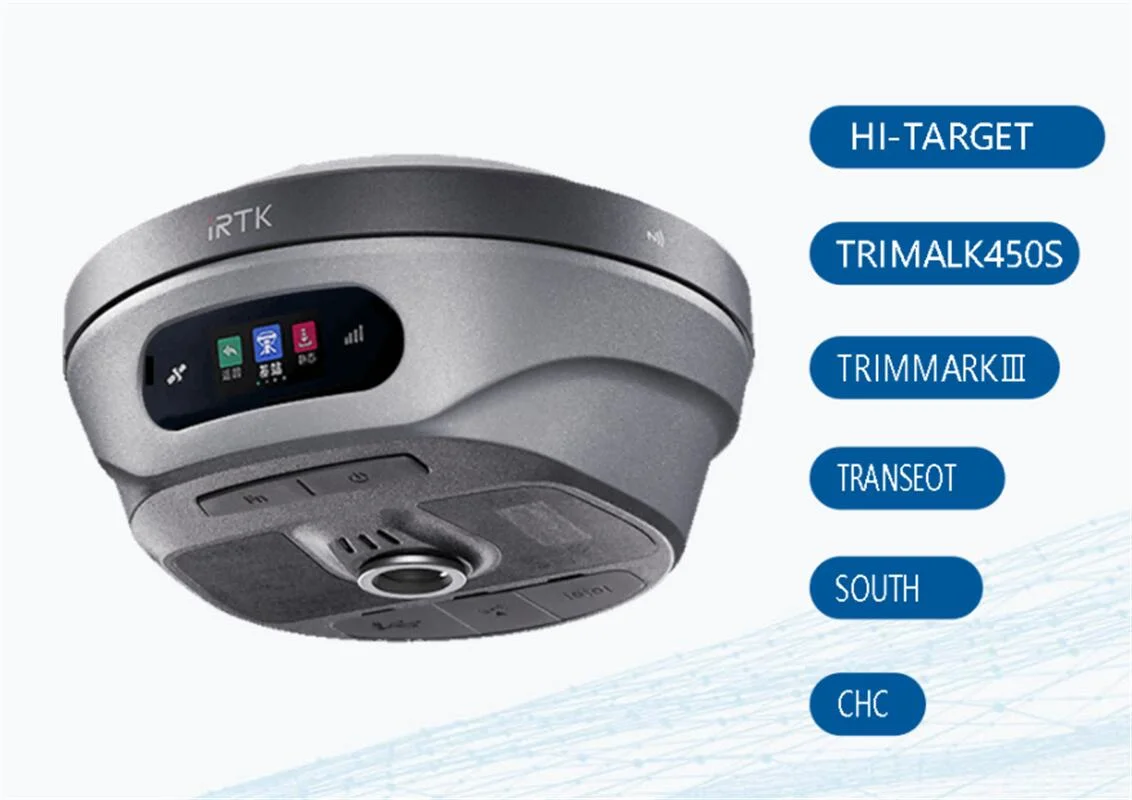
| 1~4W Hi-Target Advanced Radio | |||
| Supports multiple protocols: HI-TARGET, TRIMTALK450S, TRIMMARK III, | |||
| TRANSEOT, SATEL-3AS, etc. | |||
| Working range:.Typically 3~5km, optimal 5~8km | |||
| External UHF Radio | Frequency:403-473MHz Channel:116 (16 scalable) | ||
| External HDL460A Full Protocols Radio | 10W/35W adjustable | ||
| Protocols: HI-TARGET, TRIMTALK450S, TRIMMARK III, TRANSEOT, etc. | |||
| Working range : Typically 8~10km, optimal 15~20km | |||
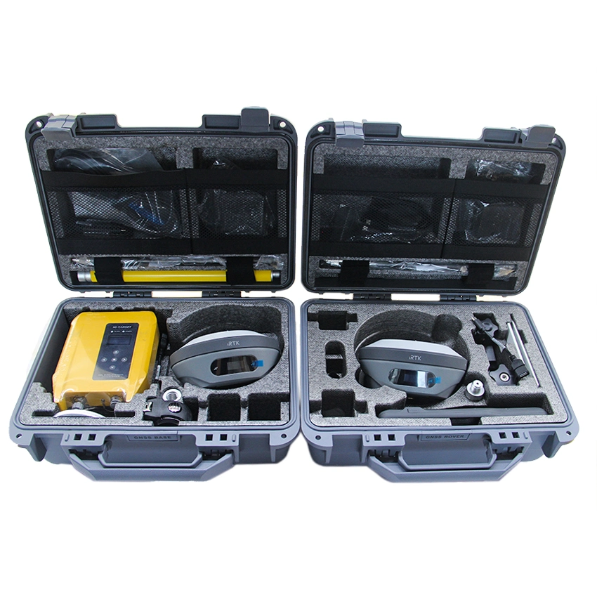
| Physical | Internal battery | Internal 7.4V / 6800mAh lithium-ion rechargeable battery | |
| Charging: supports USB PD3.0quick charge, Quick charge within 3.5 hours. | |||
| RTK Rover (Network) for 10 hours. | |||
| External power | Power consumption:4.2W | ||
| Dimensions (W×H):156mm×77mm | |||
| Support Power Bank charging. | |||
| Weight:≤1.2kg (includes battery) | |||
| Data storage:8GB ROM internal storage | |||
| Control Panel | LED Lamp | Satellite, Signal | |
| Physical button | 2 | ||
| I / O Interface | 1 × USB port, Type C, OTG function | ||
| 1 × SMA antenna connector | |||
| 1 × DC power input (5-pin) | |||
| 1 × Nano SIM card slot | |||
| Data Formats | Output rate | 1Hz-20Hz. | |
| Static data format | GNS, Rinex | ||
| Network model | VRS, FKP, MAC; supports NTRIP protocol | ||
| CMR& RTCM | CMR, RTCM 2.x, RTCM 3.0, RTCM 3.2 | ||
| Navigation outputs ASCII | NMEA-0183 | ||
| Environment | Water / Dustproof | IP68 | |
| Shock and vibration | Designed to survive a 2m natural fall onto concrete | ||
| Humidity | 100%, condensing | ||
| Operation temperature | -30ºC~+70ºC | ||
| Storage temperature | -40ºC~+80ºC | ||
Shanghai Apekstool was founded and based in Shanghai, specializing in the manufacturing and sales of Surveying equipment. We are dedicated to being a professional provider for survey equipment. Our goal is to provide the best products and excellent service to our customers all over the world.
We have been involved in the geographic mapping industry for 10 years. We supply all products with reasonable prices and real-time support upon our own professional experience and high-quality supply chain. Like gnss rtk, total station, theodolite, auto level, rotary laser level, laser level and surveying accessories. We have sold to more than 156 countries and build our stable market.
We are proud to guarantee that, with our strong technical background and communication capability, our sales/support engineers are able to answer your most complicated technical questions over the phone in English. That would save so much time for communication. Our business is growing and we invite you to be part of the success.
We focus on Hi target, CHCNAV, EFIX, FOIF, STONEX, SOUTH , KOLIDA ,RUIDE, Unistrong, E-survey GNSS, Geomax , Sunway, Stonex, Hi target and Kolida total station. Including surveying accessories pole , tripod, tribrach, prism and leveling staff.