 Complaint

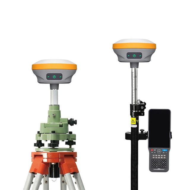
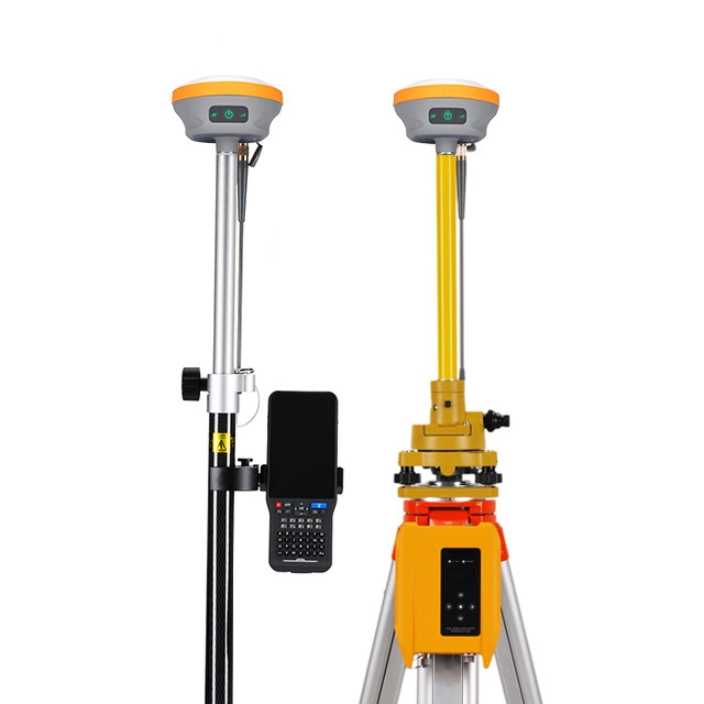
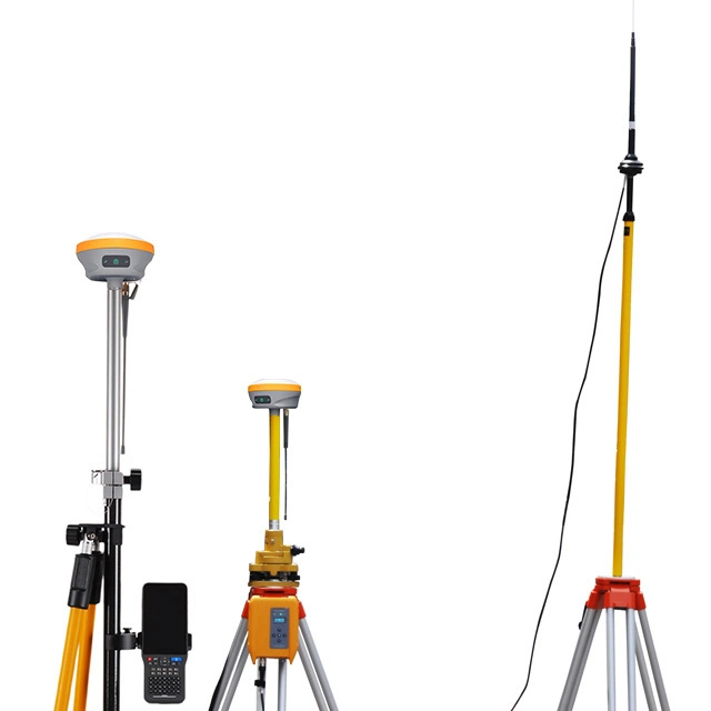
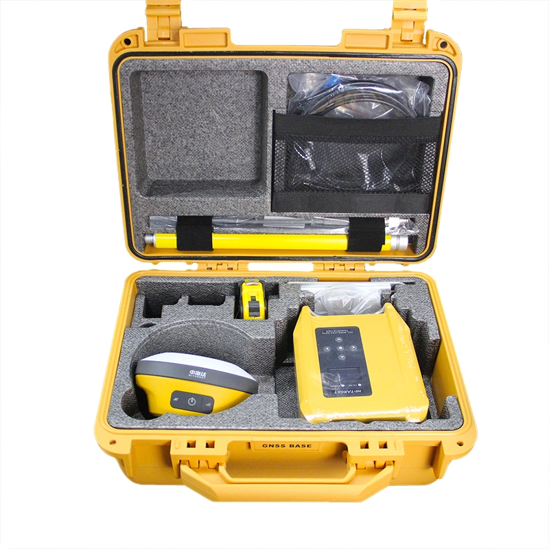
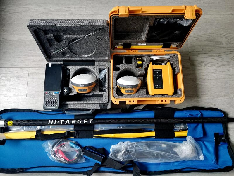
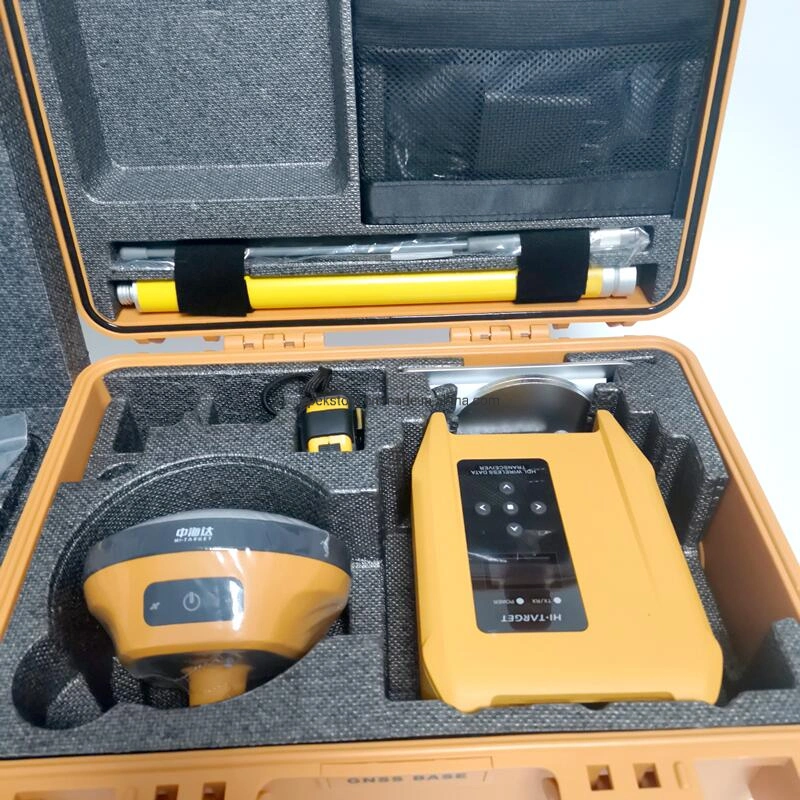
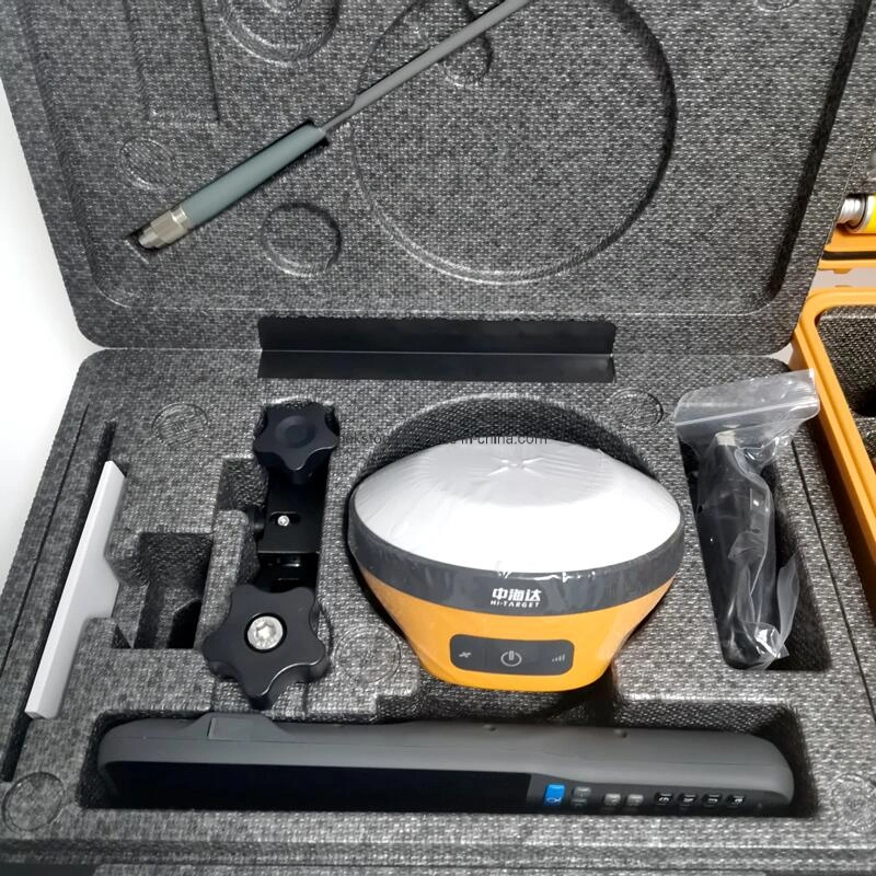
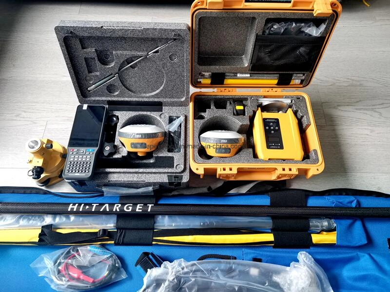
*More Portability
Equipped with an ultra-light EPP material instrument case of a high anti-strong impact, shock and impact resistance and a centering rod that can be contracted to 1.25 m, making it durable and portable in the fieldwork.
*Greater Flexibility
It can bring accurate and reliable results and boost efficient fieldwork with self-developed built-in IMU and core algorithm.
*Higher Accuracy and Precision
Equipped with the High-Performance Patch Antenna, enhances the low elevation angle tracking capabilities and keeps it maintaining a high gain for higher elevation satellites while tracking low-elevation satellites
*More Stability
Hi-Target Hi-Fix enables continuous connectivity and quality results even if you lose the signal while using the RTK base station or VRS network under extreme circumstances.
| GNSS configuration | Number of channels: 800 | ||
| BDS: B1 / B2 / B3 / B1C / B2a | |||
| GPS: L1 / L2 / L5 / L2C | |||
| GLONASS: L1 / L2 / L3 | |||
| GALILIEO: E1 / E5 AltBOC / E5a / E5b / E6 | |||
| SBAS: L1 / L5 | |||
| QZSS: L5 | |||
| Output format | ASCII: NMEA-0183, binary code | ||
| Positioning output frequency | 1Hz~20Hz | ||
| Static data format | GNS, Rinex dual format static data | ||
| Difference format | CMR, RTCM2.X, RTCM3.0, RTCM3.2 | ||
| Network mode | VRS, FKP, MAC; support NTRIP protocol | ||
| System Configuration | operating system | Linux operating system | |
| Start Time | 3 seconds | ||
| data storage | Built-in 8GB ROM, supports automatic storage of static data | ||
| Accuracy and reliability | RTK positioning accuracy | Plane: ±(8+1×10⁻⁶D) mm (D is the distance between the measured points) | |
| Elevation: ±(15+1×10⁻⁶D) mm (D is the distance between the measured points) | |||
| Static positioning accuracy | Plane: ±(2.5+0.5×10⁻⁶D) mm (D is the distance between the measured points) | ||
| Elevation: ±(5+0.5×10⁻⁶D) mm (D is the distance between the measured points) | |||
| DGPS positioning accuracy | Plane accuracy: ±0.25m+1ppm; elevation accuracy: ±0.50m+1ppm | ||
| SBAS positioning accuracy | 0.5m | ||
| Initialization time | <10 seconds | ||
| Initialization reliability | >99.99% | ||
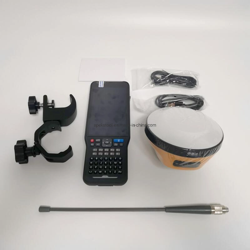
| Communication unit | I/O port | USB Type-C interface, SMA interface | |
| Built-in 4G network communication | Built-in eSIM4 card, including 3 years Internet access fee, you can connect to the Internet after power on | ||
| WiFi communication | 802.11 a/b/g/n access point and client mode, can provide WiFi hotspot service | ||
| Bluetooth communication | Bluetooth® 4.2/2.1+EDR, 2.4GHz | ||
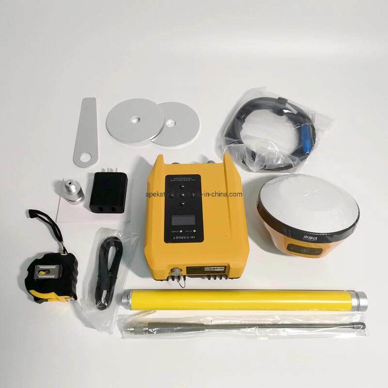
| Built-in transceiver station: | |||
| Power: 0.5W/1W/2W adjustable | |||
| Frequency band: 410MHz~470MHz | |||
| Protocol: HI-TARGET, TRIMTALK450S, TRIMMARKIII, TRANSEOT, SOUTH, CHC | |||
| Number of channels: 116 (16 of which can be configured) | |||
| sensor | Electronic bubble | Realize smart alignment | |
| Tilt measurement | Built-in high-precision inertial navigation, automatic attitude compensation, 8mm+0.7mm/°tilt (accuracy within 30°<2.5cm) | ||
| User Interface | button | A power button | |
| LED indicator light | Satellite lights, signal lights, power lights | ||
| WEB UI | Built-in WEB page to realize receiver setting and status check | ||
| Function application | Advanced Features | OTG function, NFC IGRS, WebUI interaction, U disk firmware upgrade | |
| Smart application | OTG function, NFC IGRS, WebUI interaction, U disk firmware upgrade | ||
| Remote Service | News push, online upgrade, remote control | ||
| cloud service | Equipment management, location services, collaborative operations, data analysis | ||
| Physical characteristics | Host battery | Built-in high-capacity lithium battery 6800mAh/7.4V, network mobile station working time is more than 10 hours | |
| External power supply | Support USB port charging and external power supply | ||
| size | Φ132mmx67mm | ||
| weight | ≤0.8kg with battery | ||
| Power consumption | 4.2W | ||
| material | The shell is made of magnesium alloy material | ||
| Environmental characteristics | Dustproof and waterproof | IP68 | |
| Anti-fall | Resistance to natural drop of 2m high measuring rod | ||
| Relative humidity | 100% non-condensing | ||
| Operating temperature | -30ºC~+70ºC | ||
| storage temperature | -40ºC~+80ºC | ||
Shanghai Apekstool was founded and based in Shanghai, specializing in the manufacturing and sales of Surveying equipment. We are dedicated to being a professional provider for survey equipment. Our goal is to provide the best products and excellent service to our customers all over the world.
We have been involved in the geographic mapping industry for 10 years. We supply all products with reasonable prices and real-time support upon our own professional experience and high-quality supply chain. Like gnss rtk, total station, theodolite, auto level, rotary laser level, laser level and surveying accessories. We have sold to more than 156 countries and build our stable market.
We are proud to guarantee that, with our strong technical background and communication capability, our sales/support engineers are able to answer your most complicated technical questions over the phone in English. That would save so much time for communication. Our business is growing and we invite you to be part of the success.
We focus on Hi target, CHCNAV, EFIX, FOIF, STONEX, SOUTH , KOLIDA ,RUIDE, Unistrong, E-survey GNSS, Geomax , Sunway, Stonex, Hi target and Kolida total station. Including surveying accessories pole , tripod, tribrach, prism and leveling staff.