Ins570d Mems Inertial Navigation System Rtk Ins for Unmanned Driving

Min.Order: 1
Product origin: Shenzhen, Guangdong, China
Infringement complaint: complaintComplaint
US$ -1

Description
INS570D MEMS Inertial Navigation System RTK INS For Unmanned Driving

INS570 high-precision vehicle integrated navigation and positioning unit is a real-time navigation and positioning unit developed by the company to meet the needs of passenger car assisted automatic driving. The integrated navigation and positioning module adopts a high-performance MEMS inertial sensor, a high-precision GNSS board card and a vehicle-mounted odometer to realize integrated navigation, and can output high-precision positioning, speed measurement and attitude information of a centimeter level in real time,The product can be used for passenger cars and unmanned vehicles with automatic driving or intelligent driving functions.
The core sensor of the product can be customized according to the needs of different projects. The functional safety IMU is used as the core sensor in the integrated navigation and positioning unit, in which the Z-axis (vehicle-mounted heading) gyroscope can be replaced by a higher precision sensor to further improve the pure inertial navigation accuracy after the GNSS signal is unlocked. A high-precision GNSS position module with an RTK function is adopted,It supports BDS B1/B2, GPS L1/L2, GLONASS L1/L2, GALILEO E1/E5b and other satellite signals, and supports single antenna positioning/dual antenna orientation and other configurations.
The product can be upgraded to a customized inertial navigation system through software, and can also be connected to other sensors to achieve multi-source integrated navigation.

Specifications:


GNSS indicators

Signal tracking
BDS:B1/B2;GPS:GPL1/L2;GLONASS:1/L2; GALILEO
Positioning accuracyRTK: horizontal 2cm + 1 ppm, elevation 3cm + 1 ppm
Orientation accuracy0.2 ° (1m baseline)
Data update rate1Hz,5Hz

Integrated positioning performance (integrated wheel speed)
TimePosition accuracy (m)Velocity accuracy (m/s)
LevelElevationLevelElevation
0s0.020.030.020.01
10s0.20.30.070.03
60s230.20.1
Attitude accuracyOrientation accuracy0.2 ° (integrated navigation), 0.1 ° (GNSS loosing lock for 60s)
Roll/pitch0.1°(RMS)
MEMS performancePeg-topRange: ± 300 °/s; Zero-bias instability: ≤ 2 °/H
Z-axis (optional): ± 300 °/s; Zero-bias instability: ≤ 0.5 °/H
AccelerometerRange: ± 6 G; Zero-bias instability: < 50ug
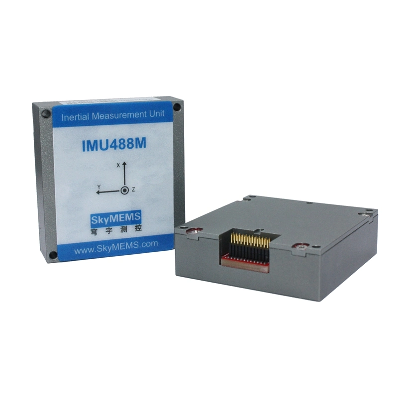
Physical dimensions 
Size(L x W x H): 100mm x 100 mm x 30 mm 
Weight250g 
Environmental characteristics 
Operating temperature-40ºC ~ +85ºC 
Storage temperature-55ºC ~ +95ºC 
Power requirements 
Voltage+9~+36VDC 
Power consumption8W 
Interface requirements 
GNSS RF InterfaceAntenna: FAKRA type C/D, 50Ω rated impedance 
Data input/output interface1-way 422, 1-way 232, 2-way CAN, 1-way PPS _ OUT 

Size


Company info


Product Tag:
Related categories:
Scroll to Top