 Complaint

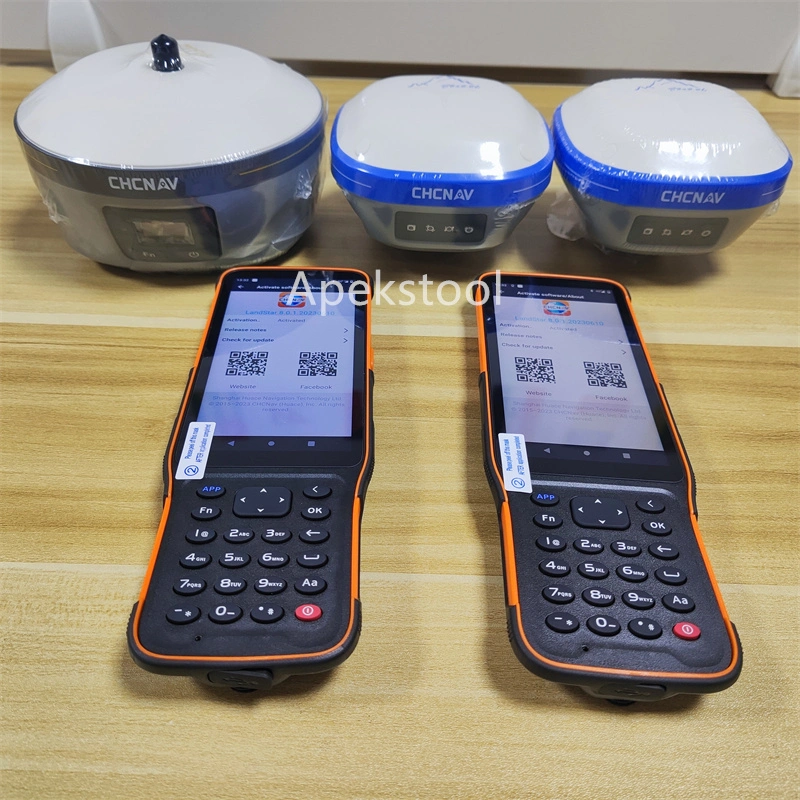
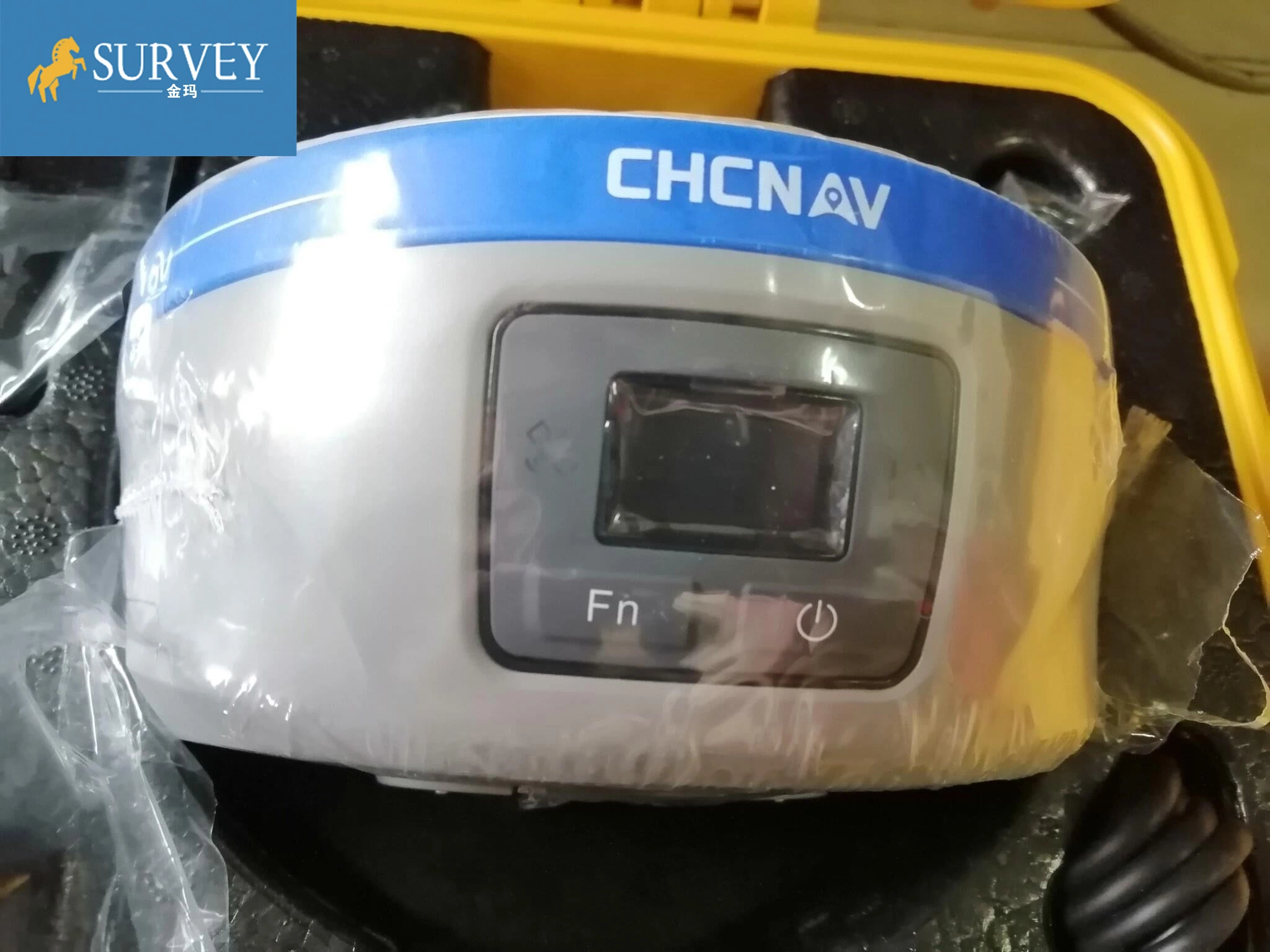
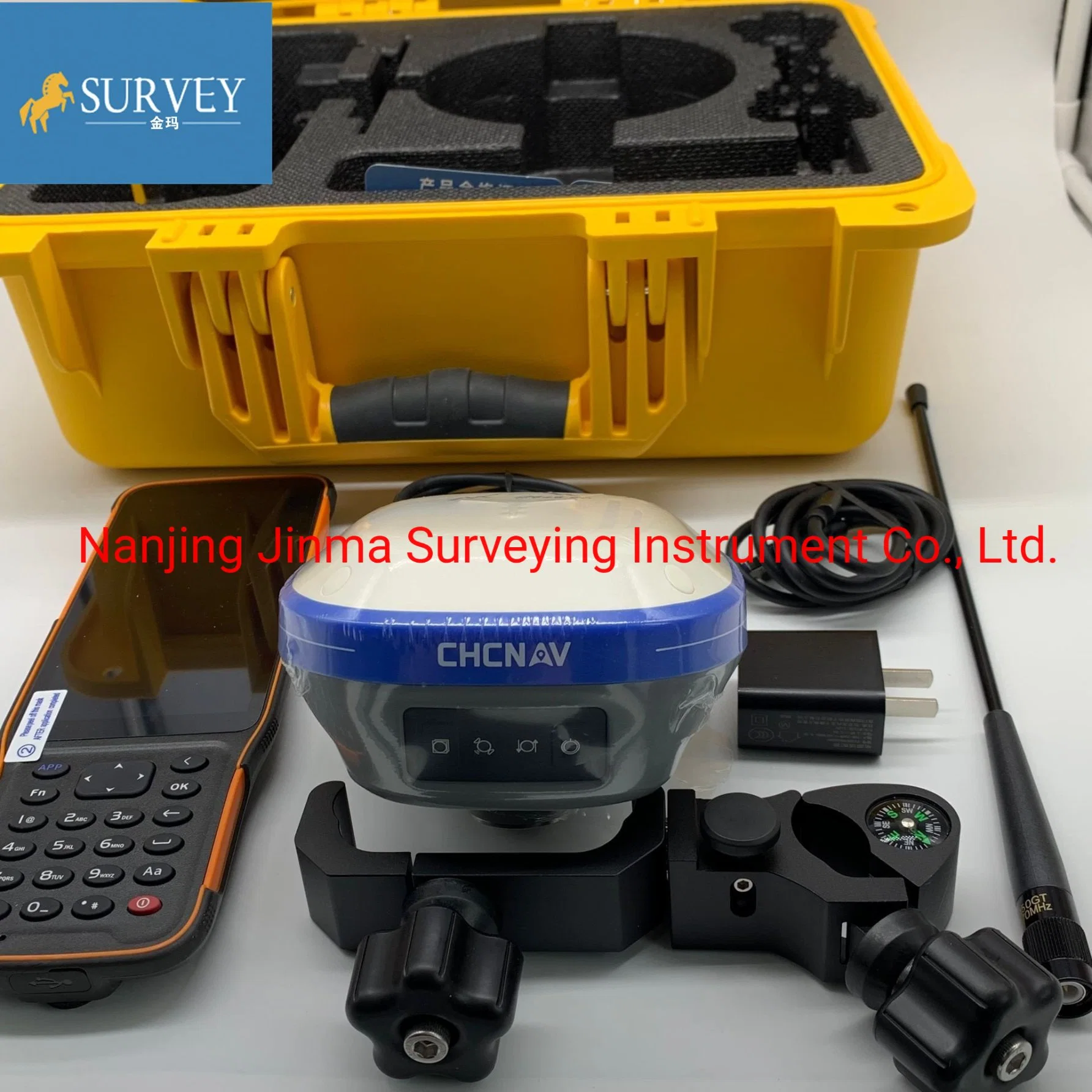
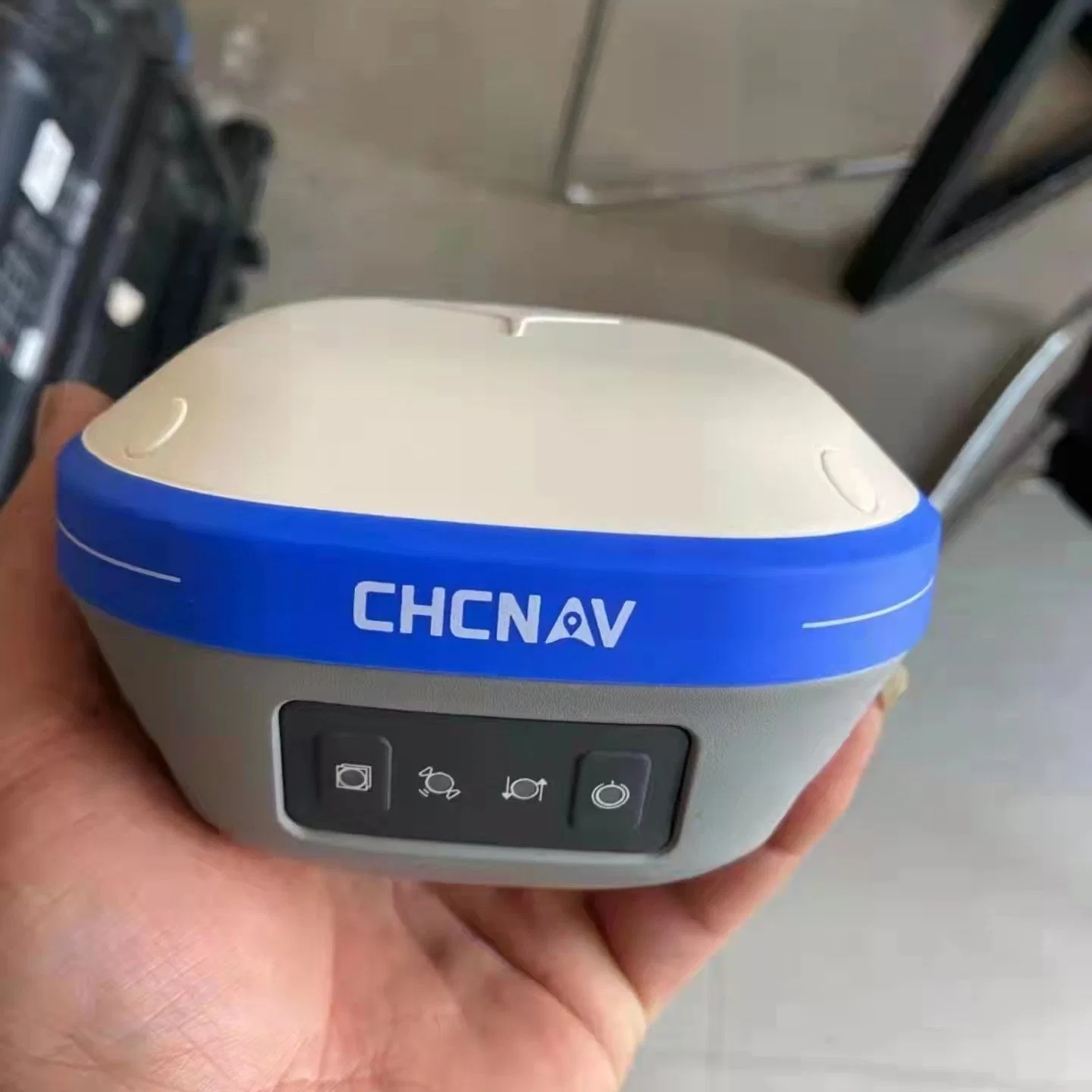
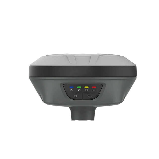
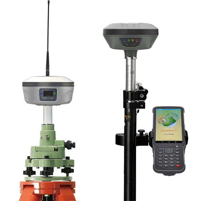
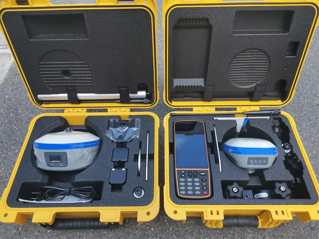
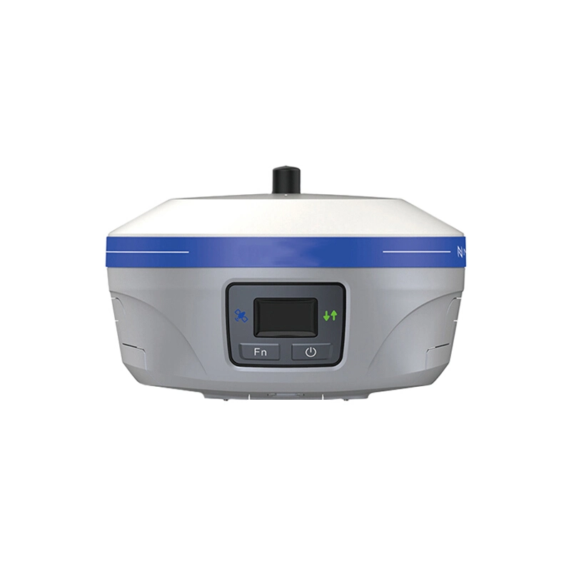
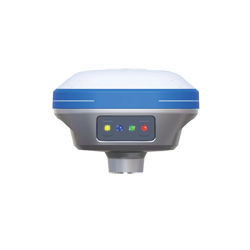
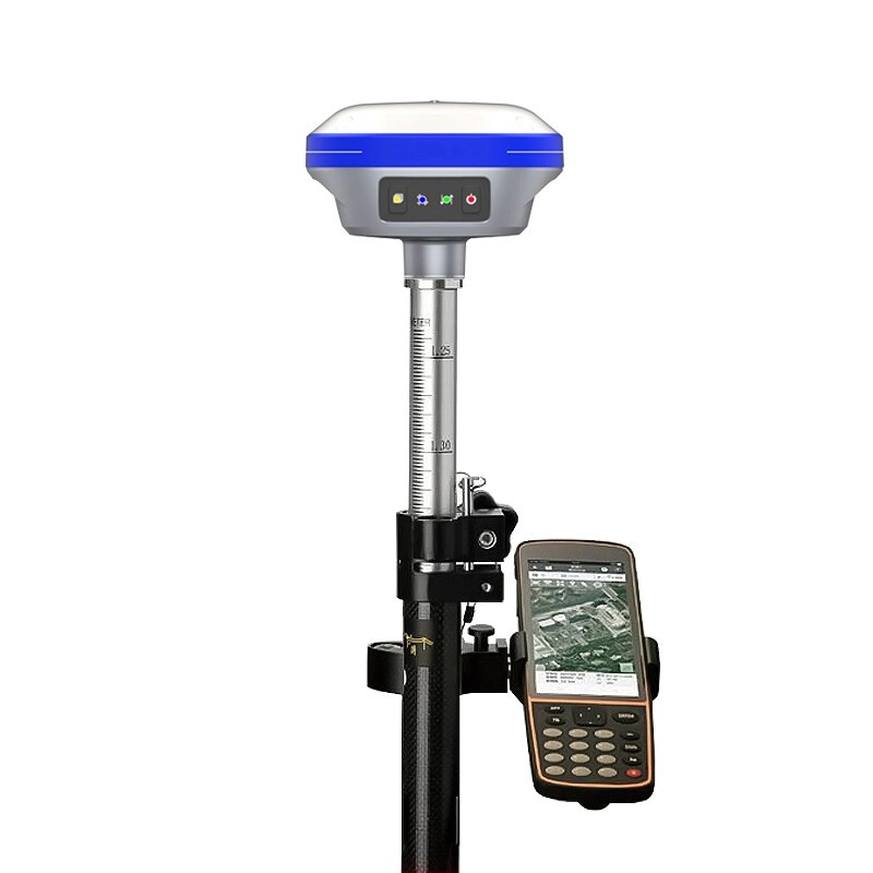
The i73 GNSS receiver removes barriers to portability without sacrificing performance. Featuring full GNSS technology, it offers best-in-class GNSS signal tracking even in a harsh environment, enabling GNSS surveying beyond usual constraints. The i73 GNSS incorporates the latest innovations such as an inertial module providing automatic pole-tilt compensation in a very compact design. Connected to a GNSS RTK network via CHCNAV LandStar field software, or combined with the iBase GNSS receiver, the i73 GNSS is a highly productive rover for surveying and stakeout in any topographic, mapping or construction site applications.
COMPREHENSIV EDESIGN EASY TO USE SUPPORT CAD
LandStar7 is the field-proven survey and mapping software solution for any Android devices and data controllers. Designed for high precision surveying and mapping tasks, LandStar7 provides seamless workflow management, easy-to-learn and easy-to-use graphical user interface
to complete all your projects efficiently. Comprehensive data import and export formats, multiple measurement and stakeout methods ensure instant productivity.
| GNSS Performance | Channels | 624 channels |
| GPS | L1, L2, L5 | |
| GLONASS | L1, L2 | |
| Galileo | E1, E5a, E5b | |
| BeiDou | B1, B2, B3 | |
| SBAS | L1 | |
| QZSS | L1, L2, L5 | |
| GNSS Accuracies | Real time | Horizontal: 8 mm + 1 ppm RMS |
| kinematics (RTK) | Vertical: 15 mm + 1 ppm RMS | |
| Initialization time: < 10 s | ||
| Initialization reliability: > 99.9% | ||
| Post -processing | Horizontal: 3 mm + 1 ppm RMS | |
| kinematics (PPK) | Vertical: 5 mm + 1 ppm RMS | |
| Post - processing static | Horizontal: 3 mm + 0.5 ppm RMS | |
| Vertical: 5 mm + 0.5 ppm RMS | ||
| Code differential | Horizontal: 0.4 m RMS Vertical: 0.8 m RMS | |
| Autonomous | Horizontal:1.5 m RMS | |
| Vertical: 3 m RMS | ||
| Positioning rate | Up to 10 Hz | |
| Coldstart: < 45 s | ||
| Time to first fix | Hot start: < 10 s | |
| Signal re-acquisition: < 1 s | ||
| RTK tilt - compensation | Additional horizontal pole-tilt uncertainty | |
| typically less than 10 mm +0.7 mm/°tilt | ||
| Hardware | Size (L x W x H) | Φ160.54 mm*103 mm |
| Weight | 1.73kg | |
| Environment | Operating:-40°C to +65°C | |
| (-40°F to +149°F) | ||
| Storage: -40°C to +75°C | ||
| (-40°F to +167°F) | ||
| Humidity | 100% condensation | |
| Ingress protection | IP67waterproof and dustproof, protected from temporary immersionto depth of 1 m | |
| Shock | Survive a 2-meter pole drop | |
| Tilt sensor | E-Bubble leveling | |
| Front panel | 1 satellite light, 1 differential signal light, 1 static data acquisition light, 1 Wi-Fi indicator, 2 power lights | |
| Communication | Integrated4G modem | |
| LTE(FDD):B1,B2,B3,B4,B5,B7,B8,B20 | ||
| Network modem | DC-HSPA+/HSPA+/HSPA/UMTS: | |
| Wi-Fi | B1, B2, B5, B8 | |
| EDGE/GPRS/GSM | ||
| 850/900/1800/1900MHz | ||
| 802.11 b/g/n, access point mode | ||
| Ports | 1 x 7-pin LEMO port (external power, RS-232) | |
| 1 x USBType-C port (data download, firmware update) | ||
| UHFradio | 1 x UHFantenna port (TNCfemale) | |
| Standard InternalRx/Tx: 410 - 470 MHz | ||
| TransmitPower: 0.5 W to 2 W | ||
| Protocol: CHC, Transparent, TT450,3AS | ||
| Data formats | Link rate: 9600 bps to 19200 bps | |
| Range:Typical 3 kmto 5 km | ||
| RTCM2.x, RTCM3.x, CMR input / output | ||
| HCN,HRC,RINEX2.11, 3.02 NMEA0183 output | ||
| NTRIPClient,NTRIPCaster | ||
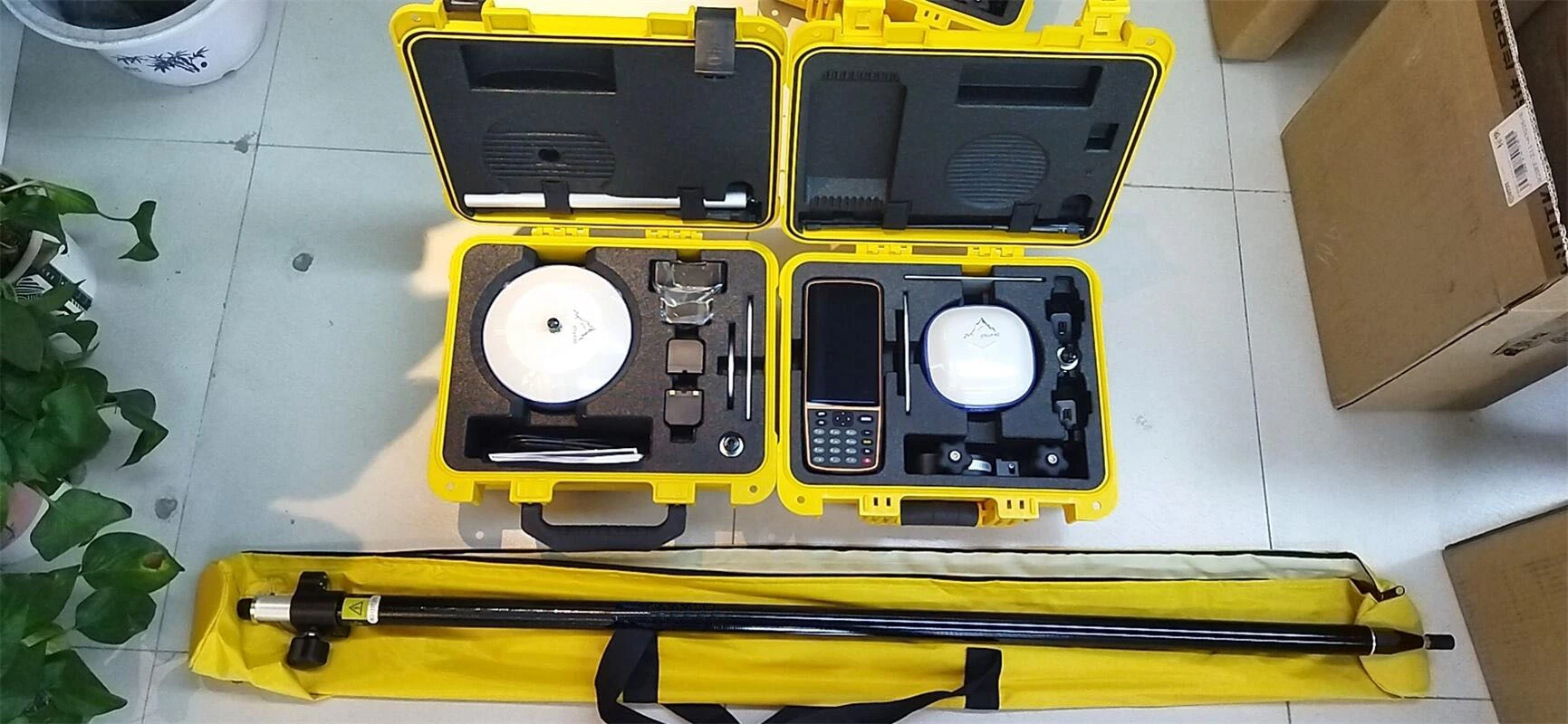
| Data storage | 8 GB internal memory | |
| Power consumption | 4.2 W (depending on user settings) | |
| Li-ion battery capacity | 2 x 7000 mAh, 7.4 V | |
| Operating time on | UHFreceive/transmit (0.5 W): 6 h to 12 h | |
| Electrical | internal battery | Cellularreceive only: up to 12 h,Static: up to 12 h |
| External power input | 9V DC to 36 V DC | |
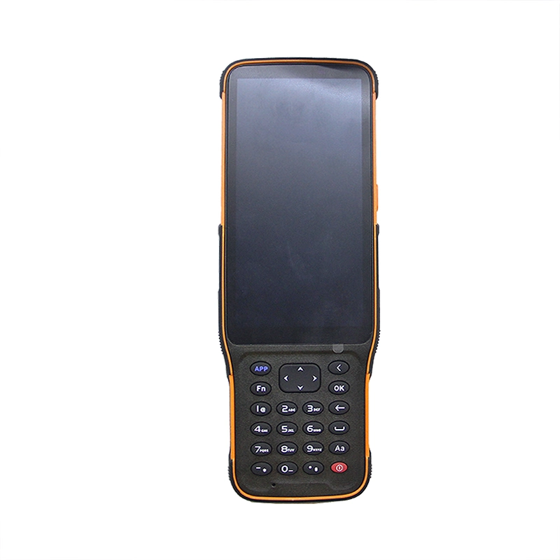
| Controller | model | HCE600 |
| network | 4G All Netcom (Mobile Unicom Telecom 2G/3G/4G) | |
| operating system | Android 10 | |
| CPU | Eight-core 2.0Ghz processor | |
| LCD screen | 5.5'' HD display | |
| Battery | 14 hours of battery life | |
| Waterproof and dustproof | Full function button | |
| input method | IP68 |
Shanghai Apekstool was founded and based in Shanghai, specializing in the manufacturing and sales of Surveying equipment. We are dedicated to being a professional provider for survey equipment. Our goal is to provide the best products and excellent service to our customers all over the world.
We have been involved in the geographic mapping industry for 10 years. We supply all products with reasonable prices and real-time support upon our own professional experience and high-quality supply chain. Like gnss rtk, total station, theodolite, auto level, rotary laser level, laser level and surveying accessories. We have sold to more than 156 countries and build our stable market.
We are proud to guarantee that, with our strong technical background and communication capability, our sales/support engineers are able to answer your most complicated technical questions over the phone in English. That would save so much time for communication. Our business is growing and we invite you to be part of the success.
We focus on Hi target, CHCNAV, EFIX, FOIF, STONEX, SOUTH , KOLIDA ,RUIDE, Unistrong, E-survey GNSS, Geomax , Sunway, Stonex, Hi target and Kolida total station. Including surveying accessories pole , tripod, tribrach, prism and leveling staff.