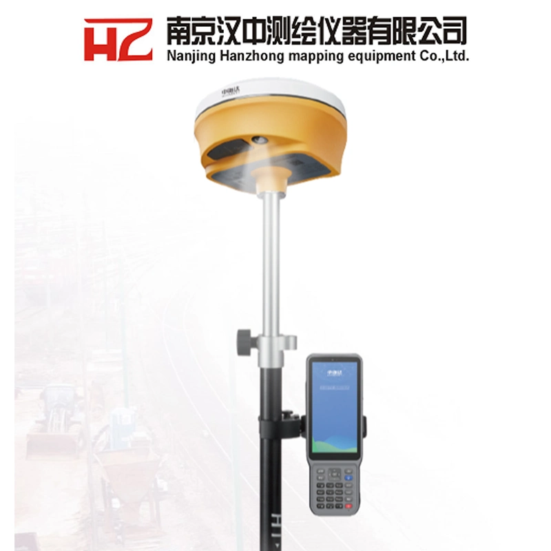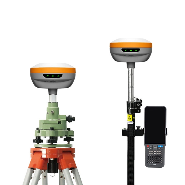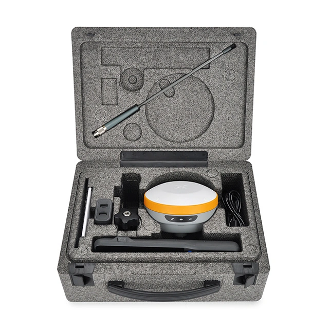

 Complaint

| Hi-target V300 Specifications | ||
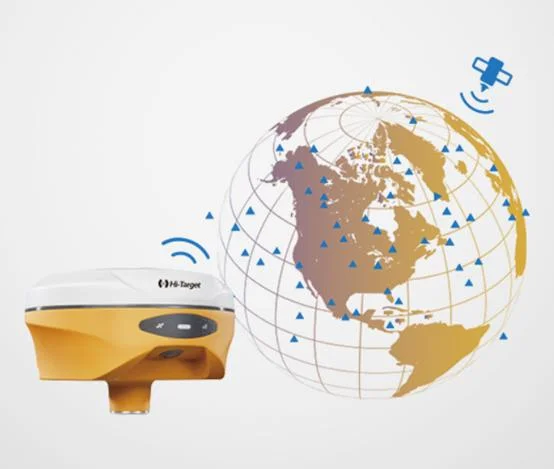
| GNSS Signal | Channels | 1408 |
| Satellite tracking | BDS:B1B21B3B1CB2a,B2b | |
| GPS: L1C/A, L1C, L2P(Y), L2C, L5 | ||
| GLONASS: Ll, L2 | ||
| GALILEO: E1, E5a, E5b, E6* | ||
| QZSS: L1, L2, L5, L6 | ||
| RNSS: L5* | ||
| SBAS: Ll, L2, L5 | ||
| L-BAND | ||
| Output format | ASCII: NMEA0183, binary code | |
| Positioning output frequency | 1Hz-20Hz | |
| Static data format | GNS, Rinex dual format static data | |
| Differential format | RTCM2. X, RTCM3. X | |
| Network mode | VRS, FKP, MAC; Support for NTRIP protocol | |
| System Configuration | Operating system | Linux operating system |
| Data storage | built-in 16 GB ROM, supporting automatic cyclic storage of static data | |
| Accuracy and reliability | RTK positioning accuracy | Horizontal: 8mm+1ppm RMS Vertical: 15mm+1ppm RMS |
| Static and Fast Static | H: 2.5 mm + 0.5ppm RMS V: 5 mm + 0.5ppm RMS | |
| PPP | H: 10cm | V: 20cm | |
| Code Differential GNSS Positioning | H: ±0.25m+1ppm RMS V: ±0.5m+1ppm RMS | |
| SBAS | 0.5m (H), 0.85m (V) | |
| Tilt Survey Performance | Additional horizontal pole-tilt uncertainty typically less than 8mm+0.7mm/°tilt (2.5cm accuracy in the inclination of 60°) | |
| AR stakeout accuracy | 1cm | |
| Initialization Time | <10 S | |
| Initialization reliability | Typically>99.9% | |
| Breakpoint continuation test | RTK measurement is still provided during differential signal interruption | |
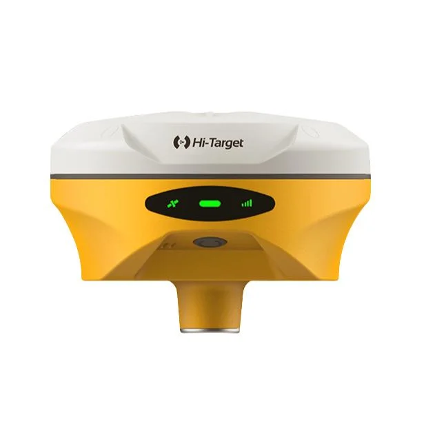
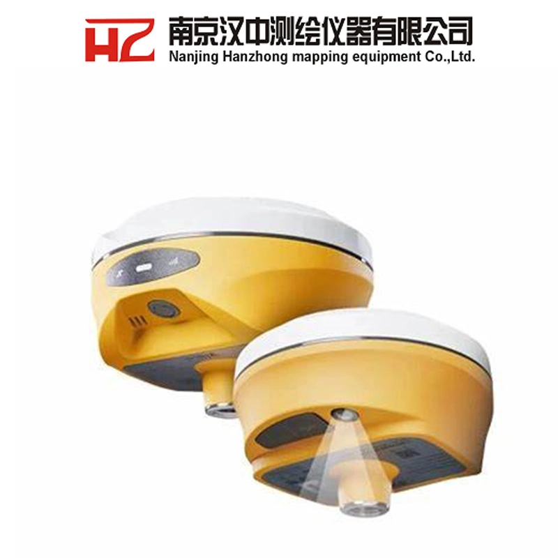
| Camera | Function | Professional starlight night vision HD camera, large viewing angle, support live view stakeout |
| Communication | I/O Interface | 1 × USB type C port; 1 × SMA antenna port |
| WiFi | Frequency 2.4GHz, Supports 802.11 a/b/g/n | |
| Bluetooth | BT 5.2, 2.4GHz | |
| Internal UHF Radio | Power: 0.5W/1W/2W Adjustable | |
| Frequence: 410MHz~470MHz | ||
| Protocol: HI-TARGET, TRIMTALK450S, TRIMMARK III, SATEL, TRANSEOT, SOUTH,CHC | ||
| Working Range: Typically 3~5km, optimal 8~15km | ||
| Channel: 116(16 scalable) | ||
| Cellular mobility | eSIM card:supports dual eSIM dual network dual standby for both the host and controller, including 3-year traffic, providing high-precision upon startup | |
| Built in 4G network communication: TDD-LTE, FDD-LTE, WCDMA, TD-SCDMA, EDGE, GPRS, GSM | ||
| Sensor | Electron bubble | Implement intelligent alignment |
| Tilt measurement | Built-in new generation high-precision inertial navigation, automatic initialization and attitude compensation upon startup | |
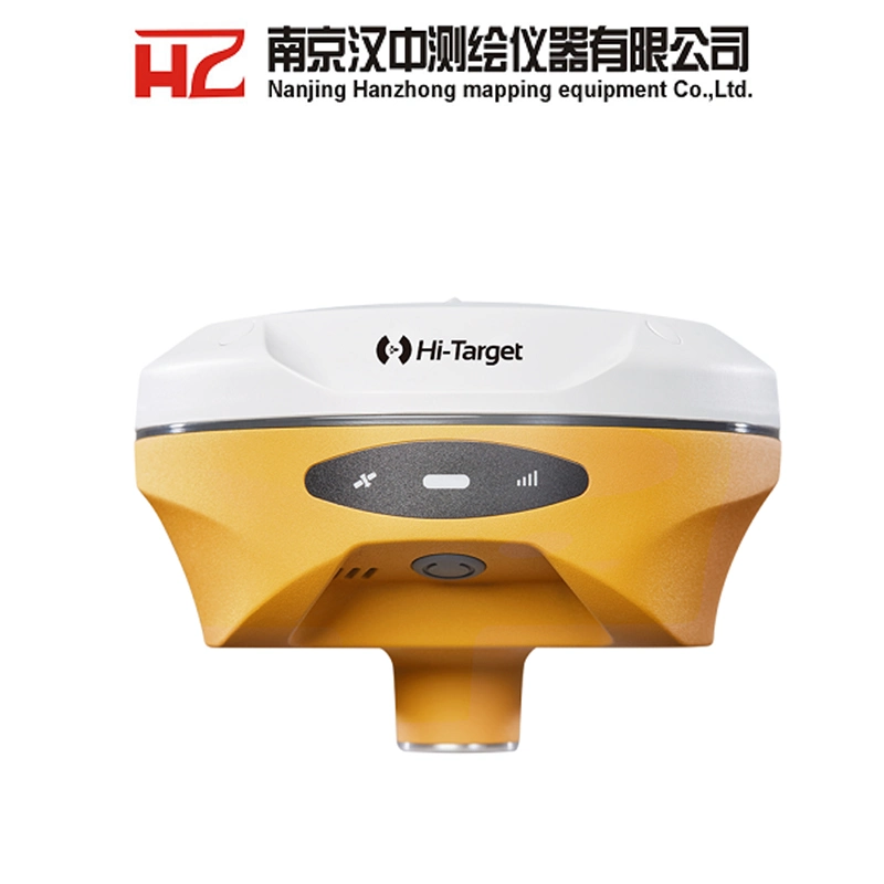
| Control Panel | Keys | Single button |
| LED Lights | Satellite, Signal, Power | |
| Functional application | Advanced features | NFC flash connection, WebUI interaction, USB firmware upgrade |
| Intelligent applications | Intelligent voice, function self check | |
| Remote Services | Message push, online upgrade, remote control | |
| Cloud Services | Equipment management, location services, collaborative work, data analysis | |
| Physical | Dimensions (W x H) | 130mm × 68mm |
| Operation temperature | '-40ºC~+75ºC(-40ºF~+167ºF) | |
| Storage temperature | -55ºC~+85ºC(-67ºF~+185ºF) | |
| Humidity | 100% non-condensing | |
| Water/dustproof | IP68 dustproof, protected from temporary immersion to depth of 1.0m (3.28ft) | |
| Free fall | Designed to survive a 2m(6.56ft) natural fall onto concrete | |
| Host battery | High capacity lithium battery with 6900mAh working time better than 16 hours | |
| External power supply | USB 15W charging | |
Service
2.All our products have one year warranty, And we sure the products will be free from maintenance within warranty period.
3.All products will have been strictly quality checked in factory before sending out.
Payment
We accept payment by TT,Paypal, West union.
If you'd like other payment method, Pls let us know before the order
Delivery / shippment :
1.Usually, we will send out the products within 3-5 working days after the payment confirmed
2.Before shipment, pls supply the following information to us :
Contact person or company name,Detail address,Telephone No,Zipcode
3.The buyer are responsible for the tax and/or duty charged by their country.
Return and warranty:
1.All products are inspected before shipment, if you are not satisfactory with the purchase,you can exchange the items in one week,and you must contact us within 24 hour of receipt of the products.
2.The shipping charges are not refundable and the customer should be responsible for all the charges of return and reshipping.
3.For our majority products (Auto level, Theodolite, Total Station) we are offing 1 year warranty;
4.For small issues like missing or damaged part, key board, please send us the photos, we will send the required part and related instructions to you for free;
5. For big issues in one year warranty like EDX board, main board issue. We could only ask you to send the instrument back to us. Normally we will have it fixed in 10 working days and send back to you. You and we shall take care of the corresponding shipping cost on each side. For big issues out of one year warranty, the customer should be responsible for all the cost.
Contact Us: