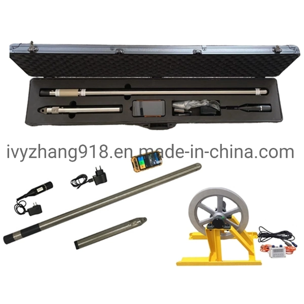
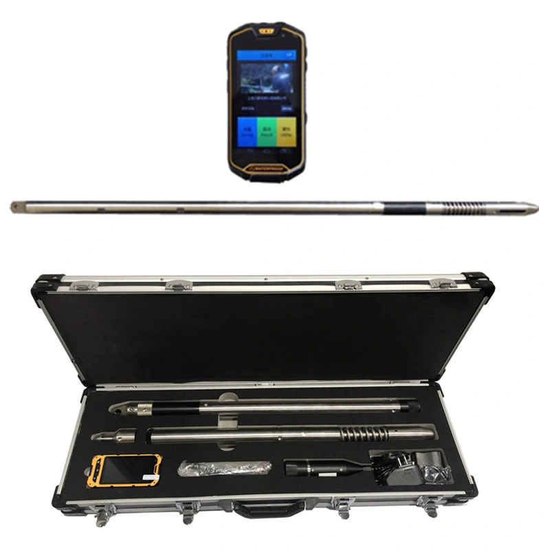
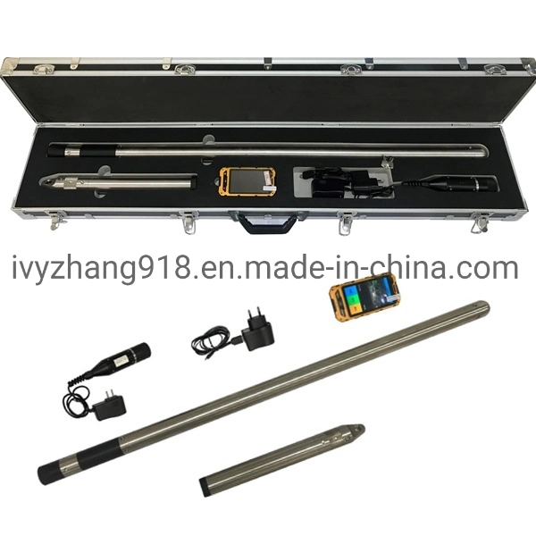
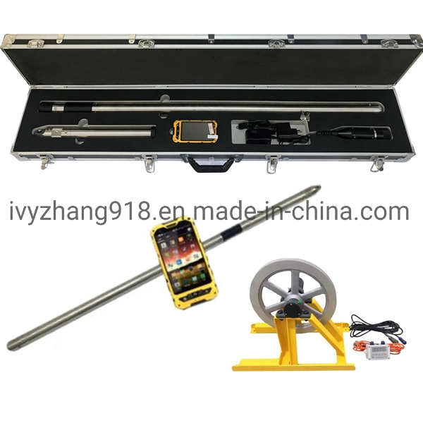
Description
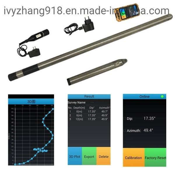
Multi Shot North Seeking Gyroscopic Shot Survey Tool Borehole Magnetic Shot Inclinometer For Mining And Geotechnical Borehole Investigation| 1. Measuring range of inclination: 0~45°, error ≤ 0.2°; |
| 2. Measuring range of azimuth: 0~360°, error ≤ 4° (1° ≤ inclination ≤ 45°); |
| 3. Static drift ≤ 2°, drifting nonlinearity ≤ 1°; |
| 4. Measuring mode: point measurement (frequency: 1 time / 140 s); |
| 5. Service life of the gyro > 1800 h; |
| 6. Serial port R232 for data transmission; |
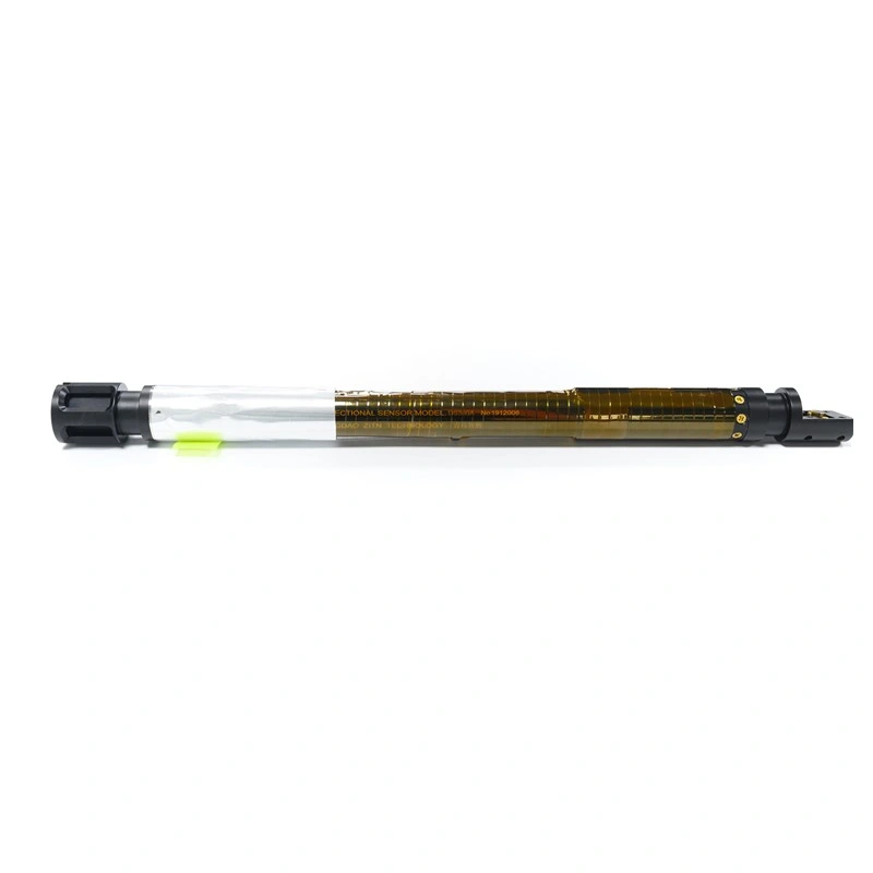
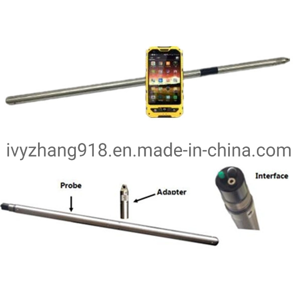
| 7. Probe outer diameter of downhole instrument: φ40mm |
| 8. Measured depth ≤ 2000m; |
| 9. Resistance to pressure of the probe ≤ 200kg/cm2; |
| 10. Working power of the instrument: AC220V±10%, 50Hz±10%; |
| 11. Working environment: |
| Temperature: -10°~60° |
| Humidity: 90% (40ºC) |
| 12. Probe overall dimension: φ40×2100mm |
| 13. Weight: 3kg |
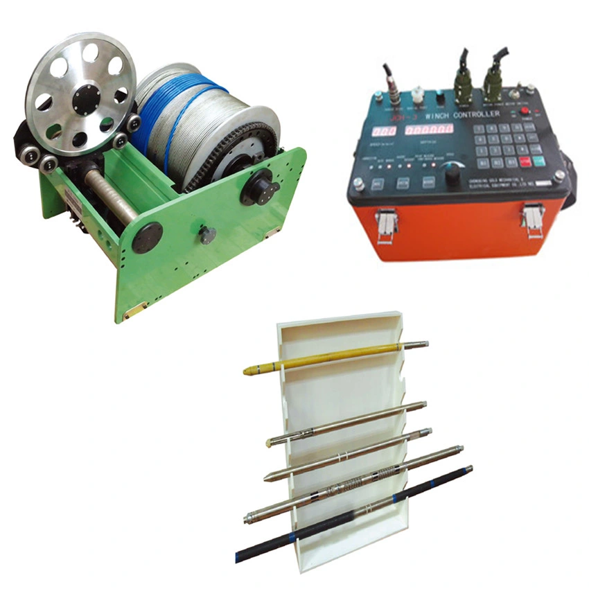
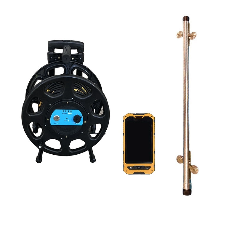
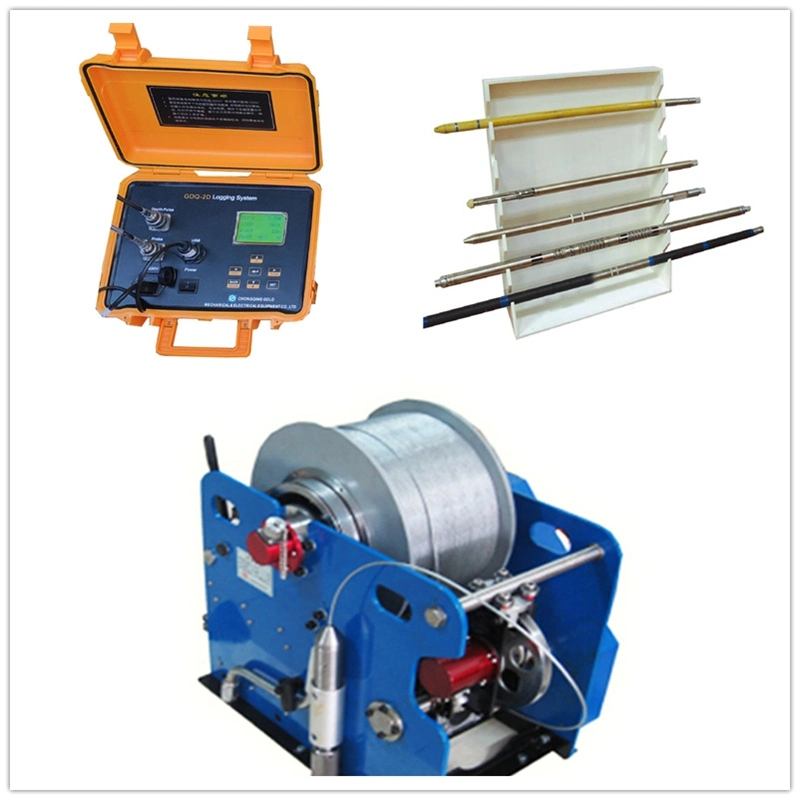
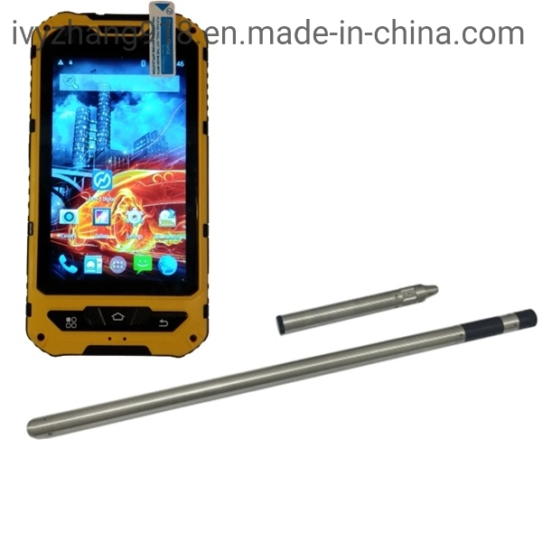
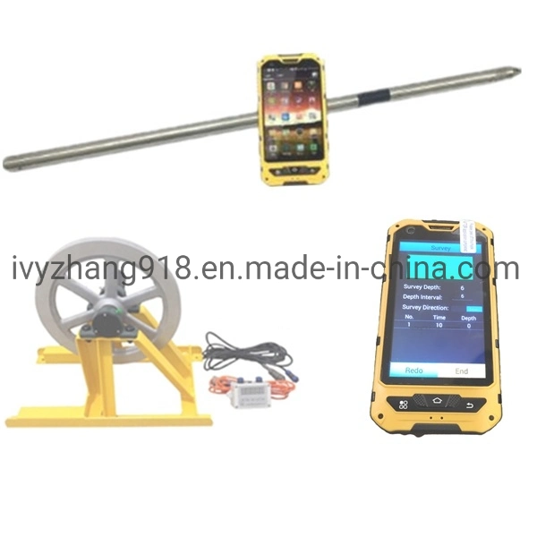
The GDY-2GW is an easy to use and multi-shot tool. It is based on good quality Fiber Optic Gyro technology. The tool measures the self-rotation of the earth where the tool is placed at to indicate the True-North angle. The adapter with an ID number "420xxx" is used to connect a steel wire and slowly lower it down the hole. There is no switcher on the probe so you don't need to disassemble GDY-2GW during the whole measuring process. Once being assembled with the battery housing, the GDY-2GW will 5 automatically start to work. The probe is powered by a 7.4V rechargeable lithium battery, which can be charged no less than 500 times. The endurance of the survey tool is about 20 hours.
The controller to operate the survey tool runs Android 4.4.2. It is IP68 rated and is impervious to water and dust. It has a rugged casing and integrated with GPS. The controller has "cqgold" app installed when it is shipped. User can use the controller to measure and check data. The app will be explained in moredetail in section 3.3
There are several ways to measure the deviation of boreholes, and what method that is best for you depends on what sort of borehole you have.
But for all boreholes we want to place the survey tool at a given depth, called a survey station. At that survey station we want to make a measurement, sometimes called a survey shot, to get the azimuth and inclination. The azimuth and inclination, together with the depth are used to calculate the borehole trajectory.
1. Accurate Directional Measurement
2. Enhanced Data Logging: It can record various parameters such as azimuth, inclination, toolface, temperature, and pressure at regular intervals during the survey.
3.Compact and Robust Design: The tool is built with a compact design, allowing it to be deployed in various wellbore sizes and environments.
4. User-Friendly Interface: The tool features a user-friendly interface for easy operation.
5.High Accuracy and Precision: This tool is known for its high level of accuracy and precision in directional measurement. It provides reliable data for wellbore positioning, reservoir mapping, and other critical surveying applications.
 Complaint