Description
Duk-2 Electric Tomography, Resistivity Imaging, Geological Mapping Instrument for Water Detection, Water Finder, Groundwater Detector
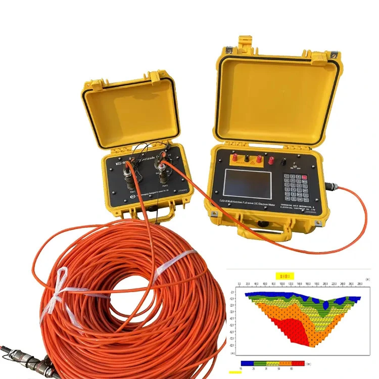
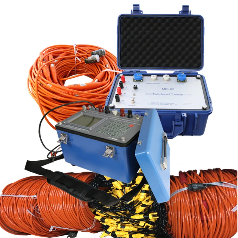
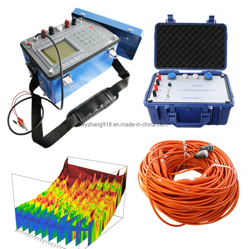
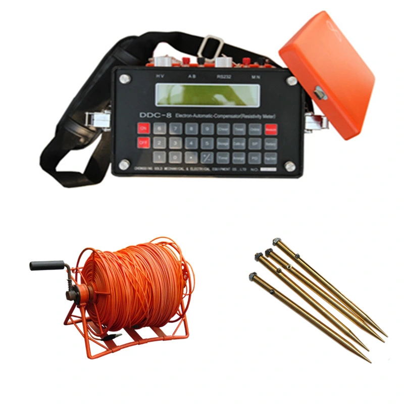
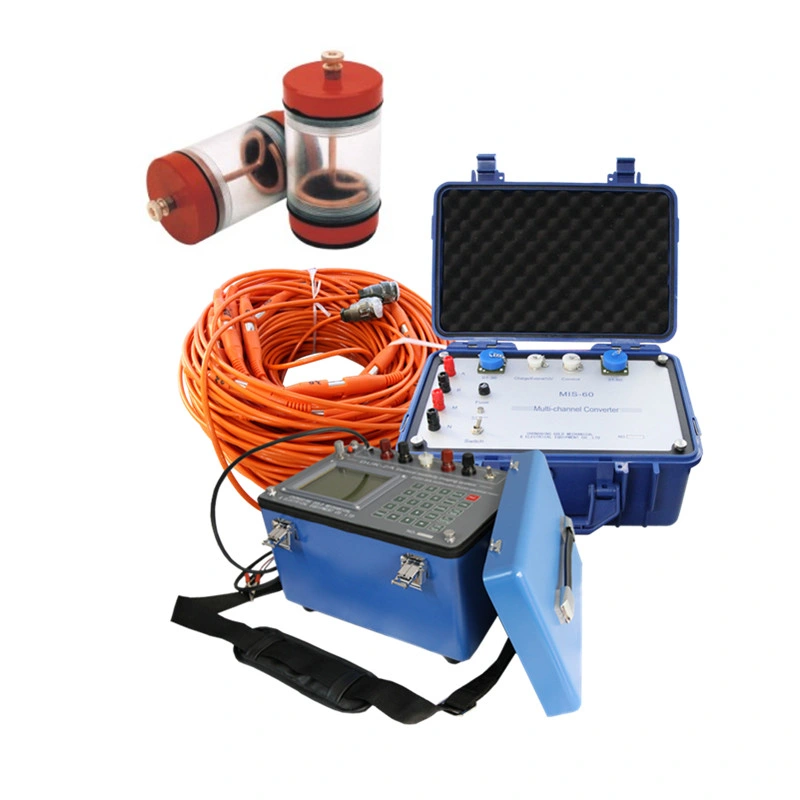
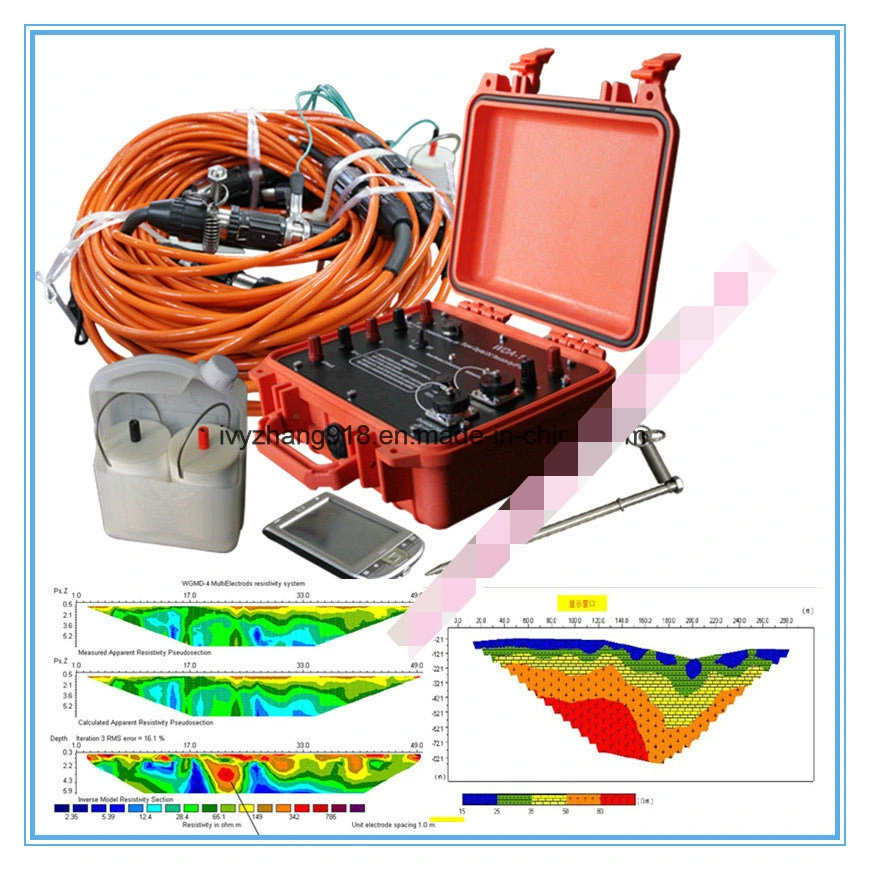
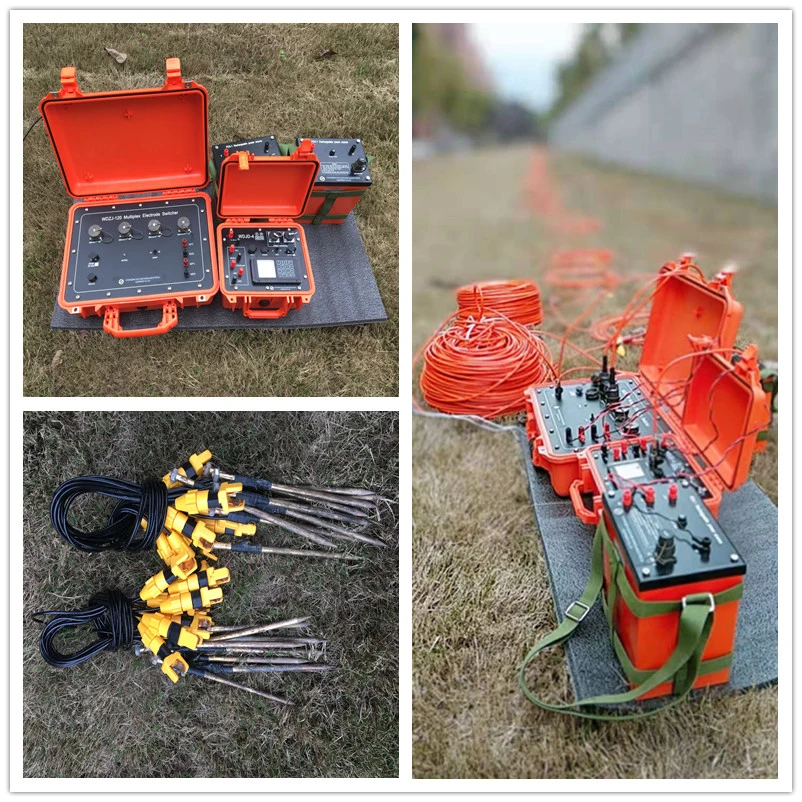
DUK-2A Multi-Electrode Resistivity Survey System as the survey and control unit in the system
DUK-2A Multi-Electrode Resistivity Survey System
Main Applications
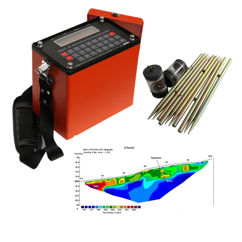
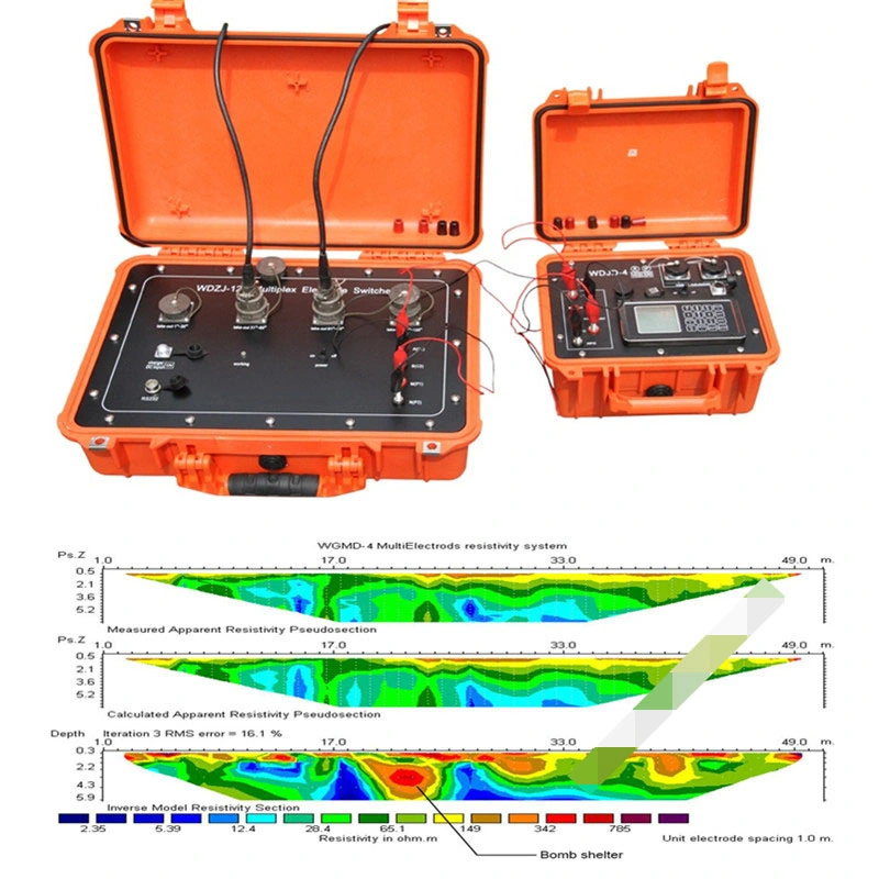
1 By utilizing relevant parameters of apparent resistivity and induced polarization method, the instrument is widely used in many aspects including metal and non-metal mineral resources exploration, energy exploration, city geophysical exploration, railway and bridge engineering exploration, etc.
2 Search for groundwater, solve the human and animal drinking water issue as well as industrial and agricultural water issue. Determine the hidden safety risk location in reservoir dam foundation and flood-control dyke, find faultage zone and collapse column, landslides, coal mining goaf, search for geothermal and other hydrological, engineering geological exploration.
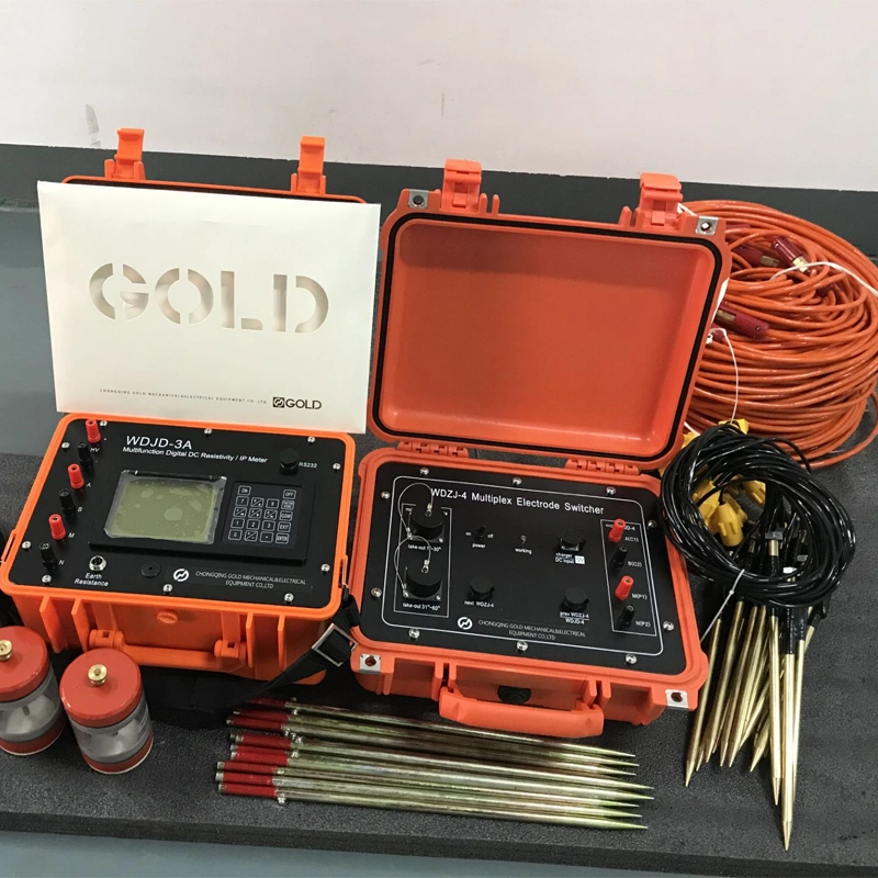
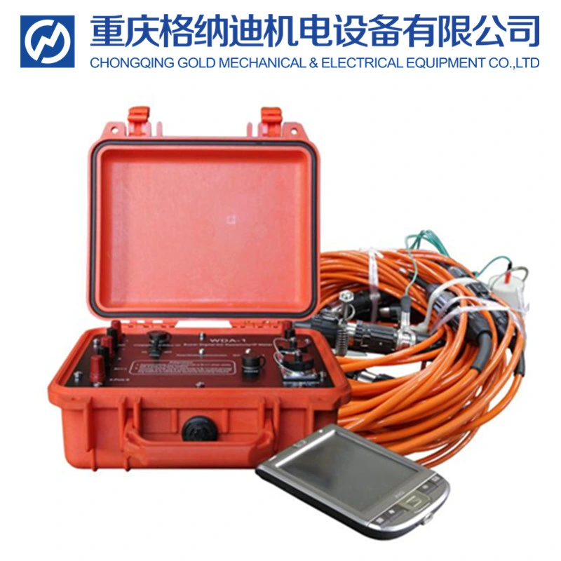
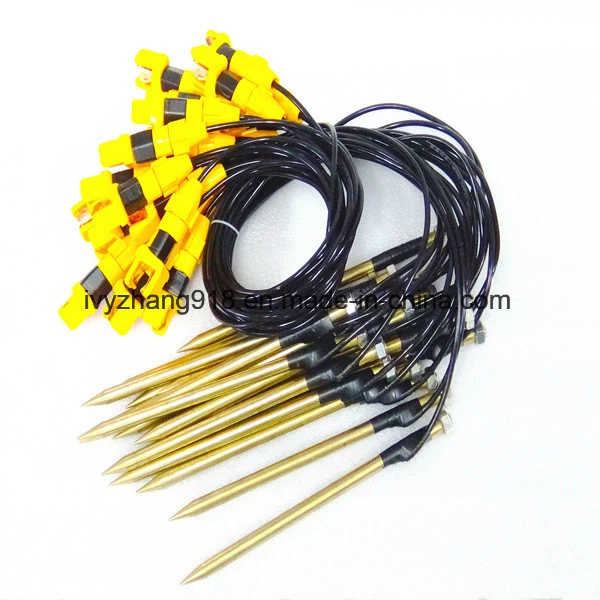
3 Accessories made by our factory with 60-channel or 120-channel multiplex electrode switch, also can be used for multi-electrode resistivity survey system.
Geo Electric Resistivity Tomography, Resistivity Imaging, Geological Mapping Instrument for Underground Water Detection, Water Finder, Groundwater Detector
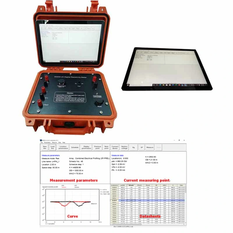
Receiving Part
1 Measuring Voltage Range: -6000mV~+6000mV
2 Measuring Voltage Resolution: 0.01 mV
3 Measuring Voltage Accuracy: (at Vp>10mV)± 5%, ± 1 digit; (at Vp<10mV)± 1%, ± 1 digit
4 Measured Apparent Polarizability Accuracy: ± 1%, ± 1 digit
5 Measuring Current Range: 0~5000 mA
6 Measuring Current Resolution: 0.01 mA
7 Measuring Current Accuracy: (at Ip>10mA)± 5%, ± 1 digit; (at Ip<10mA)± 1%, ± Digit
8 Input Impedance: ≥ 50MΩ
9 Interference Suppression on 50Hz Power Frequency: Better than 80dB
Geo Electric Resistivity Tomography, Resistivity Imaging, Geological Mapping Instrument for Underground Water Detection, Water Finder, Groundwater Detector
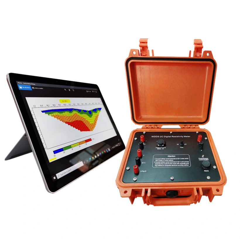
Transmitter Part of Geophysical Equipment
1 Maximum Transmitting Power: 4500 W
2 Maximum Power Supply Voltage 900V
3 Maximum Power Supply Current: 5A
4 Instrument has over-voltage and over-current protection devices
5 Power Pulse Width: 1-60 seconds, Duty Cycle 1: 1
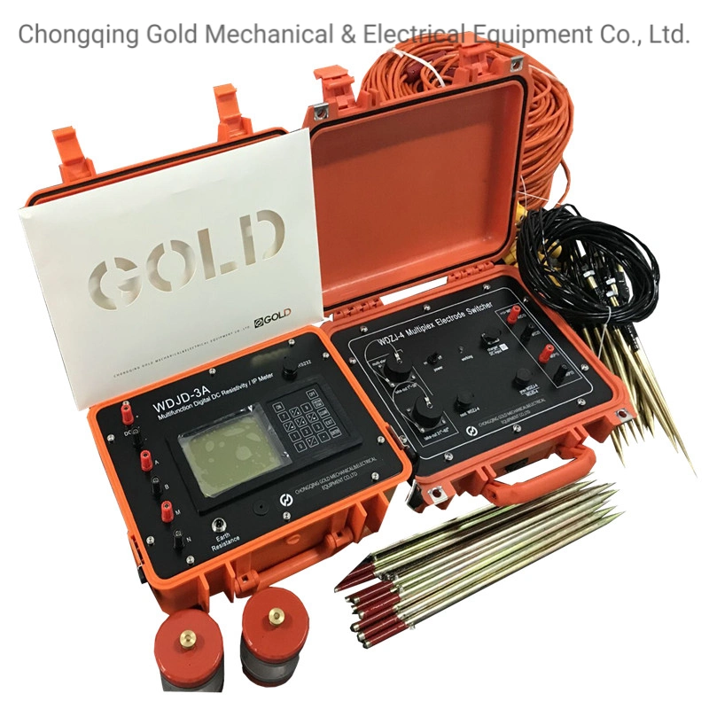
1. Resistivity Transmitter and Receier
2. Electrode
3. Software of English
Geo Electric Resistivity Tomography Resistivity Imaging Geological Mapping Instrument for Underground Water Detection, Water Finder, Groundwater Detector

 Complaint