
 Complaint

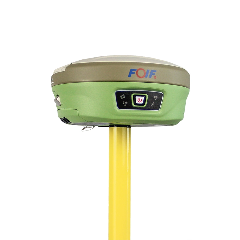
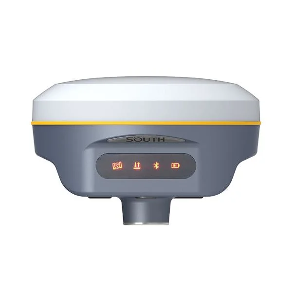
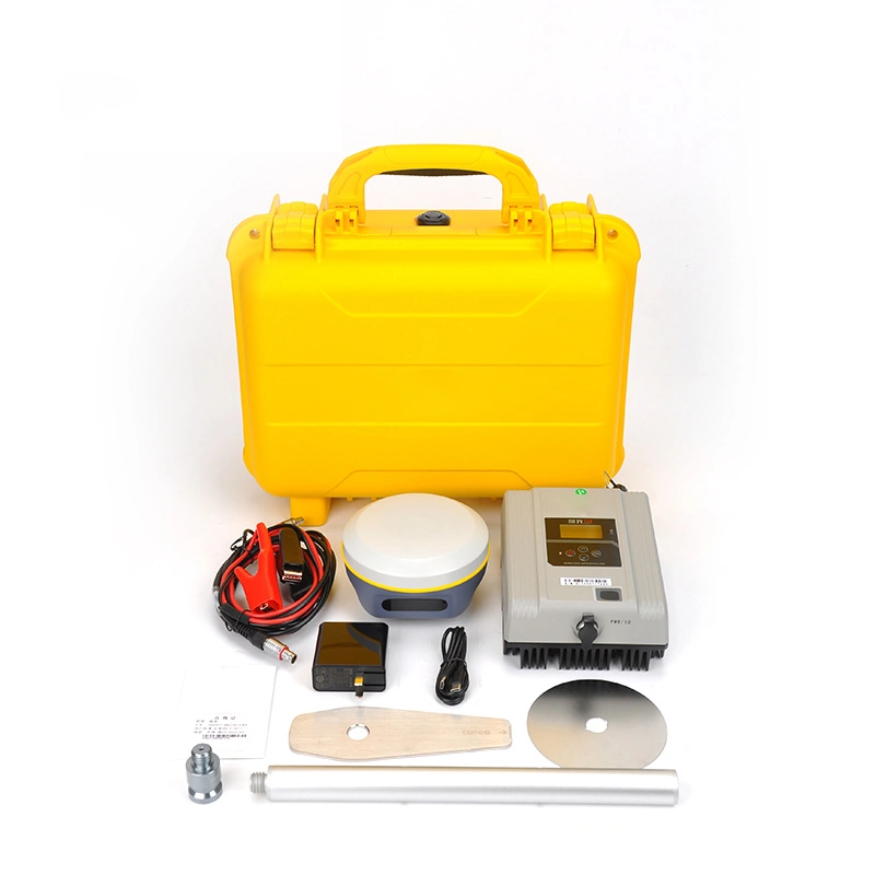
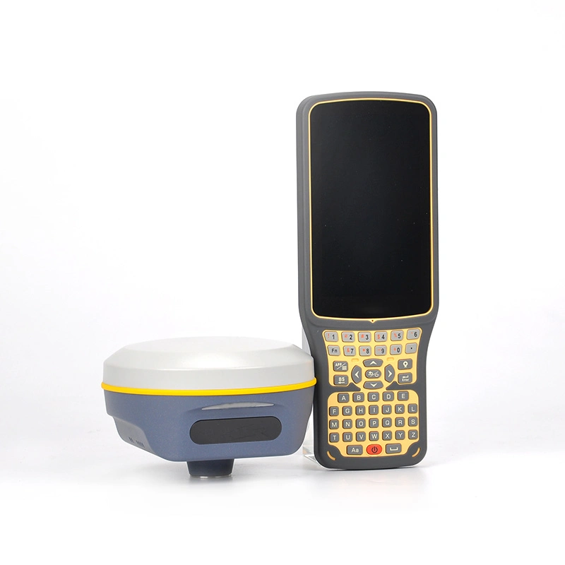
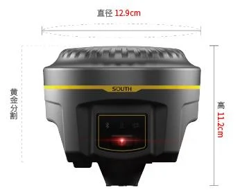
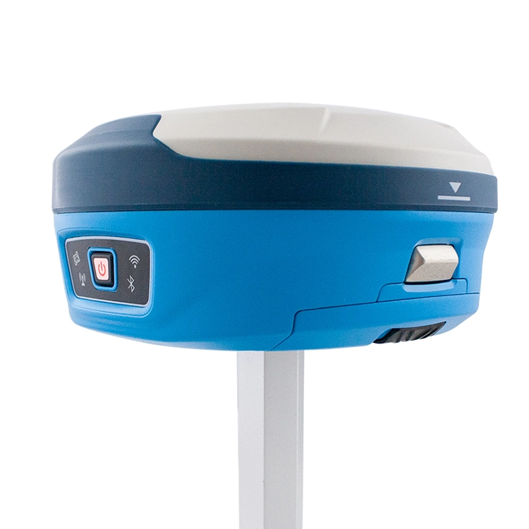
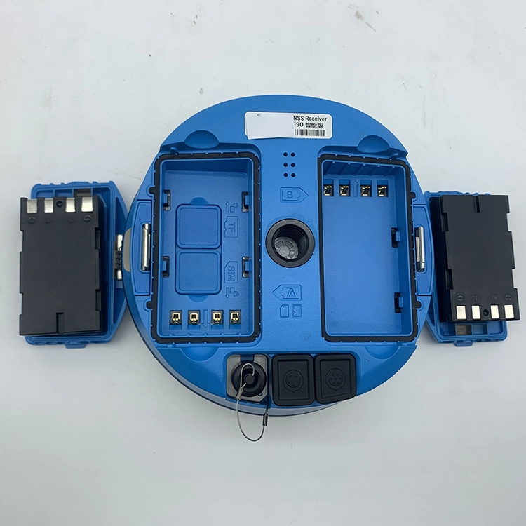
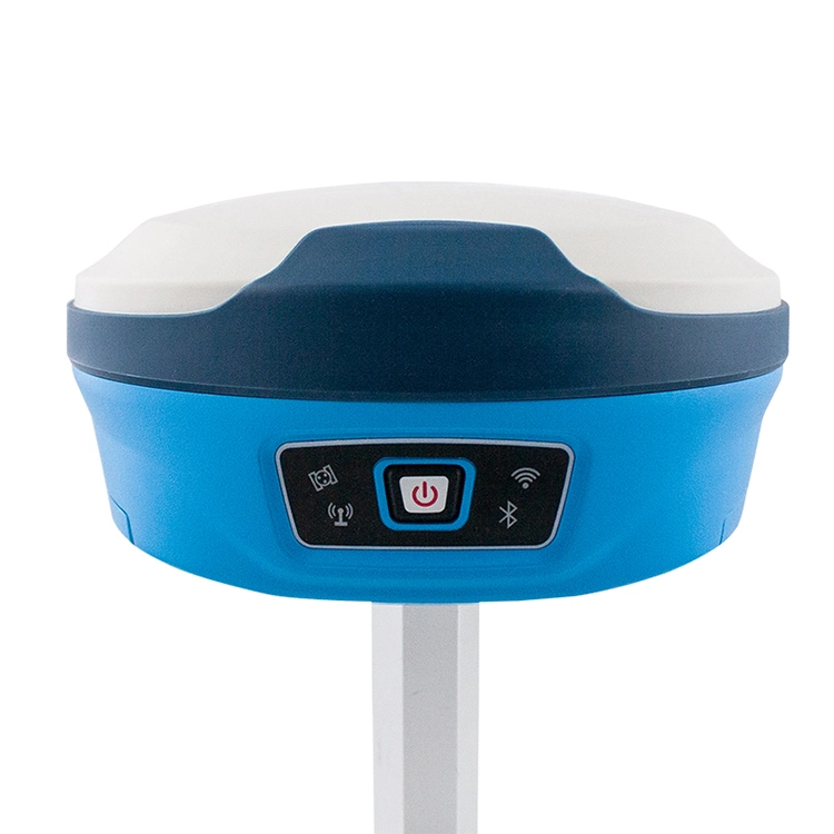
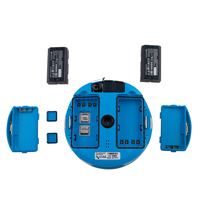
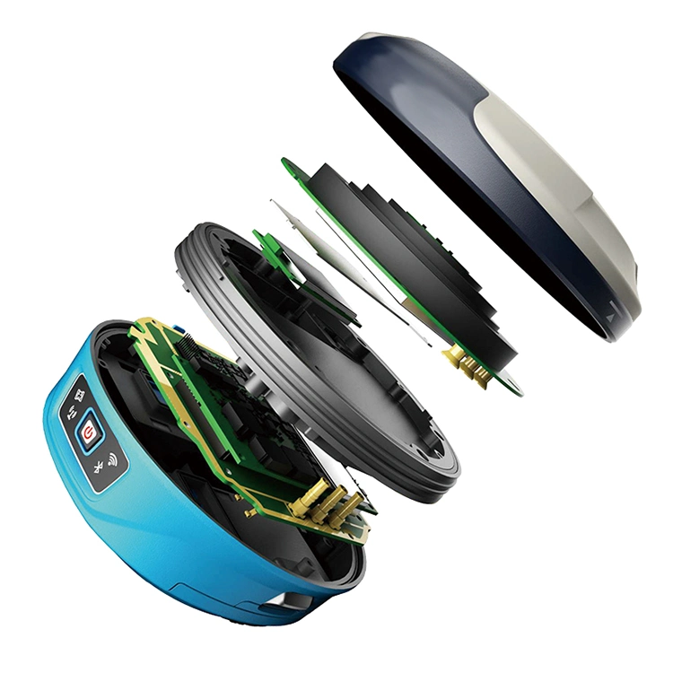
F90 Intelligent GNSS Receiver
| Specification | ||
| Items | ||
| GNSS Engine | GNSS board | H board |
| Channel | 800 | |
| Satellites | GPS: L1 C/A, L2E, L2C, L5 | |
| GLONASS: L1 C/A, L2 C/A, L3 CDMA14 | ||
| BeiDou: B1, B2, B313 | ||
| Galileo: E1, E5A, E5B, E5AltBOC, E614 | ||
| IRNSS: L5 | ||
| SBAS: L1C/A, L5 | ||
| QZSS: L1 C/A, L1 SAIF, L1C, L2C, L5, LEX | ||
| MSS L-Band: OmniSTAR, Trimble RTX | ||
| Tilt survey: The forth generation Tilt Technology, IMU function | ||
| Real-Time Accuracy(rms) | SBAS | Horizon: 60cm(1.97ft); Vertical: 120cm(3.94ft) |
| Real-Time DGPS position | Horizon: 40cm(1.31ft); Vertical: 80cm(2.62ft) | |
| Real-Time Kinematic Position | Horizon: ±( 8mm+1ppm) ; Vertical: ±( 15mm+1ppm) | |
| Real-Time Performance | Instant-RTK Intialization | Typically |
| Stop and Go solution | 99.9% reliability | |
| RTK Intialization range | >40km | |
| Post Processing Accuracy(rms) | Static, Rapid Static | Horizontal: 2.5mm(0.008ft) +1.0ppm; |
| Vertical: 5mm(0.016ft)+1.0ppm | ||
| Post-processing Kinematic | Horizontal: 10mm(0.033ft)+1.0ppm; Vertical: 20mm(0.066ft)+1.0ppm | |
| Solutions | Surpad software | Main function include: F90 GNSS Support: configuration, monitoring and control |
| Field Software Suite | Volume computation | |
| Network connectivity, Coordinate System Support: predefined grid systems, predefined datums | ||
| projections, Geoids, local grid | ||
| Map view with colored lines Geodetic Geometry: intersection, azimuth/distance, offsetting, poly-line, curve, area | ||
| Road Construction (3D): Survey Utilities: calculator, RW5 file | ||
| Viewing: Data import/Export: DXF, SHP, RW5 | ||
| Data logging | Recording Interval | 0.1-999 seconds |
| Physical | Flat design | |
| Size | 156mm*76mm | |
| Bottom cover | Aluminum magnesium alloy | |
| Memory | Internal memory | 8GB standard; supports extending to 32GB |
| I/O Interface | TNC port | connecting built-in radio antenna |
| 5-pin port | connecting external power supply and external radio | |
| 7-pin port | (USB+serial port): connecting PC and handheld | |
| Operating system | Linux | Based on Linux; Supports Web UI |
| Voice | Multi-language supported | |
| Tilt survey sensor | Automatic correct system by 30 degree | |
| Data format | Data format | RTCM 2.3 |
| RTCM 3.0.RTCM 3.X | ||
| CMR, CMR+ | ||
| NovAtelX/5CMRx | ||
| Operation | Operation | RTK rover/base, post-processing |
| RTK Network rover | VRS, FKP, MAC | |
| Point-to-point GPRS through Real-time Data | ||
| Server Software (internal GPRS or external cell phone) | ||
| LandXML (FOIF Field Genius support) | Total Station support ( FOIF Field Genius) | |
| Import and stake directly from a DXF File (FOIF Field Genius) | ||
| Office Software | Main functions include: Network post-processing | |
| Integrated transformation and grid system computations | ||
| Pre-defined datums along with use-defined capabilities | ||
| Survey mission planning | ||
| Automatic vector processing | ||
| Least-squares network adjustment | ||
| Data analysis and quality control tools | ||
| Coordinate transformations | ||
| Reporting | ||
| Exporting | ||
| Geoid | ||
| Environmental | Operating temperature | -30ºC to +65ºC(-22°F to 149°F) |
| Storage temperature | -40ºC to +80ºC(-40°F to 176°F) | |
| Humidity | 100% condensing | |
| Waterproof | IP67 (IEC60529) | |
| Shock | 2m (6.56ft) pole drop | |
| 1.2m (3.94ft) free drop | ||
| Power | 7.2v.2 removable batteries (total up to 6800mAh, supports single battery working) | |
| Optional System Components | Communication Module | Internal radio: UHF Link (410-470MHz) |
| 1W | ||
| External radio | R*&*both (5w/35w selectable) | |
| 4G LTE module (EC25 series) | Fits various networks | |
| Bluetooth | 2.1+EDR Class 2 | |
| WiFi | IEEE 802.11 b/g/n | |
| Antenna | Built-in antenna, integrating GNSS, BT/WLAN and network antenna | |
| Controller | F58 | |
Carlson SurvCE/FieldGenius/Surpad
Surpad Software Professional,intuitive and efficient
This ESurvey RTK data controller Field Software is designed & developped by the most professional software R&D engineers team, which brings you a professional, intuitive and efficient measurement of the new experience. TheSurpad software integrates construction survey, power survey, GIS data collecting in one unit. This software is compatible both with Windows Mobile and Android platform, it also supports the smart phone to be used as data controller.
1. Power Survey
Line selection, cross measurement, 4-D Data Format output.
2. Road survey
Road design, Middle Side Stake Layout, Cross section survey.
3. Base Map Loading
Support vector data loading such as DXF, SHP and GCP.
4. GIS collection
Support Attribute Data Collecting by Self-Defined data dictionary and export GIS exchange format.
5. Post Processing Software GGO
Support to convert the data format into RINEX, which is compatible with AutoCAD and other Drawing & Mapping Software.