 Complaint

| D8 VR II Technical Parameters | |
| Channel | 1408 |
| Satellite Tracking | BDS: B1I, B2I, B3I, B1C, B2a, B2b |
| GPS: L1C/A, L1C, L2P(Y), L2C,L5 | |
| GLONASS: L1, L2 | |
| Galileo: E1, E5a, E5b, E6* | |
| QZSS: L1, L2, L5, L6* | |
| IRNSS: L5* | |
| SBAS: L1, L2, L5 | |
| L-BAND | |
| Output format ASCI | ASCII: NMEA-0183, binary code |
| Position output frequency | 1Hz~20Hz |
| Static data format | GNS, Rinex dual format static data |
| Differential format | RTCM2.X,RTCM3.X |
| Network mode | VRS, FKP, MAC; Supports NTRIP protocol |
| Operation system | Linux operation system |
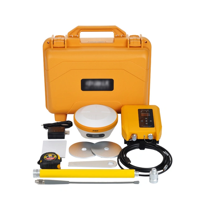
| Data storage | With built-in 16GB ROM which supports automatic cyclic storage of static data |
| RTK positioning accuracy | Plane: ± (8+1x10⁻⁶D) mm Elevation: ± (15+1x10⁻⁶D) mm (D refers to the distance between the measured points) |
| Static positioning accuracy | Plane: ± (2.5+0.5x10⁻⁶D) mm Elevation: ± (5+0.5x10⁻⁶D) mm (D is the distance between the measured points) |
| DGPS positioning accuracy | Planar accuracy: ± 0.25+1ppm Elevation accuracy: ± 0.50m+1ppm |
| Satellite station differential accuracy | Plane accuracy: 10cm Elevation accuracy: 20cm |
| SBAS positioning accuracy | 0.5m |
| Tilt measurement accuracy[3] | 8mm+0.7mm/tilt |
| Visual stakeout accuracy | 1cm |
| Initialization time | <10s |
| Initialize reliability | >99.99% |
| Signal interruption measurement | RTK measurement is still provided during differential signal interruption |
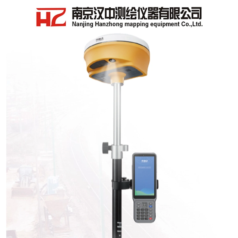
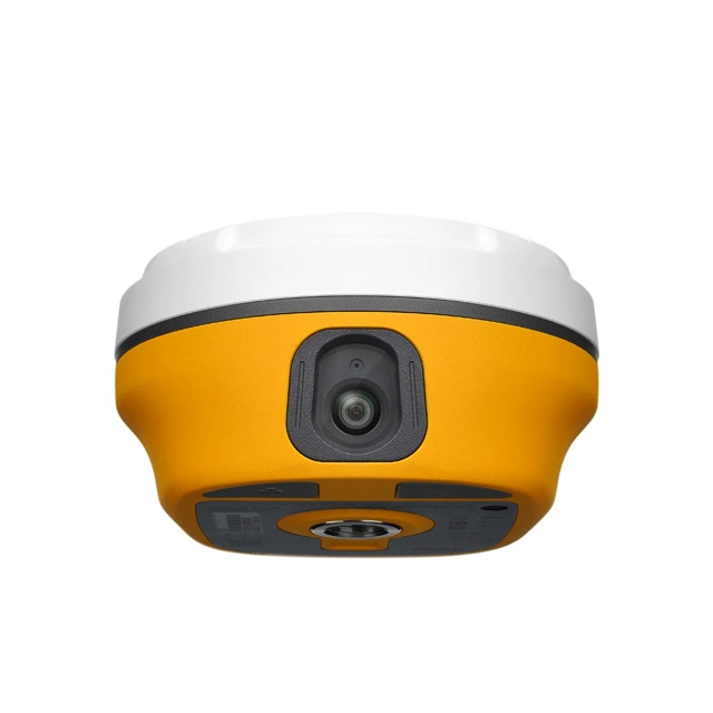
| Function | Professional night vision high-definition camera with large viewing angle and supports live scene stake out |
| I/O ports | USB Type-C interface; SMA interface |
| Built-in 4G network | TDD-LTE, FDD-LTE, WCDMA, TD-SCDMA, EDGE, GPRS, GSM |
| WIFI | 802.11 a/b/g/n access point and client mode, capable of providing WIFI hotspot services |
| Bluetooth | Bluetooth® 2.4GHz, BT5.2 |
| Internal radio | Integrated transmission and reception with base transmission and rover reception |
| Power: 0.5W/1W/2W adjustable | |
| Frequency band: 410MHz~470MHz | |
| Protocol: HI-TARGET, TRIMTALK450S, TRIMMARKIII, TRANSEOT, South, CHC, SATEL | |
| Channel: 116 (of which 16 are configurable) | |
| External radio | HDL460A full protocol external radio station |
| Power: 10W/30W adjustable | |
| Frequency band: 403MHz~473MHz | |
| Protocol: HI-TARGET, TRIMTALK450S, TRIMMARKIII, TRANSEOT, South, CHC, SATEL | |
| Transmission power: 19.2kbps/9.6kbps adjustable | |
| Channel: 116 (of which 16 are configurable) | |
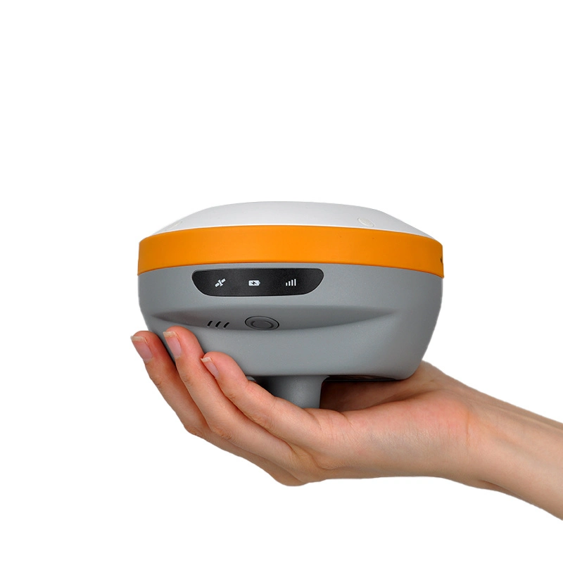
| Electronic bubble | Realize intelligent alignment |
| Tilt measurement | With built-in new generation high-precision IMU, realizing automatic initialization upon startup and automatic device-shape compensation |
| Button | Single button |
| LED indicator | Satellite indicator, signal indicator, power indicator |
| Advanced function | NFC flash connection, Web UI interaction, USB firmware upgrade |
| Intelligent application | Intelligent voice guidance, functional self-check |
| Remote services | News feed, online upgrade, remote control |
| Cloud services | Equipment management, location services, collaborative work, data analysis |
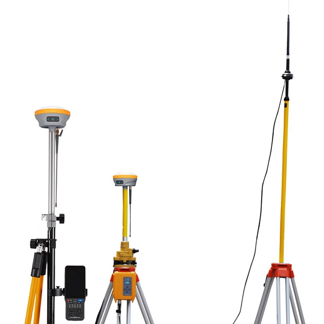
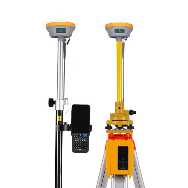
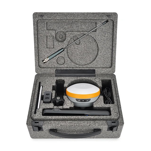
| Host battery | High capacity lithium battery 6800mAh, with a working time better than 16 hours[4] |
| External power supply | USB 15W charging |
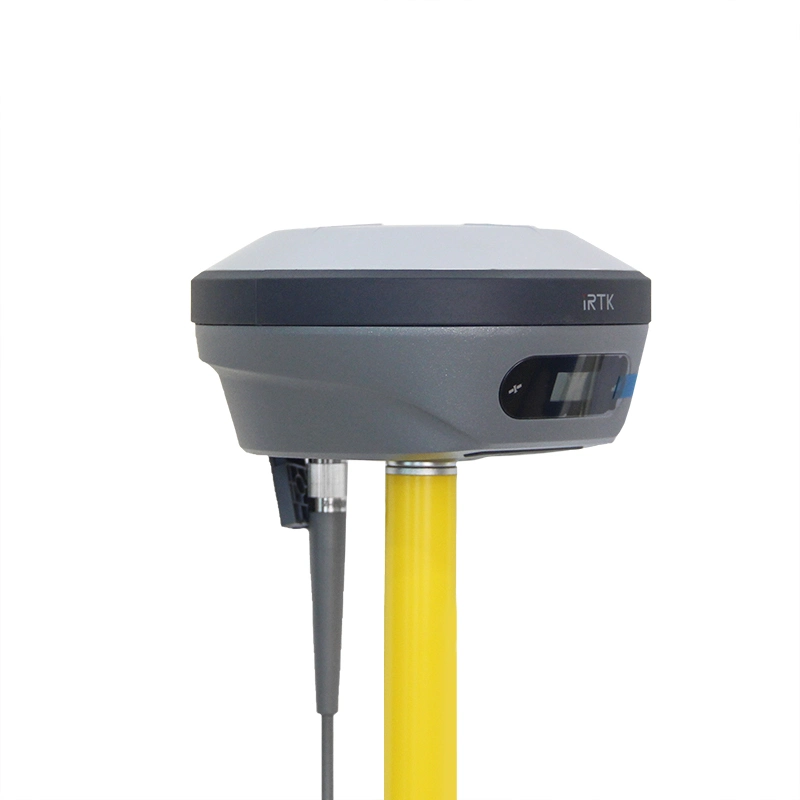
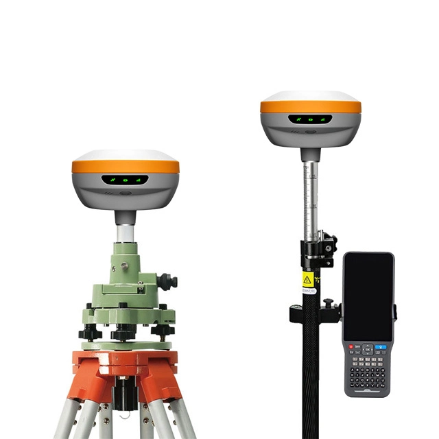
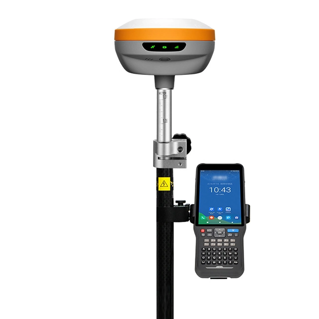
| Size | Φ130mm x 68mm |
| IP grade | IP68 |
| Vibration/Shock | Resistant to natural drop from a 2m high rover pole |
| Relative humidity | 100% non condensing |
| Working environment | -45°C-+75ºC |
| Storage environment | -55°C-+85ºC |
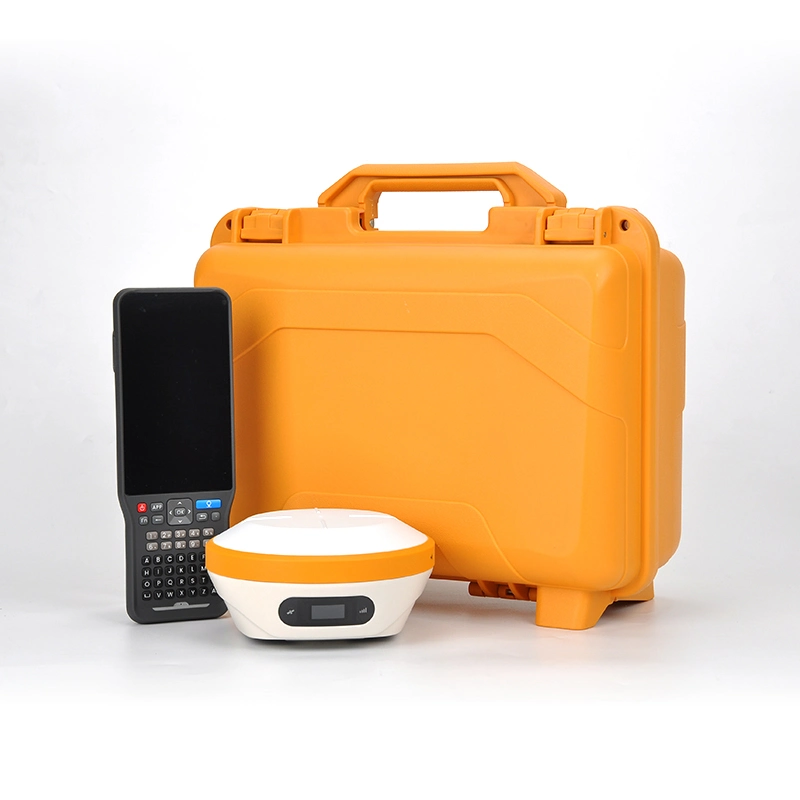
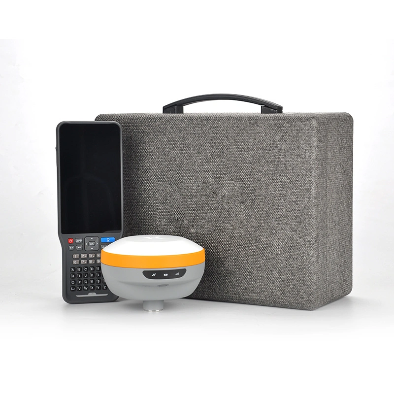
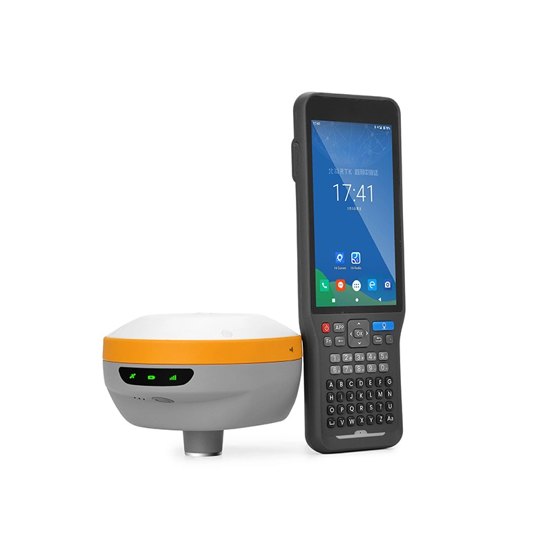
| Operating system | Android 11 operating system |
| Processor | 2.0GHz, 8-core processor |
| Storage | 3GB RAM+32GB ROM; Supports T-Flash memory card up to 128GB |
| Display | 5.5-inch bright outdoor color capacitive touch screen (supports touch pen and can be operated with gloves) |
| Display resolution | 720*1440, visible to sunlight, typical brightness 600nits |
| Input | Surveying and mapping professional keyboard, Hi Target intelligent input method |
| Positioning | With built-in GNSS antenna, supporting GPS+Beidou+GLONASS, AGPS |
| Cellular mobile | 4G full network connectivity |
| WIFI | 802.11 a/b/g/n/ac, Wapi, AP (supports WIFI and cellular mobile dual smart selection internet access) |
| Bluetooth | Bluetooth® 2.4GHz, BT5.1 |
| NFC | Supports NFC flash connection |
| USB | USB Type-C interface, supporting OTG function |
| Built-in battery | With built-in large capacity and high-performance lithium battery, supporting fast charging |
| Working hours | Can work continuously for 22 hours[1] |
| Camera | Integrated 13 megapixel camera with flash |
| Flash lamp | High brightness flash LED lamp (supports flashlight function) |
| Sensor | Gravity sensor, geomagnetic sensor, light sensor, gyroscope |
| Size | 221mm x 77.6mm x 16mm |
| Temperature | Working temperature: -20 ºC~+60 ºC; Storage temperature: -30 ºC~+70 ºC |
| IP grade | IP68; ResistanT to 1.8m free fall |
-----------------------
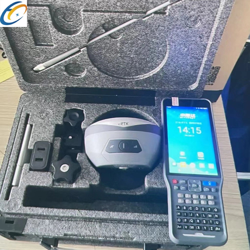
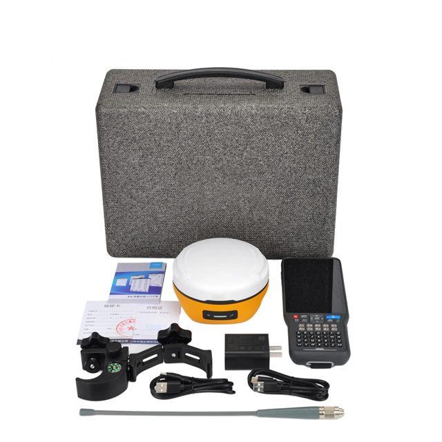
Multiple modes of transportation
-----------------------
Buyer display